Calmly negotiating the inclement weather that we have had recently, the Research Team for the Past in its Place project (http://pastplace.exeter.ac.uk/) visited Norwich a few weeks ago. My own ‘memories’ of Norwich revolve around a post-A-Level boat trip with nine friends and 20 crates of Newcastle Brown Ale (2 each) on the Norfolk Broads. This was not exactly a glorious memory to be proud of, so I was very keen to return to Norwich partly in order to apologise to anyone who might have remembered my last visit.
My memory of Norfolk was that it was topographically quite flat – I guess this is the impression that many people have of East Anglia more broadly. With this in mind, therefore, something that struck me as odd when I was doing some preparatory reading for the trip was a reference to the city being poorly fortified, partly due to it being overlooked by a prominent hill: “Norwich is like a great volume with a bad cover, having at best but parchment walls about it. Nor can it with much cost and time be effectually fortified, under the frowning brow of Mousehold-hill, hanging over it”. The passage is from Francis Blomefield’s (1806) Topographical History of the County of Norfolk, volume 3: History of the City and County of Norwich, part 1, (pages 220-265). According to Blomefield, who draws heavily from Alexander Neville’s Norfolkes Furies (published in 1575) the prominence of this hill, which provided a commanding prospect over the City, played a key role in Kett’s Rebellion of 1549.
Kett’s Rebellion (see http://en.wikipedia.org/wiki/Kett%27s_Rebellion for a general history), is commemorated through several features of the present cityscape of Norwich: Kett’s Hill Bakery and Kett’s Tavern are both situated on Kett’s Hill (the B1140), leading north from the city centre towards Mousehold Heath. And, despite being less than 50m above sea level, the relative topography of the hill certainly does provide a commanding prospect of the city, witnessed by an official Ordnance Survey ‘viewpoint’ on the 1:25,000 scale Explorer Map (OL40).
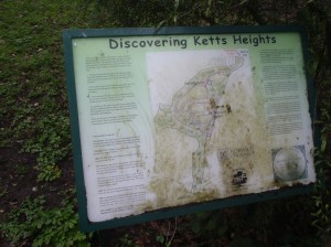
On the south side of Kett’s Hill Road, is an overgrown park overlooking the gas works. Originally donated to the city council by an anonymous benefactor in 1970, the park was called Jubilee Heights until 1985 when it was renamed Ketts Heights, and was cleared and ‘restored’ for the enjoyment of all the residents of Norwich.
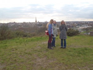
On the north side of Kett’s Hill, however, the land is cleared of trees and undergrowth, and from the Ordnance Survey’s viewpoint, one can see across the city centre, over the ‘parchment walls’ towards Bishopsgate and other streets named by Neville and Blomefield as being the scenes where some of the fiercest hostilities took place in 1549.
Reading Neville’s and Blomefield’s descriptions of Kett’s Rebellion, the topography of the city, and the seeming porousness of its walls appears to be a significant factor in the events as they unfolded. Skirmishes took place along streets that could be clearly seen; confrontations occurred in the dense urban quarters that could be surveyed from on high; while artillery manoeuvres were observed from the safety of the hill. Sitting on this prominent height more than 450 years later, it is the actual view, and the experience of a sort-of-aerial survey of the landscape, possible from this southern edge of Mousehold Heath, which is one of the key aspects of the Rebellion’s heritage.
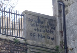
Graffiti on Norwich Castle (2014)


