Golowan, Cornish identity and the heritage of mid-Summer festivals

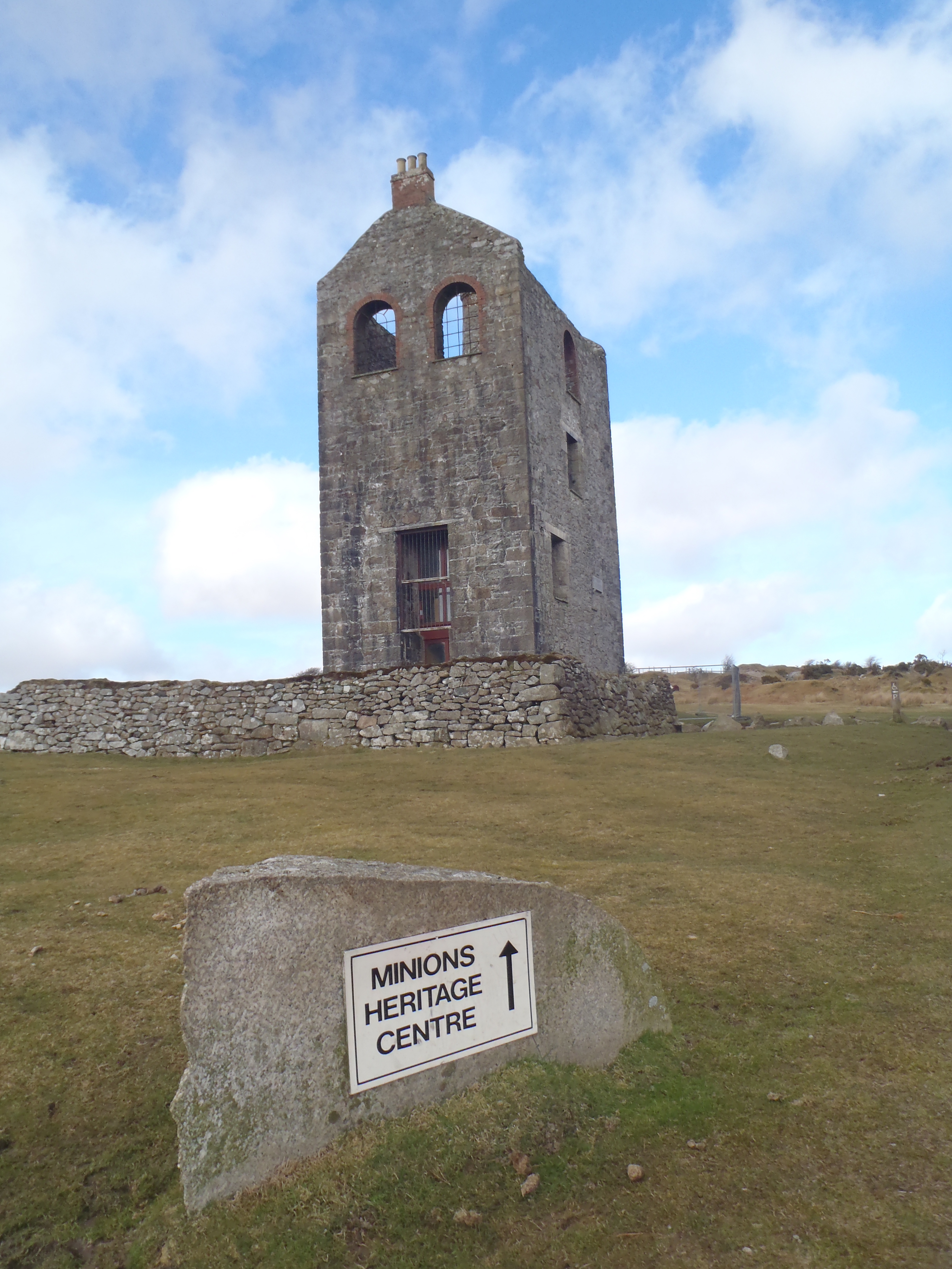
Since we are getting close to the northern hemisphere Midsummer, I thought I would have a look at some aspects of Midsummer Heritage:

The Cornish language word for ‘Midsummer’ is Golowan. This was a time of celebrations and festivals in Cornwall, particularly connected to St John’s Eve (23rd June) and St Peter’s Eve (28th June); corresponding to a period marked by rejoicing, street fairs and festivals, particularly of bonfires, fireworks and processions.

Golowan_Festival_Penzance_June_2005_Mid_Argyl_band

If you follow some internet links, you soon discover that Golowan is a distinctly ‘Cornish’ activity. It is certainly used today to celebrate and re-inforce a sense of Cornish cultural identity. Golowan is a Cornish word; the festival and outdoor performance activities that are associated with it (such as Mazey Day in Penzance), are portrayed as distinctly ‘Cornish’; a day to wave the black and white flags of St Piran; a day to do the Trelawny Shout; steeped in a distinctly Cornish and Celtic heritage.

But just how useful is it to describe this event as ‘Cornish’? Afterall, the calendar dates are those of Christian saints (John and Peter), who have an international standing: While fishing has long been a prominent industry in Cornwall (and one very important to the self-image of many people who describe themselves as ‘Cornish’), St Peter is celebrated by many fishermen across Europe and beyond; while St John’s Eve is also prominently celebrated with bonfires in many countries, with a particular public face in Scandinavia. These are international Christian festivals, not ‘Cornish’ in essential detail.

While these events were not essentially ‘Cornish’, however, it can be argued that, first: the continued to be celebrated for longer in Cornwall than elsewhere, with an (at times, perhaps) intermittent cultural memory of celebratory practice that stretches back many centuries. Secondly, of course, although these festivals are ostensibly ‘Christian’, they could also be marking the vestiges of a pre-Christian midsummer festival, which might not be ‘Cornish’ as such, but would seem to have the sort of ‘Celtic’ roots that is customarily assigned to ‘Cornishness’.

800px-Midsummer_bonfire_closeup

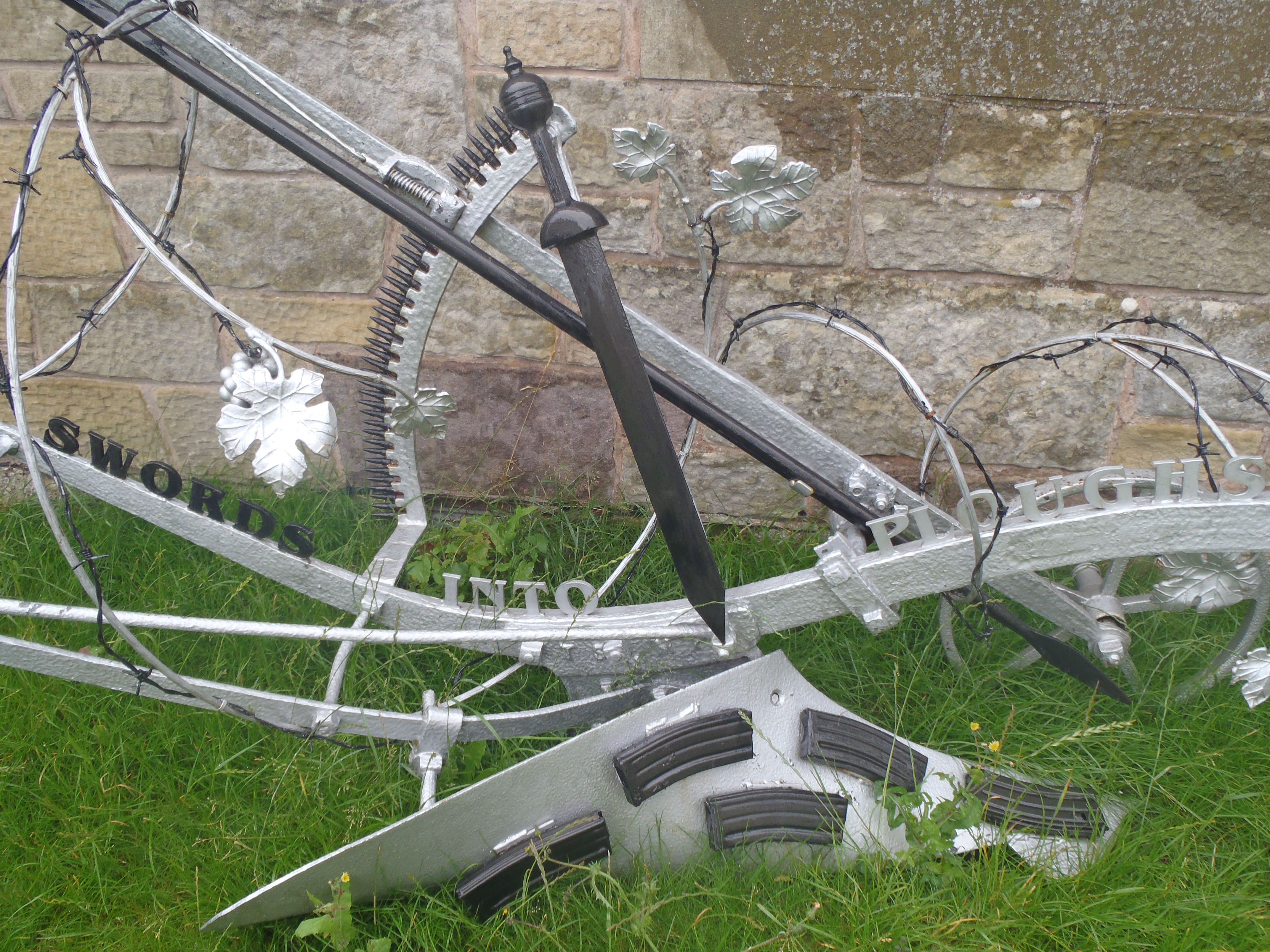
Golowan, therefore, has been revived and celebrated as an item of (Celtic and Cornish) ‘folk tradition’. It is an item of non-elite identity performance, group cohesion and communal heritage. This sounds very positive, and perhaps also points towards a wider tradition of carnivals and fairs – vernacular events that blur the boundaries of official and non-official; participant and audience, and which are celebrated as ‘authentic’, local and inclusive. Within Cornwall, such activities were noted in the 18th century by the local antiquarian, Dr William Borlase, as being of ‘Druid’ origin, hinting at a William Stukeley-style ‘British’ aboriginal Druid being conjoured up. But while for William Stukeley, the ‘British Druid’ represented a fairly elite aboriginal bulwark against continental Catholicism, more recent Druidic narratives have tended to suggest an anti-Establishment Pagan-Celtic folksiness that is very much locally embedded. Basically, there is a strong argument that such activities might genuinely possess quite ancient roots, and the very being of these sorts of activity often seems to (proverbially) stick two fingers up at the Establishment, akin to practices such as ‘rough music’, of masquerade, and a history of folk resistance. This line of thinking, to my mind at least, certainly broadens out the ‘Cornish essentialism’ that is often trotted out in the commentary of these events. Rather than being essentially ‘Cornish’, it rather suggests Cornwall as a place where these once-widely celebrated traditions lived on and survived. But how does this sit with other ‘Cornish’ traditions?

As a spiritual movement that seems to be strongly rooted in Cornwall, the Methodist Church is sometimes referred to as the ‘national church of Cornwall’. The strength of Methodism on Cornwall was certainly recognised in the earlier 20th century Cornish revival movement – as being anti-established Church (of England). But Methodism and non-conformity also has a slightly ‘severe’ image when it comes to interpreting the ancient remains of aboriginal ‘Druids’. This is often recounted in the naming of stone circles and megaliths: as ‘maidens’ (either numbered or ‘merry’) who were turned to stone for dancing (to the tune of ‘piper’ stones) on a Sabbath. More recently, the Cornish agenda seems to have shifted, from identifying with Methodism and Nonconformity, to a stronger association with Earth Mysteries and Pagan spirituality, and some scholars have invoked the term ‘Cardiac Celts’ for whom they characterise as middle class metropolitan ‘blow-ins’. Resonant with Stukeley’s Druids, this line of thinking sits very comfortably with the activities of Golowan and Mazey Day – but is an alignment of a fairly exclusive ‘ethnic’ sense of Celtic-Cornishness with a supposedly middle class set of earth mysteries enthusiasts really ‘anti-Establishment? Perhaps it can be said to ‘blur the boundaries’ between a vernacular and spontaneous sense of subversive revelry and a more sober expression of a desire to find a ‘sense of place’.

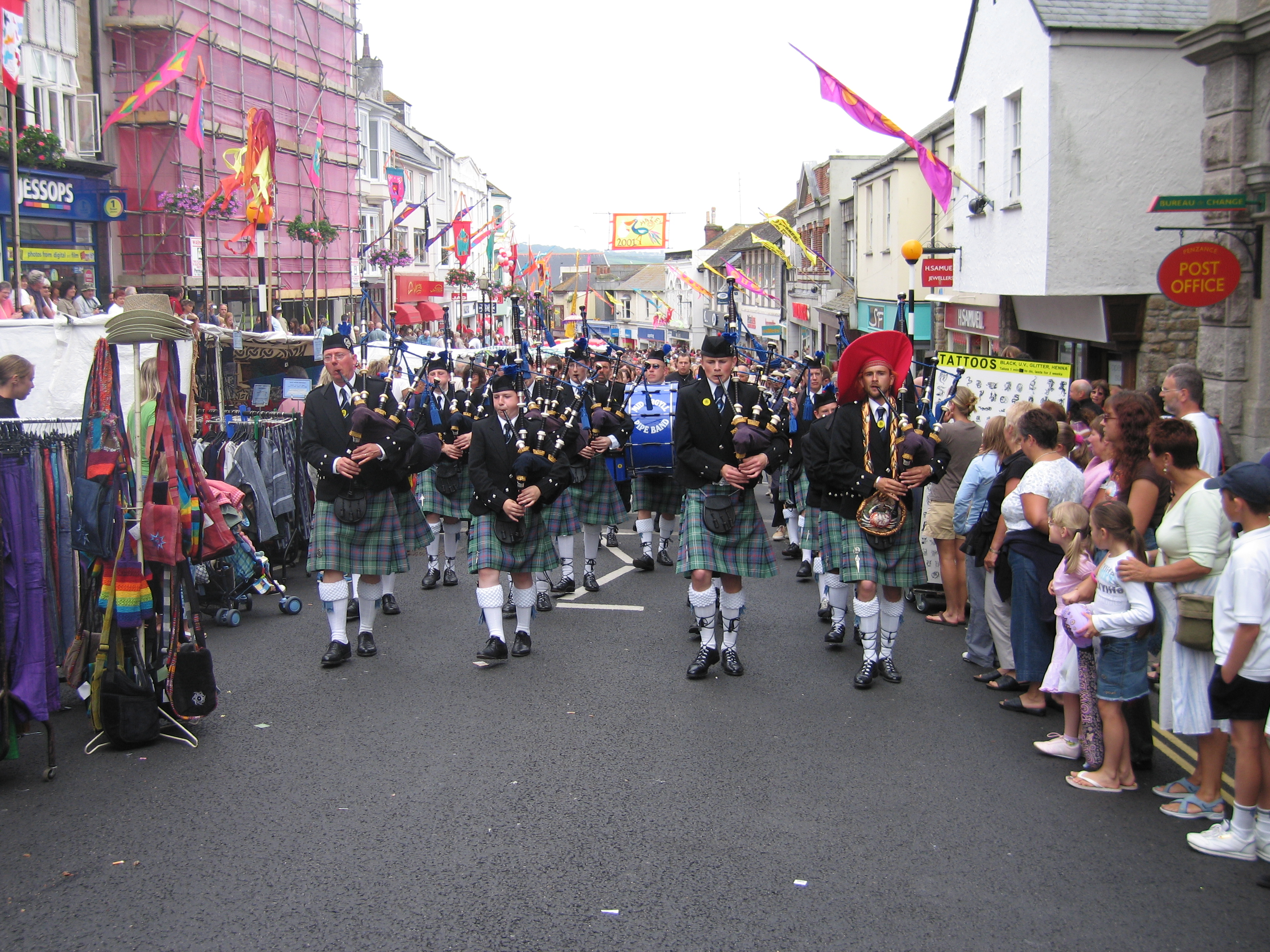
In some ways, this blurring also has resonance with another distinct practice of ‘Methodist’ tradition in Cornwall – that of parading and street procession. Every Chapel in Cornwall would have been involved in street processions, on auspicious days such as May Day or Chapel anniversaries. In towns such as Penzance or Redruth, the streetscape would be dominated by Methodist parades on certain days – as Chapel groups processed through the streets to converge on a park or field for a ‘tea treat’. Rather than hedonistic revelry, these events were concerned with showing a sober and upright sense of civic pride – but they would have attracted many of the accoutrements of fairs and fetes. In the 19th century, the Methodist Chapel at Morvah, in west Penwith, had an annual parade that ended with a march to the top of the local beacon ‘Watch Croft’. Prayers would be recited and hymns sung, during an event that actually has a striking resemblance to the bonfires and beacon gatherings of Golowan!

Methodist parade Methodist Parade (late 1950s)

Maybe what we can pick out amongst this array of marches, carnivals, gatherings and parades, therefore, is that they all reflect the activities of a largely non-elite population in ‘claiming the street’ in a variety of guises. More recently, through Heritage Lottery and Arts Council funding, there has been a good deal of State support for what can be termed ‘outdoor public arts performance’. Perhaps this state-sanctioned support of such spectacle corresponds to an ‘Establishment’ co-option of an essentially non-elite practice, where the ‘vernacular’ is ‘tamed’? I hope not – but we must therefore ensure that the ‘vernacular’ is never cast as a stable and time honoured practice. Rather than being an ‘essential’ and unchanging practice that never existed, we must invoke a sense of the vernacular as a critical, spontaneous event that is always sensitive to power relations and never exclusive.

Putting statues on trial: the case of Cecil Rhodes in Cape Town

I have been laid up these last few weeks with a ruptured Achilles tendon. On the one hand, this experience has made me reflect on the continuing heritage of Greek myth – in that the ‘Achilles tendon’ has to be written as a proper noun (and Microsoft Word automatically corrects it). On the other hand, it gave me a chance to read the newspaper every day from cover to cover. On heritage-related story that caught my eye connected to the Cecil Rhodes statue in Cape Town: what it means, and what to do with it.

Cecil Rhodes was a mining magnate and arch imperialist in Southern Africa towards the end of the 19th century (http://en.wikipedia.org/wiki/Cecil_Rhodes). As with many imperialists, he was commemorated and memorialised throughout this region with statues, buildings and even entire countries being named in his honour, as well as within the Metropole with, for instance, the Cecil Rhodes Memorial Museum in his birthplace in Hertfordshire, UK. Not surprisingly, recent decades have seen a good deal of re-naming practices taking place – with the ‘Rhodesias’ being renamed as Zambia and Zimbabwe, and his Memorial Museum being prosaically renamed as the Bishop’s Stortford Museum.

Two decades after the end of apartheid in South Africa, however, a Cecil Rhodes statue from the 1930s still sat on the campus of the University of Cape Town, and became a focus of protest. A campaign that involved the daubing of excrement over the statue and various other site-centred protests in Cape Town, alongside a social media effort, through Facebook and Twitter brought worldwide media attention – which I have followed in newspapers.

Cecil John Rhodes

Within Cape Town, the University Authorities first held a ballot of students to decide the statue’s fate: 60% of those voting were against the removal of the statue – but this came alongside an acceptance that the simple holding of a ballot hardly scratched the concerns of the protesters over the legacy of imperialism in Africa. It seems that the issue has triggered a wider and deeper debate over issues of heritage and power. On the 9th April, the University of Cape Town removed the statue, though I cannot find out what the longer term plans are. See newspaper articles for more information:

http://www.theguardian.com/world/2015/mar/20/students-attack-cecil-john-rhodes-statue-south-africa-university-cape-down-questions-race

http://www.theguardian.com/commentisfree/2015/apr/13/cape-town-remove-cecil-rhodes-statue

Goodbye_Cecil_John_Rhodes20_(16481463023)

“Goodbye Cecil John Rhodes20 (16481463023)” by Tony Carr – Goodbye Cecil John Rhodes20. Licensed under CC BY-SA 2.0 via Wikimedia Commons

More widely, the controversy has led to further reflection and protest. Students at Oriel College, Oxford, where Rhodes was a scholar, have called for the removal of their own statue, but I feel that this event points towards a larger issue of what to do with Imperial statues worldwide. In itself, this is a much debated concern, with the experience of Soviet-era statues in Eastern Europe providing an important prompt for an on-going debate that has an interesting history in itself (see Yvonne Whelan’s work on the changing statuary in Dublin, before and after Irish independence, for instance). Indeed, Laragh Larsen has written a very good paper about the curation (and moving) of colonial era monuments in Kenya (Journal of Historical Geography, 2012). But the use of a public vote to help make decisions on the issue reminds me more of Lisa Johnson’s work on the statue of Jan-Peter Coen, in the Dutch town of Hoorn (International Journal of Heritage, 2014).

Jan-Peter Coen was the Governor General of the Dutch East India Company in the early 17th century, and his statue has long stood in the central square of his home town of Hoorn. In 2011, there was growing pressure to remove the statue, and in 2012 the local Council added a (slightly timid) section of text that criticised Coen’s involvement with the slave trade, and genocidal activities. The protests did not cease, however, so the town’s Museum held an exhibition on the controversy, which included putting the statue on formal ‘trial’. Visitors were asked to vote on whether the town should keep the statue, and as things turned out, 60% voted to keep it, not as a celebratory memorial, but as a warning – with a stronger critical statement of text added to the plaque.

I thought it was interesting that the proportions of ‘keep the statue’ votes were very similar to that in Cape Town, where the statue was removed despite the narrow vote to keep it – but I can’t help thinking that the context of the votes were quite different, and the implication of the decision to keep/not keep was entirely different.

The role and potential for critical and creative destabilisation of hegemonic heritage narratives for an imperial statue in Holland seems to be entirely different to the on-going meaning and implication of an imperial statue in post-Apartheid South Africa. Indeed, maybe these events point towards a fair and defendable practice of how it is possible to ‘decommission’ heritage in certain circumstances. In Holland, the maintenance of JP Coen’s statue as a ‘warning’ and ‘critical reminder’ suggests a continuing and progressive use-value of the statue. But, as Johnson herself implies, we need to be careful that the reflection on the 17th century ‘deep-past’ of Dutch colonial endeavour does not mean that more recent colonial stories (such as the Indonesian War of Independence, 1945-9) are skimmed over or ignored in the process. What these stories show, therefore, is how crucial it is to uncover and narrate the open-ended ‘biographies’ of heritage – their meaning in the present for different populations, as well as their future potential.

Preserving the heritage of heritage: heritage ruins, or ruined heritage?

In his book ‘Heritage: Critical Approaches’ (2013), Rodney Harrison calls for society to take more consideration of how we can de-commission ‘heritage’. Arguing that ‘we live in a world in which heritage is ubiquitous’ Harrison is concerned with all the piling up of heterogeneous items, traces and practices of the past in the present. Connecting this to the contemporary value systems that govern conservation agendas, he suggests that we are at risk of being ‘overwhelmed by memory’. This is very dramatic language, but perhaps we do need to think about how we can ‘prune’ some elements of heritage? There is, perhaps, too much of it about – but how should we make decisions?

This issue can be approached from at least two perspectives: First, as Harrison himself notes, we should recognise that (drawing on Mark Augé) forgetting is a necessary form of cultural production. So that while we might place a lot of emphasis on remembering and memorialising events and phenomena that have ‘social value’, we should not necessarily be sad or worry about to forgetting things that are ‘irrelevant’. In other words, we need to think sustainably and sensibly about the pasts we produce in the present for the future. Of course, this decision-making process should not be focussed on preserving and protecting ‘the best examples’, but by recognising and thinking about issues of power and equality. And this leads me to consider the second approach towards deciding what sort of heritage to maintain and what to let go – allowing ‘the market’ to decide.

Allowing ‘the market’ to decide what is preserved and protected seems to be an increasingly common method of dealing with the issue; and one which is an honest reflection of the Neoliberal world that we live in, whether you agree with the outcome or not.

There are many heritage centres and museums that are cutting their work force, opening hours and attractions, and are increasingly reliant on voluntary labour. Having gone through a period of ‘expansion’, as Heritage Lottery Funds, EU monies and other State-led grants allowed for a relatively positive environment for the celebration and marking of all sorts of heritage, we are now in an era of austerity.

As ‘austerity’ kicks in, the ‘market-led’ approach to preservation decisions is something that is increasingly clear. Optimistic visitor projections have come back to haunt several sites, leading to an increasing category of ‘ex-heritage sites’, representative of a sort of ‘heritage of austerity’; the heritage of decaying heritage; obsolete, due to market pressures. This is certainly something that crossed my mind last week when I visited the Minions Mine Heritage Centre, in the small village on Minions, high up on Bodmin Moor.

P3064107

Although the website reported that it should be open at 10am, the site was boarded up and clearly closed when we visited. A plaque on the wall celebrated the building of the original mine engine house in 1881 (at a time when the Cornish mining industry was already in decline); and its refurbishment in 1991, with a grant from the Rural Development Commission. I checked up on further websites when I got home, however, and found that the closure is only temporary – brought on by the need to replace some rotten lintels, it should be open by the Summer.

While this heritage centre was not permanently closed, however, the situation still turns our attention towards the wider issue of how to deal with the ‘heritage of heritage’: the recognition that heritage-related decisions, processes and practices, themselves, have a recognisable ‘heritage’.

In 1997, The Archaeolink Prehistory Park at Oyne, in Aberdeenshire, was hailed as a flagship attraction. Aberdeenshire Council was forced to take control of the prehistory park in 2005 after spending £1.5 million of taxpayers’ money in a bid to keep the centre afloat as its visitor numbers, originally projected at 100,000 a year, plunged to just over 19,000. The park finally closed its doors in February, 2011. (See article in the Scotsman for details: http://www.scotsman.com/news/scotland/top-stories/aberdeenshire-council-to-pull-plug-on-archaeolink-1-2948032). There are a few blog sites that have recorded the slow demise of this heritage theme park: for instance, see the ‘Heritagelandscapecreativity’ blog for August 2013, which has some excellent photos: (https://heritagelandscapecreativity.wordpress.com/tag/archaeolink-prehistory-park/).

open-door

In many ways, this now corresponds to an exploration of the ‘heritage’ of the early 21st century ‘heritage industry’; one that reflects both the choices and funding regimes that permitted the park to open in the late 1990s, as well as the political-economic context that faces such heritage sites today. It strikes me that this ‘heritage of austerity’ is not something that should be swept under the carpet, in an attempt to air-brush out the political decisions that are being made about what is deemed fundable. And it should also be challenged, in a manner that goes beyond the slightly ironic – slightly dramatic realms of ‘urban exploration’ at such sites. Once more, we must be prompted to look towards issues of power and equality – in how sites get funded; what sorts of heritage get chosen to be preserved in a state of ‘managed obsolescence’ as a ‘heritage-ruin’ – or abandoned to become ‘ruined heritage’ of an obsolete past.

Panda Heritage in Cornwall:

Later this week, the Past in its Place project (http://pastplace.exeter.ac.uk/), will be visiting is Cornwall; making trips to Bodmin Moor and Castle-an-Dinas, a large Iron Age hillfort close to St Columb Major. This hillfort is actually very close to the new section of the A30 dual carriageway between Victoria and Indian Queens, though it does not appear at all remarkable when viewed from the road.

Castle_an_Dinas_02

Although all the guidebooks, official websites and archaeological surveys talk about Castle-an-Dinas (loosely) as a ‘hillfort’ from the ‘Later Bronze Age and used through the Iron Age’, this ‘time-tagging’ tends to gloss over the longer-term life history of the site. There is lot of Arthurian material associated with the site, linking it to Tintagel, while it is also the possible camping ground and site of an ‘Army Council’ of a Royalist force in 1646, where they deliberated whether to surrender to Parliament. It is also the place where at least two murderers were starved to death; of suicide pacts and ghost stories. In the 20th century, Wolfram was discovered and mined on the slopes of the hill, while more recently Castle-an-Dinas has seen the ‘revival’ of Midsummer Eve Bonfires, connected with the Cornish Nationalist Movement. In such a ‘busy’ and multi-faceted landscape, it seems a shame to foreclose so much of the meaning of the site by simply calling it an ‘Iron Age hillfort’!

For me, however, one of the highlights of the trip is the chance to stay in Lanivet. It brings back memories.

lanivet_chu1

When I was a young boy, journeys along the A30 involved a traffic jam through Bodmin (and many other long-since by-passed places). When we reached Lanivet, my father always reminisced about the same story – that Lanivet was famous for the Pandas. The Pandas were not actually resident at Lanivet; rather, Lanivet was where the bamboo was grown to feed the Pandas of London Zoo. In my mind, the village was overgrown with bamboo, and there were pandas hiding behind every clump. But when the Bodmin By-pass opened in the mid-1970s, I never went through again to check.

On hearing that the Past in its Place project would be staying in Lanivet, I was intrigued as to whether there were still any signs of pandas – and have been very pleased to see that the Pandas of Lanivet (or panda memories of Lanivet) are still alive and well. The local football team (and even the Lanivet team in the Bodmin and district Pool League) are nick-named ‘The Pandas’. Indeed, the online report of the football match between St Cleer Reserves and Lanivet FC in October 2014 (http://www.pitchero.com/clubs/lanivetinnfc/s/match-centre-134198/1-1130240/) is entitled ‘Disappointing Result for the Pandas’ (St Cleer won 4-3). This is a banner headline that would be difficult to fathom without knowledge of the village’s panda memories, and the pub sign of the Lanivet Inn is unmistakable for its panda connections.

Lanivet_Inn_Sign_Saints_Way

Revisiting World Heritage in Canterbury – and taking notice of half-hidden signposts

As part of the Past-Place project, I visited Canterbury during the summer, paying a visit to St Augustine’s Abbey, which (along with Canterbury Cathedral and St Martin’s Church) is listed by UNESCO as a World Heritage Site: http://whc.unesco.org/en/list/496

Although tacitly espousing ‘universal’ heritage values, as with many UNESCO sites, the heritage narrative of Canterbury’s heritage is mostly conveyed through reference to specific events – time-tagged to the arrival of St Augustine in AD597, and the murder of Thomas Becket in AD1170 – and with a story that is contained within distinctly ‘national’ boundaries, with the ‘oldest church in England’. As critics such as Rodney Harrison and Marco D’Eramo have noted in recent years, UNESCO ‘World Heritage’ status has become a valuable ‘brand’, suggestive of a process of commodification that stretches between economic, cultural and political value. St Augustine’s Abbey is now managed by English Heritage. The entrance fee (£5.20 for an adult) seemed quite steep, but I guess that (in common with the National Trust), the fairly high one-off fee provides a strong encouragement to join the organisation at a fairly reasonable price, and thereby get ‘free’ entrance to many hundreds of properties across the country. This is a prompt to join a specifically ‘national’ club, whose sense of comradeship can perhaps be enhanced by the thought that the people who have to pay full fees for each property are mostly international tourists and those who are, for one reason or another, not prepared to be full members of the nation/club.

As I entered the site, however, I noticed an old green sign, mounted on the wall, which seemed to convey a different heritage narrative: “This garden was presented to the city of Canterbury in 1977 by the Trustees St Augustine’s Precincts Recovery Fund…. The fund was raised by public subscription with the purpose of making more beautiful the surroundings to the abbey and providing a garden for the enjoyment of citizens and visitors to the city”. Almost covered with overgrown ivy – this promised a free and open public space for the enjoyment of all. Surely something that any notion of ‘universal heritage value’ ought to be signed up to support, one would think!?

OLYMPUS DIGITAL CAMERA

I paid my £5.20 and entered the sunny green parkland to find a controlled and curated space; a directed walk, with specified stopping points, punctuated by interpretation boards. People generally kept to the official path. This is a heritage for the people; public education in a national story – but not really what was promised on the partially-hidden green signpost outside.

OLYMPUS DIGITAL CAMERA

Drawing on the work of Patrick Wright, this seems to be a UNESCO-branded heritage-landscape that is ‘already achieved’ – it has a supposedly timeless historical identity, which demands only appropriate reverence and protection in the present. Frozen – cleared – cleaned – packaged. Rather than a celebration of ‘Canterbury’, or of the multiplicity of entangled heritage within the city, this seems to be a site that is bounded off from the city. While I feel that some commentators of the UNESCO process have been fairly over-wrought and shrill in their criticism of the ‘brand’, perhaps we can take more heed of the green noticeboard, half-covered with ivy. Rather than something that is ‘already achieved’, we need more open spaces for heritage to be produced by a heterogeneous society that makes its own history as it moves forward: a for the enjoyment of citizens and visitors alike.

Flodden Field Heritage: Nations, Pacifism, and Pacifist Aggressive Behaviour on the Borderlands

As part of the Past-Place project, I visited Northumbria a few weeks ago, staying on the English side of the River Tweed, near Coldstream. This is “1513 Country”, through which buildings, villages, and entire landscapes are ‘time-tagged’ according to the date of the Battle of Flodden Field, for which 2013 marked a 500th anniversary.

2014 has seen a good deal of attention directed at the 700th anniversary of the Battle of Bannockburn – Scotland’s most famous victory – with a £10million refurbished visitor centre being opened by Alex Salmond in April. The 500th anniversary of Scotland’s most famous defeat, in which King James IV and many of his leading nobles lost their lives, has not received such a high profile.

The Battlefield site lies on the English side of the border, and forms the centre piece in the recently established multi-site Flodden 1513 Ecomuseum. Initially developed in France to protect vulnerable rural communities, the ecomuseum concept has become increasingly popular in recent years, providing a means through which to channel a variety of community-led initiatives and encourage multi-agency co-operation in rural areas. The resulting ‘museum’ is a slightly ambiguous mix – of several stories and interpretations being loosely encapsulated under a single ‘time-tagged’ umbrella of “1513” – a strangely static way of dealing with temporality. Under this umbrella, however, there are several narratives:

At nearby Etal Castle, there is a permanent display by English Heritage. Essentially, this is a story of two armies confronting one and other on the battlefield, with individual stories mostly taking a back seat amidst the over-arching ‘battle of nations’. The imaginatively drawn battle scenes ‘helpfully’ depict soldiers bearing either the red cross of England, or the blue saltires of Scotland, so it is easy to tell who is who!

OLYMPUS DIGITAL CAMERA

OLYMPUS DIGITAL CAMERA

At the nearby Flodden Peace Centre, however, there is a vigorous attempt to use the Flodden Battlefield story as a prompt for contemporary practices of peace and reconciliation. A colour coded garden leads the visitor through moments of ‘clash’, ‘loss and desolation’, and towards ‘dialogue’, renewal and reflection.

OLYMPUS DIGITAL CAMERA

The red garden: “There is a time for confrontation. Things must be said. This is a rant space”

OLYMPUS DIGITAL CAMERA

The place of reflection: “A quiet seat for prayer and reflection”

The centrepiece of the Flodden Peace Centre Garden is the Peace Plough, by artist, Nick Watton Drew: “barbed wire sprouting vice leaves symbolises the end of wars and the end of all barbaric fences of imprisonment and separation”

OLYMPUS DIGITAL CAMERA

Meanwhile, at the actual Flodden Battlefield site, the Remembering Flodden Project has established ‘The World’s Smallest Visitor Centre’ in an old BT Phone Box:

OLYMPUS DIGITAL CAMERA

In many ways following the example of the Flodden Peace Centre, rather than seeking to glorify victory in a triumphalist manner, the actual battlefield site, trail and Telephone Box-cum-Visitor Centre tries to convey the battle as one of both ‘victory and despair’, encouraging visitors to reflect on the lives of ordinary people who were caught up in the battle, and prompting notions of reconciliation.

In many ways, this is a laudable attempt to ‘do battlefields differently’ – conveying them not as victorious scenes set in aspic to be celebrated through ritual commemoration, but as active and present-centred touchstones through which to think about the nature of conflict. However, I do feel that the pacifist tone can become a little over-wrought, particularly in some of the petty sniping at the Bannockburn juggernaut. To quote the Remembering Flodden Project leaflet: “To mark the 700th anniversary of the famous battle in 2014, Bannockburn now boasts a multi-million pound visitor centre. We were not so fortunate, but the disused phone box was purchased from BT for £1 and now helps to commemorate the 500th anniversary of the Battle of Flodden”

In some ways, the hard sell to visitors that they should reflect on ‘peace’ rather than ‘war’ comes across as a form of ‘pacifist aggressive behaviour’ – that debate might be closed down through a command towards only peaceful reflection. Perhaps this might be seen as another ‘casualty’ of the time-tagging paradigm: that if everything is channelled through the prism of “1513”, then practices of perceived injustice and dynamic power relations are over-looked.

I really liked the Remembering Flodden material, but there is sometimes a fine line between seeing a message of peace as being a prompt for present-centred reflection, and using a ‘message of peace’ in a slightly triumphalist ‘holier-than-thou’ manner. And anyway: sometimes it is good to scratch at scabs!

The future heritage of the past: the Canterbury Town Plan

As part of the Past-Place project, I visited Canterbury last week, with an interest in post-war planning.

Like many cities that had been bombed during the Second World War (e.g. Exeter and Coventry), an all-encompassing post-war plan was put forward for Canterbury. Like many such schemes, Holden and Enderby’s (1945) Canterbury Town Planning Report proposed a more efficient road network – including a broad new main shopping street and inner ring road, and a fitting range of public buildings and transport hubs. In short, it contained an over-riding sense of reaching out to the ‘city of the future’; a modernist dream of metropolitan efficiency and mobility. While German bombers had inadvertently done a lot of ground work for this dream of the future, a lot of old buildings still needed to be cleared; many narrow streets needed to be widened and public spaces required systematic re-organisation, with the clean lines, efficiency and lightness of re-enforced concrete.

While these schemes are sometimes held up as a Philistine attempt to destroy the material heritage of the past, a reflection of the thoughts of post-war planners such as Charles Holden suggests a slightly different view. In 1957, Holden said that “I don’t seek for a style, either ancient or modern … I want an architecture which is through and through a good building; a building planned for specific purpose, constructed in the method and use of materials, old or new, most appropriate to the purpose the building has to serve”. His Plan for Canterbury did not go down very well with the locals, but many of Holden’s buildings around the country came to be strongly supported by preservation lobbyists and practitioners alike. For instance, many of his London Underground stations are now protected under heritage law, as is Charles Holden’s most famous building, the University of London’s Senate House. As his writings make clear, Holden did not seek to ‘destroy the past’. Rather, his attitude towards ‘heritage’ was more focussed on use and meaning than on tangible constructions. This is a heritage of function rather than one of built form. The considerable public debate and conflict over the post-war plan for Canterbury, therefore, was not simply about the ‘preservation’ and ‘destruction’ of heritage, but was rather focussed on what heritage was; how the past is presenced in the built landscape of the city; a heritage of function, and the function (or purpose) of heritage; and of the ‘future heritage’ that people in post-war Canterbury desired to pass on.

Within the public realm, the debate over the Canterbury plan raged on during the Summer of 1945 through a series of public meetings and within the letters pages and editorials of local newspapers (especially the Kentish Gazette). The local elections of November 1945 saw a clean sweep of victories for candidates of the ‘Canterbury Citizens Defence Association’ (CCDA), who had led the opposition to the sweeping plans of Charles Holden (et al).; the Canterbury Plan seemed to be dead – or was it? Despite some of the rhetoric of their proclamations, the CCDA were actually quite supportive of some of the ‘sweeping aside’ of old buildings and routeways. It was the amount of land under orders of compulsory purchase and, most of all, the apparent practices of central planners riding rough-shod over local rights of Freehold that seemed to raise the hackles of the CCDA. The CCDA put forward their own plan – there is still a ring road and a lot of development around the centre of Canterbury, but the re-development largely follows lines of pre-existing freehold patterns. The Plan that was finally settled upon was the Wilson Plan of 1949, which moved the ring road inside the old city walls and included a large roundabout in the very centre, just off the High Street (around Jewry Lane/White Horse Lane). The Wilson Plan was never fully implemented, leaving Canterbury as it is found today: a hybrid of partially implemented ‘comprehensive plans’, the changing visions of what Canterbury should look like, and the unplanned-for eventualities of finance, investment and happenstance.

The vestiges of this heritage of future heritage can be seen today in the buildings and streetscapes of the city. Along Northgate, for instance, the ‘ghost’ of a planned-for wide boulevard can still be seen next to St John’s Hospital, where a Veterinary practice and a William Hill Bookmakers were built during the 1950s(?) to sit along the side of a widened street that was never built (see photos below). Had this street been built, then the St John’s Hospital would have been demolished – indeed, the older buildings actually overlap very slightly with the footprint of 1950s re-build.

It is within these hybrid streetscapes that the heritage of heritage planning can be seen – the prospective heritage of the past.

Heritage claims and heritage rejection: from Irish-British relations to Ukrainian-Russian relations and back again

[This is a re-blog from David Harvey’s ‘Geographies of Heritage’ site]

I have previously posted a few items on issues of national heritage, and of how heritage becomes a potent weapon in proverbial battles within the Atlantic archipelago – with relations between Ireland and the UK, or the experience of a sense of Scottish nationhood within the polity of the United Kingdom. Indeed, mirroring the Queen’s heritage-heavy visit to Ireland in 2011, the Irish President this week has been visiting London with both ‘sides’ keen to construct and support a singular heritage narrative that emphasises a cordial partnership between a diversity of flavours, amid a broader sense of common inheritance. With more dissonant overtones, this summer will also see the commemoration of the Battle of Bannockburn as a centre-point of claims to a Scottish heritage that is distinct from and perhaps antagonistic to a sense of Britishness. But this is a ‘heritage battle’ in which no shots will be fired, and no-one will get hurt.

In Eastern Europe, meanwhile, recent weeks have witnessed an altogether more serious and troubling confrontation over issues of heritage; between Russia and Ukraine. These recent experiences can be related to heritage issues on two levels. Firstly, these events have displayed the very real contemporary power of purposefully conjured and deployed heritage images: from the calculated use of notions of the Peoples’ will and democratic mandates for political circumstance, to the conscious use of terms regarding fascists, and revolutionaries. Heritage provides a deep rhetorical resource that has tremendous affective power. Secondly, however, the Post-Soviet heritage experience has long provided fertile ground for such metaphorical and increasingly real conflicts.

One of the key elements of Post-Soviet experience over the last 25 years has been the rise of seemingly cut-and-dried senses of nationhood. Indeed, a sense of national identity has long been one of the key axes through which change in the 1980s and 1990s was prompted and occurred – arguably, it was a crucial element in the break-up of the old system and the expansion of social freedoms. But this also left a residue in the form of heritage being seen as easily categorise-able into supposedly stable and homogenous national units. In trying to account for and manage the numerous elements of Second World War and Soviet-era sites and artefacts that litter the region, many heritage resources in the Baltic States and Eastern Europe have been categorised – implicitly or explicitly – as heritage that is not ours: German cemeteries, Cold War era bunkers, Soviet buildings and institutions. Whether military installations or collective farm buildings, this has become a category that is specifically not of the nation state in which they are located, be it Estonia, Moldova or in the Crimea.

Such a narrative places the nation at the heart of all heritages and as the key axis of identity that all citizens should recognise as their primary loyalty. On the face of it, the question of what we should do with these items of Soviet heritage – a heritage that is not ours – seems fair: another group of people left it here and we don’t want it. But there are pitfalls. Should Scotland deny its Norse heritage on the basis that it represents a group of raiders that we would rather forget? Should Britain deny its Neolithic heritage on the basis that the builders of Stonehenge would not have known the words to the national anthem? The temporal proximity, specific power relations and rawness of feeling of the events in Eastern Europe gives a different quality to the issue in comparison with the Neolithic in Britain, but there is still a lesson to be learnt, in terms of how heritage is categorised and claimed – or specifically not claimed.

The process of delineating a category of heritage that ‘is not ours’ seems to invoke heritage as something to be rejected. One could argue, however, that the act of rejecting the heritage as specifically ‘not ours’ is actually a powerful means through which to claim it as being most definitely ours: ours to interpret and present in a certain manner – through a process of rejection. And of course, the act of rejecting heritage tacitly invites another group to claim ownership. Indeed, the act of rejection – whether of physical artefacts and buildings, or languages, practices and customs – arguably paves the ground that legitimises a set of practical ‘rescue’ procedures by whoever is making this claim of ownership. They perhaps may even send in a gang of hooded militia-men to undertake this rescue operation.

It has taken the best part of a century for the Irish and UK Governments to agree on a common ‘heritage message’, and many thousands of people have died in the process. As the Irish President Michael D Higgins put it, during a speech in Westminster on the 8th April 2014: “[A]s both our islands enter periods of important centenaries we …. must reflect on the ethical importance of respecting different but deeply interwoven narratives. Such reflection will offer us an opportunity to craft a bright future on the …. common ground we share and where we differ … to have respectful empathy for each other”. President Higgins was referring to the on-going and up-coming Centenaries of the First World War and the Dublin Easter Uprising, both of which have often been used to cement the building of boundaries in the intervening 100 years. Rather than laying the foundations for yet more walls and boundaries, let us hope that heritage might be used in a more creative and peaceful means for the sake of people in Eastern Europe.

Dartmoor: the blending of ‘myth’ and ‘reality’ when the Devil pays a visit

Reading Howard’s refelctions of his Dartmoor visit last weekend reminded me of my recent field trip with some of my final year undergraduates last October: The weather forecast was atrocious, with bands of heavy rain sweeping across the south west, getting heavier in the afternoon. As it turned out, things started off grey and cloudy, but cleared up after lunch with the sunshine helping to take the edge off the keen SSE winds. We headed off from Bennett’s Cross, leaving the coach behind to go over Birch Tor, and on to Hookney Tor.

We came across a very docile group of ‘Highland’ Cattle, acting as key ‘countryside curators’, managing the land to maintain a desired look and feel of this National landscape. After a stop at Grimspound and Headland Warren, we walked back towards the coach through the old industrial areas of Golden Dagger, Vitifer and Birch Tor mines – and could make out (vaguely) some of the shapes of the Devil’s Playing Cards – and it struck me that the it was almost exactly 375 years to the day since (legend has it) these ‘Devilish enclosures’ got their name….

Sunday 21st October 1638 was stormy day, with heavy rain and strong winds. While some locals were gathered at the Tavistock Inn at Poundsgate, the Devil came in for a swift half – they knew it was the Devil, since he had cloven hooves, and he paid for his pint using ‘solid gold coins’ that turned to dry leaves as soon as he left! Other locals sheltered from the storm in the church in Widecombe-in-the-Moor – these included Jan Richards, a well-known local gambler who was playing cards at the back of the church. All of a sudden, the Devil struck – he smashed through the roof of the church and plucked Jan Richards from his pew. Poor old Jan was carried over the hills, never to be seen again – except that he dropped his playing cards: 4 aces that he’d hidden up his sleeve. These 4 aces landed on the hillside between Challacombe and the Warren House Inn, and can still be seen to this day – as 4 small enclosures that are (very roughly) in the shape of the 4 suits of a pack of cards.

This is a nice story – various versions of which can be found, repeated in several ‘folk tale’ books and websites about Dartmoor. Of course, it isn’t ‘true’ – the 4 enclosures might be physical present, but they cannot be the remnants of a pack of cards. And of course the story of the Devil, smashing his way in to Widecombe Church is just a fairy tale – right?

Sunday 21st October 1638 was stormy day, with heavy rain and strong winds. Many locals sheltered from the storm in the church in Widecombe-in-the-Moor. All of a sudden, the church roof comes crashing down, as a pinnacle from one of the towers topples and smashes through the ancient roof of the nave. The falling debris kills 4 people, including the head warrener from the rabbit farms close to Warren House Inn. This is all recorded in the church records, and is one of the earliest archival records of what is thought to be ball lightening – as a very real ‘thunder bolt’ strikes one of the pinnacles of Widecombe church, sending it crashing through the roof onto the parishioners below.

Here we see a nice example of how ‘real memory’ and ‘folk memory’ can come together through an invocation of landscape; oral histories used to account for the physical artefacts of landscape enclosures – 4 small distinct enclosures acting as a totem through which an important event of folk memory can be prompted, instilled and legitimated: folk memories of extraordinary events, working alongside an everyday requirement to make sense of the landscape, as a commonplace and non-elite space. At very least there seems to be ‘some truth’ in the folk tales of the Devil wreaking havoc at Widecombe church. By giving more credence to the “extra-ordinary” possibilities and experiences of how ordinary people engage with the world around them, however, maybe it is possible to see the story of the Devil’s Playing Cards as providing an authentic means through which to understand how heritage works? Indeed, when placed within the context of the religious upheavals of the mid-seventeenth century, the ‘real’ possibility of devilish intervention in peoples’ lives, and of the possibility of direct experience of ‘evil’, then it could be argued that the story of the Devil paying a visit to Widecombe represents the ‘whole truth’ of the matter.

A Heritage of Topographic Memory in Norwich: from 1549 to the Ordnance Survey Explorer Series Map OL40

Calmly negotiating the inclement weather that we have had recently, the Research Team for the Past in its Place project (http://pastplace.exeter.ac.uk/) visited Norwich a few weeks ago. My own ‘memories’ of Norwich revolve around a post-A-Level boat trip with nine friends and 20 crates of Newcastle Brown Ale (2 each) on the Norfolk Broads. This was not exactly a glorious memory to be proud of, so I was very keen to return to Norwich partly in order to apologise to anyone who might have remembered my last visit.

My memory of Norfolk was that it was topographically quite flat – I guess this is the impression that many people have of East Anglia more broadly. With this in mind, therefore, something that struck me as odd when I was doing some preparatory reading for the trip was a reference to the city being poorly fortified, partly due to it being overlooked by a prominent hill: “Norwich is like a great volume with a bad cover, having at best but parchment walls about it. Nor can it with much cost and time be effectually fortified, under the frowning brow of Mousehold-hill, hanging over it”. The passage is from Francis Blomefield’s (1806) Topographical History of the County of Norfolk, volume 3: History of the City and County of Norwich, part 1, (pages 220-265). According to Blomefield, who draws heavily from Alexander Neville’s Norfolkes Furies (published in 1575) the prominence of this hill, which provided a commanding prospect over the City, played a key role in Kett’s Rebellion of 1549.

Kett’s Rebellion (see http://en.wikipedia.org/wiki/Kett%27s_Rebellion for a general history), is commemorated through several features of the present cityscape of Norwich: Kett’s Hill Bakery and Kett’s Tavern are both situated on Kett’s Hill (the B1140), leading north from the city centre towards Mousehold Heath. And, despite being less than 50m above sea level, the relative topography of the hill certainly does provide a commanding prospect of the city, witnessed by an official Ordnance Survey ‘viewpoint’ on the 1:25,000 scale Explorer Map (OL40).

On the south side of Kett’s Hill Road, is an overgrown park overlooking the gas works. Originally donated to the city council by an anonymous benefactor in 1970, the park was called Jubilee Heights until 1985 when it was renamed Ketts Heights, and was cleared and ‘restored’ for the enjoyment of all the residents of Norwich.

On the north side of Kett’s Hill, however, the land is cleared of trees and undergrowth, and from the Ordnance Survey’s viewpoint, one can see across the city centre, over the ‘parchment walls’ towards Bishopsgate and other streets named by Neville and Blomefield as being the scenes where some of the fiercest hostilities took place in 1549.

Reading Neville’s and Blomefield’s descriptions of Kett’s Rebellion, the topography of the city, and the seeming porousness of its walls appears to be a significant factor in the events as they unfolded. Skirmishes took place along streets that could be clearly seen; confrontations occurred in the dense urban quarters that could be surveyed from on high; while artillery manoeuvres were observed from the safety of the hill. Sitting on this prominent height more than 450 years later, it is the actual view, and the experience of a sort-of-aerial survey of the landscape, possible from this southern edge of Mousehold Heath, which is one of the key aspects of the Rebellion’s heritage.

Graffiti on Norwich Castle (2014)