Poem of the Week: Anna Seward’s “Llangollen Vale”

Inaugurating a new tradition on the “Past in its Place” blog: Poem of the Week. Check back each week for a piece of immortal (or, sometimes, all too mortal) verse treating one of our Sites of Memory.

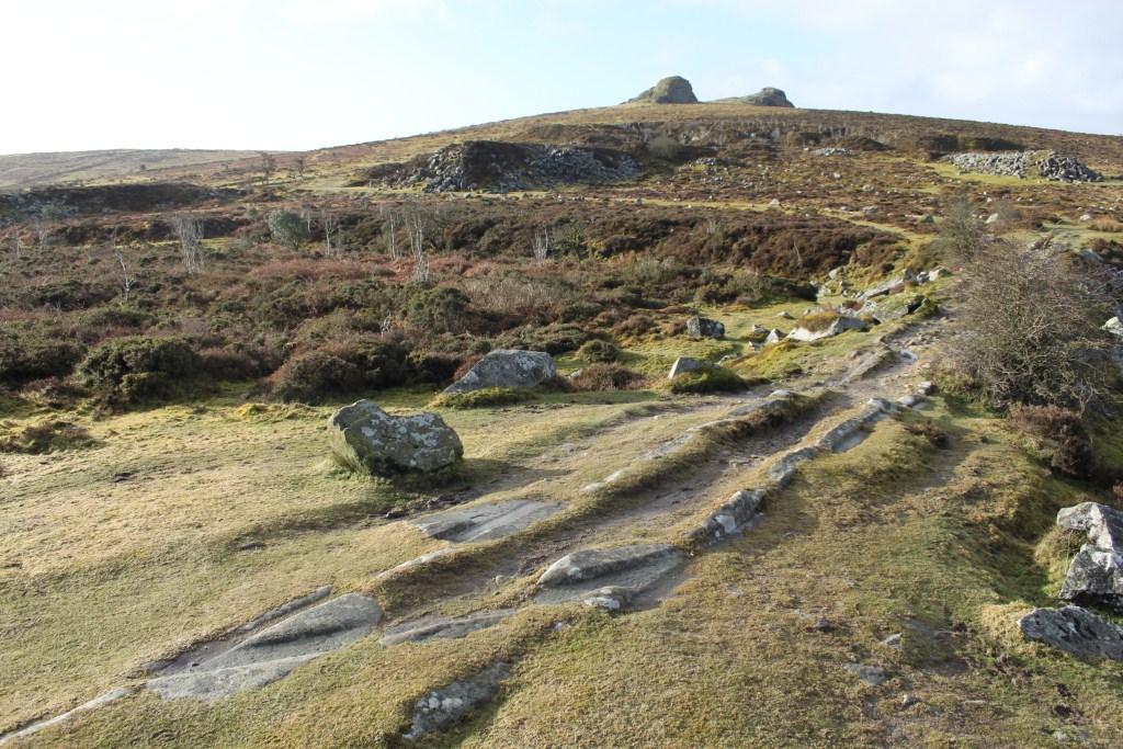
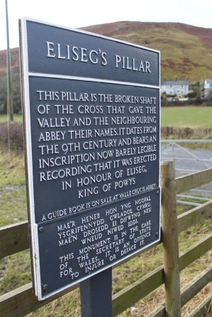
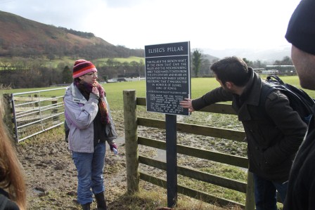
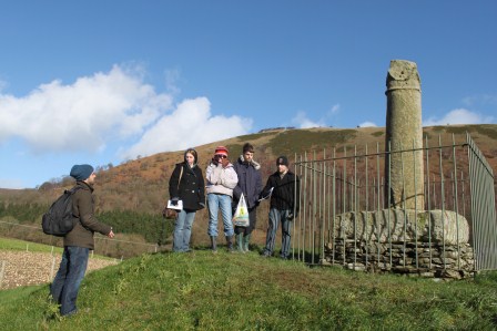
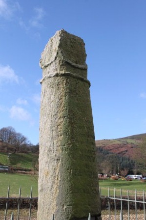
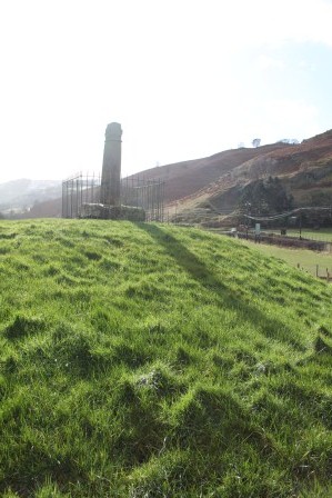
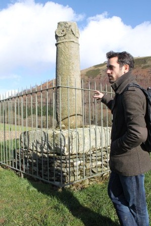
To begin with, here’s the Romantic poet Anna Seward’s “Llangollen Vale,” composed in 1795 following the Romantic poet’s visit to the celebrated Ladies of Plas Newydd,  Sarah Ponsonby and Lady Eleanor Butler. The Ladies and their “Fairy Palace” make their appearance a little more than midway through this 168-line poem, following a stirring if oddly inconclusive account of Glyndwr’s rebellion. The weepy, superstitious monks of Valle Crucis get a look-in toward the end. But, Seward wonders, did any young monastic lip ever wear “gay Eleanora’s smile”?

LLANGOLLEN VALE 

Luxuriant Vale, thy country’s early boast,
What time great GLENDOUR gave thy scenes to Fame;
Taught the proud numbers of the English Host,
How vain their vaunted force, when Freedom’s flame
Fir’d him to brave the Myriads he abhorr’d,
Wing’d his unerring shaft, and edg’d his victor sword.

Here first those orbs unclosing drank the light,
Cambria’s bright stars, the meteors of her Foes;
What dread and dubious omens mark’d the night,
That lour’d ere yet his natal morn arose!
The Steeds paternal, on their cavern’d floor,
Foaming, and horror-struck, “fret fetlock-deep in gore.”

PLAGUE, in her livid hand, o’er all the Isle,
Shook her dark flag, impure with fetid stains;
While “DEATH, on his pale Horse,” with baleful smile,
Smote with its blasting hoof the frighted plains.
Soon thro’ the grass-grown streets, in silence led,
Slow moves the midnight Cart, heapt with the naked Dead.

Yet in the festal dawn of Richard’s reign,
Thy gallant GLENDOUR’S sunny prime arose;
Virtuous, tho’ gay, in that Circean fane,
Bright Science twin’d her circlet round his brows;
Nor cou’d the youthful, rash, luxurious King
Dissolve the Hero’s worth on his Icarian wing.

Sudden it drops on its meridian flight!—
Ah! hapless Richard! never didst thou aim
To crush primeval Britons with thy might,
And their brave Glendour’s tears embalm thy name.
Back from thy victor-Rival’s vaunting Throng,
Sorrowing, and stern, he sinks LLANGOLLEN’S shades among.

Soon, in imperious Henry’s dazzled eyes,
The guardian bounds of just Dominion melt;
His scarce-hop’d crown imperfect bliss supplies,
Till Cambria’s vassalage be deeply felt.
Now up her craggy steeps, in long array,
Swarm his exulting Bands, impatient for the fray.

Lo! thro’ the gloomy night, with angry blaze,
Trails the fierce Comet, and alarms the Stars;
Each waning Orb withdraws its glancing rays,
Save the red Planet, that delights in wars.
Then, with broad eyes upturn’d, and starting hair,
Gaze the astonish’d Crowd upon its vengeful glare.

Gleams the wan Morn, and thro’ LLANGOLLEN’S Vale
Sees the proud Armies streaming o’er her meads.
Her frighted Echos warning sounds assail,
Loud, in the rattling cars, the neighing steeds;
The doubling drums, the trumpet’s piercing breath,
And all the ensigns dread of havoc, wounds, and death.

High on a hill as shrinking CAMBRIA stood,
And watch’d the onset of th’ unequal fray,
She saw her Deva, stain’d with warrior-blood,
Lave the pale rocks, and wind its fateful way
Thro’ meads, and glens, and wild woods, echoing far
The din of clashing arms, and furious shout of war.

From rock to rock, with loud acclaim, she sprung,
While from her CHIEF the routed Legions fled;
Saw Deva roll their slaughter’d heaps among,
The check’d waves eddying round the ghastly dead;
Saw, in that hour, her own LLANGOLLEN claim
Thermopylae’s bright wreath, and aye-enduring fame.

Thus, consecrate to GLORY. — Then arose
A milder lustre in its blooming maze;
Thro’ the green glens, where lucid Deva flows,
Rapt Cambria listens with enthusiast gaze,
While more enchanting sounds her ear assail,
Than thrill’d on Sorga’s bank, the Love-devoted Vale.

‘Mid the gay towers on steep Din’s Branna’s cone,
Her HOEL’S breast the fair MIFANWY fires.—
O! Harp of Cambria, never hast thou known
Notes more mellifluent floating o’er the wires,
Than when thy Bard this brighter Laura sung,
And with his ill-starr’d love LLANGOLLEN’S echoes rung.

Tho’ Genius, Love, and Truth inspire the strains,
Thro’ Hoel’s veins tho’ blood illustrious flows,
Hard as th’ Eglwyseg rocks her heart remains,
Her smile a sun-beam playing on their snows;
And nought avails the Poet’s warbled claim,
But, by his well-sung woes, to purchase deathless fame.

Thus consecrate to LOVE, in ages flown,—
Long ages fled Din’s-Branna’s ruins show,
Bleak as they stand upon their steepy cone,
The crown and contrast of the VALE below,
That, screen’d by mural rocks, with pride displays
Beauty’s romantic pomp in every sylvan maze.

Now with a vestal lustre glows the VALE,
Thine, sacred FRIENDSHIP, permanent as pure;
In vain the stern Authorities assail,
In vain Persuasion spreads her silken lure,
High-born, and high-endow’d, the peerless Twain,
Pant for coy Nature’s charms ‘mid silent dale, and plain.

Thro’ ELEANORA, and her ZARA’S mind,
Early tho’genius, taste, and fancy flow’d,
Tho’ all the graceful Arts their powers combin’d,
And her last polish brilliant Life bestow’d,
The lavish Promiser, in Youth’s soft morn,
Pride, Pomp, and Love, her friends, the sweet Enthusiasts scorn.

Then rose the Fairy Palace of the Vale,
Then bloom’d around it the Arcadian bowers;
Screen’d from the storms of Winter, cold and pale,
Screen’d from the fervours of the sultry hours,
Circling the lawny crescent, soon they rose,
To letter’d ease devote, and Friendship’s blest repose.

Smiling they rose beneath the plastic hand
Of Energy, and Taste; — nor only they,
Obedient Science hears the mild command,
Brings every gift that speeds the tardy day,
Whate’er the pencil sheds in vivid hues,
Th’ historic tome reveals, or sings the raptured Muse.

How sweet to enter, at the twilight grey,
The dear, minute Lyceum of the Dome,
When, thro’ the colour’d crystal, glares the ray,
Sanguine and solemn ‘mid the gathering gloom,
While glow-worm lamps diffuse a pale, green light,
Such as in mossy lanes illume the starless night.

Then the coy Scene, by deep’ning veils o’erdrawn,
In shadowy elegance seems lovelier still;
Tall shrubs, that skirt the semi-lunar lawn,
Dark woods, that curtain the opposing hill;
While o’er their brows the bare cliff faintly gleams,
And, from its paly edge, the evening-diamond streams.

What strains Aeolian thrill the dusk expanse,
As rising gales with gentle murmurs play,
Wake the loud chords, or every sense intrance,
While in subsiding winds they sink away!
Like distant choirs, “when pealing organs blow,”
And melting voices blend, majestically slow.

“But ah! what hand can touch the strings so fine,
Who up the lofty diapason roll
Such sweet, such sad, such solemn airs divine,
Then let them down again into the soul!”
The prouder sex as soon, with virtue calm,
Might win from this bright Pair pure Friendship’s spotless palm.

What boasts Tradition, what th’ historic Theme,
Stands it in all their chronicles confest
Where the soul’s glory shines with clearer beam,
Than in our sea-zon’d bulwark of the West,
When, in this Cambrian Valley, Virtue shows
Where, in her own soft sex, its steadiest lustre glows?

Say, ivied VALLE CRUCIS, time-decay’d,
Dim on the brink of Deva’s wandering floods,
Your riv’d arch glimmering thro’ the tangled glade,
Your grey hills towering o’er your night of woods,
Deep in the Vale’s recesses as you stand,
And, desolately great, the rising sigh command,

Say, lonely, ruin’d Pile, when former years
Saw your pale Train at midnight altars bow;
Saw SUPERSTITION frown upon the tears
That mourn’d the rash irrevocable vow,
Wore one young lip gay ELEANORA’S smile?
Did ZARA’S look serene one tedious hour beguile?

For your sad Sons, nor Science wak’d her powers;
Nor e’er did Art her lively spells display;
But the grim IDOL vainly lash’d the hours
That dragg’d the mute, and melancholy day;
Dropt her dark cowl on each devoted head,
That o’er the breathing Corse a pall eternal spread.

This gentle Pair no glooms of thought infest,
Nor Bigotry, nor Envy’s sullen gleam
Shed withering influence on the effort blest,
Which most should win the other’s dear esteem,
By added knowledge, by endowment high,
By Charity’s warm boon, and Pity’s soothing sigh.

Then how should Summer-day or Winter-night,
Seem long to them who thus can wing their hours!
O! ne’er may Pain, or Sorrow’s cruel blight,
Breathe the dark mildew thro’ these lovely bowers,
But lengthen’d Life subside in soft decay,
Illum’d by rising Hope, and Faith’s pervading ray.

May one kind ice-bolt, from the mortal stores,
Arrest each vital current as it flows,
That no sad course of desolated hours
Here vainly nurse the unsubsiding woes!
While all who honour Virtue, gently mourn
LLANGOLLEN’S VANISHED PAIR, and wreath their sacred urn.

Dartmoor: the blending of ‘myth’ and ‘reality’ when the Devil pays a visit

Reading Howard’s refelctions of his Dartmoor visit last weekend reminded me of my recent field trip with some of my final year undergraduates last October: The weather forecast was atrocious, with bands of heavy rain sweeping across the south west, getting heavier in the afternoon. As it turned out, things started off grey and cloudy, but cleared up after lunch with the sunshine helping to take the edge off the keen SSE winds. We headed off from Bennett’s Cross, leaving the coach behind to go over Birch Tor, and on to Hookney Tor.

We came across a very docile group of ‘Highland’ Cattle, acting as key ‘countryside curators’, managing the land to maintain a desired look and feel of this National landscape. After a stop at Grimspound and Headland Warren, we walked back towards the coach through the old industrial areas of Golden Dagger, Vitifer and Birch Tor mines – and could make out (vaguely) some of the shapes of the Devil’s Playing Cards – and it struck me that the it was almost exactly 375 years to the day since (legend has it) these ‘Devilish enclosures’ got their name….

Sunday 21st October 1638 was stormy day, with heavy rain and strong winds. While some locals were gathered at the Tavistock Inn at Poundsgate, the Devil came in for a swift half – they knew it was the Devil, since he had cloven hooves, and he paid for his pint using ‘solid gold coins’ that turned to dry leaves as soon as he left! Other locals sheltered from the storm in the church in Widecombe-in-the-Moor – these included Jan Richards, a well-known local gambler who was playing cards at the back of the church. All of a sudden, the Devil struck – he smashed through the roof of the church and plucked Jan Richards from his pew. Poor old Jan was carried over the hills, never to be seen again – except that he dropped his playing cards: 4 aces that he’d hidden up his sleeve. These 4 aces landed on the hillside between Challacombe and the Warren House Inn, and can still be seen to this day – as 4 small enclosures that are (very roughly) in the shape of the 4 suits of a pack of cards.

This is a nice story – various versions of which can be found, repeated in several ‘folk tale’ books and websites about Dartmoor. Of course, it isn’t ‘true’ – the 4 enclosures might be physical present, but they cannot be the remnants of a pack of cards. And of course the story of the Devil, smashing his way in to Widecombe Church is just a fairy tale – right?

Sunday 21st October 1638 was stormy day, with heavy rain and strong winds. Many locals sheltered from the storm in the church in Widecombe-in-the-Moor. All of a sudden, the church roof comes crashing down, as a pinnacle from one of the towers topples and smashes through the ancient roof of the nave. The falling debris kills 4 people, including the head warrener from the rabbit farms close to Warren House Inn. This is all recorded in the church records, and is one of the earliest archival records of what is thought to be ball lightening – as a very real ‘thunder bolt’ strikes one of the pinnacles of Widecombe church, sending it crashing through the roof onto the parishioners below.

Here we see a nice example of how ‘real memory’ and ‘folk memory’ can come together through an invocation of landscape; oral histories used to account for the physical artefacts of landscape enclosures – 4 small distinct enclosures acting as a totem through which an important event of folk memory can be prompted, instilled and legitimated: folk memories of extraordinary events, working alongside an everyday requirement to make sense of the landscape, as a commonplace and non-elite space. At very least there seems to be ‘some truth’ in the folk tales of the Devil wreaking havoc at Widecombe church. By giving more credence to the “extra-ordinary” possibilities and experiences of how ordinary people engage with the world around them, however, maybe it is possible to see the story of the Devil’s Playing Cards as providing an authentic means through which to understand how heritage works? Indeed, when placed within the context of the religious upheavals of the mid-seventeenth century, the ‘real’ possibility of devilish intervention in peoples’ lives, and of the possibility of direct experience of ‘evil’, then it could be argued that the story of the Devil paying a visit to Widecombe represents the ‘whole truth’ of the matter.

A Heritage of Topographic Memory in Norwich: from 1549 to the Ordnance Survey Explorer Series Map OL40

Calmly negotiating the inclement weather that we have had recently, the Research Team for the Past in its Place project (http://pastplace.exeter.ac.uk/) visited Norwich a few weeks ago. My own ‘memories’ of Norwich revolve around a post-A-Level boat trip with nine friends and 20 crates of Newcastle Brown Ale (2 each) on the Norfolk Broads. This was not exactly a glorious memory to be proud of, so I was very keen to return to Norwich partly in order to apologise to anyone who might have remembered my last visit.

My memory of Norfolk was that it was topographically quite flat – I guess this is the impression that many people have of East Anglia more broadly. With this in mind, therefore, something that struck me as odd when I was doing some preparatory reading for the trip was a reference to the city being poorly fortified, partly due to it being overlooked by a prominent hill: “Norwich is like a great volume with a bad cover, having at best but parchment walls about it. Nor can it with much cost and time be effectually fortified, under the frowning brow of Mousehold-hill, hanging over it”. The passage is from Francis Blomefield’s (1806) Topographical History of the County of Norfolk, volume 3: History of the City and County of Norwich, part 1, (pages 220-265). According to Blomefield, who draws heavily from Alexander Neville’s Norfolkes Furies (published in 1575) the prominence of this hill, which provided a commanding prospect over the City, played a key role in Kett’s Rebellion of 1549.

Kett’s Rebellion (see http://en.wikipedia.org/wiki/Kett%27s_Rebellion for a general history), is commemorated through several features of the present cityscape of Norwich: Kett’s Hill Bakery and Kett’s Tavern are both situated on Kett’s Hill (the B1140), leading north from the city centre towards Mousehold Heath. And, despite being less than 50m above sea level, the relative topography of the hill certainly does provide a commanding prospect of the city, witnessed by an official Ordnance Survey ‘viewpoint’ on the 1:25,000 scale Explorer Map (OL40).

On the south side of Kett’s Hill Road, is an overgrown park overlooking the gas works. Originally donated to the city council by an anonymous benefactor in 1970, the park was called Jubilee Heights until 1985 when it was renamed Ketts Heights, and was cleared and ‘restored’ for the enjoyment of all the residents of Norwich.

On the north side of Kett’s Hill, however, the land is cleared of trees and undergrowth, and from the Ordnance Survey’s viewpoint, one can see across the city centre, over the ‘parchment walls’ towards Bishopsgate and other streets named by Neville and Blomefield as being the scenes where some of the fiercest hostilities took place in 1549.

Reading Neville’s and Blomefield’s descriptions of Kett’s Rebellion, the topography of the city, and the seeming porousness of its walls appears to be a significant factor in the events as they unfolded. Skirmishes took place along streets that could be clearly seen; confrontations occurred in the dense urban quarters that could be surveyed from on high; while artillery manoeuvres were observed from the safety of the hill. Sitting on this prominent height more than 450 years later, it is the actual view, and the experience of a sort-of-aerial survey of the landscape, possible from this southern edge of Mousehold Heath, which is one of the key aspects of the Rebellion’s heritage.

Graffiti on Norwich Castle (2014)

Llangollen’s Antiquarian Landscapes

IMG_6520
View north from Castell Dinas Bran

This blog was first published on Howard Williams’sArchaeodeath blog.

As a recon. trip for the Past in its Place project, Dr Patricia Murrieta-Flores and I took a look at some of its more famous sites in the Vale of Llangollen where archaeology, folklore and literary culture collide. We visited Valle Crucis and the Pillar of Eliseg and considered their roles and relationship as sites of memory since the early Middle Ages. We also visited two other sites of interest to the project.

IMG_6544
Ruins of Castell Dinas Bran

We scaled the heights of the prehistoric hillfort and medieval castle: Castell Dinas Brân. This short-lived thirteenth century castle is intriguing because its prominent situation within the Vale and traces of earlier occupation allude to a possible prehistoric and early medieval life before it was a castle.

It also has a fascinating biography, attracting folklore associated with giants, bardic poetry and, from the mid-18th and 19th centuries, travel literature and art recording and celebrating its sublime character.

IMG_6549
Ephemeral memorials to a visit, to a person, to a dead person, to a living person?

We explored the ruins and the minimalist heritage signboard, before looking at modern traces of commemoration persisting at the site.

IMG_6570
Ribbons of memory at Castell Dinas Bran

First, there are the arrangements of stones used to map out messages by visitors. Second, there is a tree, clearly a focus of commemoration and perhaps ash-scatterings. Third, there is a location, this time unmarked, but where previously I have noticed is a favourite location for ash scatterings.

IMG_6621
Plas Newydd – a ‘memorial’ to the Ladies of Llangollen
IMG_6605
The stone circle, Plas Newydd

Second, we visited Plas Newydd. Home to the Ladies of Llangollen – Butler and Ponsonby – for over 40 years, it served as a hub for the fostering Romantic movement in Llangollen. The house is situated in an antiquarian landscape where the past was imagined and fostered through landscape and retrieved material culture.

IMG_6616
Medieval churchyard cross positioned in the grounds of Plas Newydd

While the house is closed until April, there is an overtly commemorative component is the house itself on its outside: other of the Ladies’ names. Hence, through the display of its contents and its external names, serves as a form of funerary monument for the Ladies and their Romantic patronage for the arts in the Vale. Their gravestones are also commemorative, translated from St Collen’s churchyard to the Llangollen Museum.

Within the grounds, as devleoped by Butler and Ponsonby and their successors, key antiquarian features include a stone circle and relocated medieval churchyard cross, and a font brought from Valle Crucis Abbey and framed by a poem by the Ladies.

IMG_6658
The medieval font from Valle Crucis recomposed in a grotto within the grounds of Plas Newydd

So here in the Vale we have juxtaposed the medieval ruin and a landscape recreated from medieval ruins. Together, they constitute elements of the antiquarian landscape of memory constructed during the later eighteenth and early nineteenth centuries in the Vale, a process that implicated both Valle Crucis and the Pillar of Eliseg.

Exploring Dartmoor’s Landscape of Memory

IMG_6240
Haytor, Dartmoor

This is a reblog from Howard Williams’s Archaeodeath blog.

Over the last decade, there was a long-running oral history project recording ‘moor memories’ on Dartmoor. In this blog I wish to talk about different kinds of ‘moor memories’ beyond the personal recollections of its recent inhabitants. I wish to consider how archaeology and literature reveal the complex and varied uses of material culture, monuments and places, including natural features, in the creation and reproduction of social memories over the long term for communities inhabiting Dartmoor in the prehistoric and historic past. Part of this relates to memories of the dead as well as memories of the living.

IMG_6439
Quarried stone path – Dartmeet
IMG_6487
The bleak landscape and track, with Nun’s Cross Farm and the Nun’s (Siward’s) Cross

Dartmoor is one of the most archaeologically potent zones of the English landscape in two ways. First, Dartmoor is rich in surviving traces of prehistoric, medieval and post-medieval human activity. Prehistoric remains include stone rows and circles and cairns, hut circles, coaxial field systems and the famous Dartmoor reeves (long linear boundaries demarcating large sections of the moors and their field systems). Medieval and post-medieval remains including deserted farms and their field systems, wayside and boundary crosses, traces of quarrying for copper, lead, stone and (in particular) extensive evidence for tin mining and smelting.

Second, Dartmoor is potent for the long tradition of close interaction between archaeology, folkore and literature, both in terms of academic research and popular reception. This might be encapsulated in the Victorian clergyman and scholar, Sabine Baring-Gould, whose interest in Dartmoor’s folklore and archaeology led to the first excavations at Grimespound. With regard to popular reception, one only has to recall the inspiration of the folklore, archaeology and landscape on Conan Doyle’s The Hound of the Baskervilles. There are many more examples including place-names that must have been coined to reflect the stories and associations of Dartmoor’s medieval inhabitants.

IMG_6298
Tree and old gatepost – Haytor

Despite this archaeological richness, current approaches to the archaeology of Dartmoor remain memory-free in terms of how they interpret archaeological remains and present them to the public. Some categories of archaeological material might be seen as ‘funerary’ or ‘ritual’, others relate to ‘settlement’ and land division. Many recognise the rich ‘palimpsest’ of the Dartmoor landscape. Still, it is rare for these traces of past lives and past deaths to be approached with regard to social memory. Indeed, while some prehistorians have engaged with this theme, the full range of archaeological data, from prehistory to the contemporary past, rarely gets considered in relation to memory work – the practices and technologies by which memories are created, transmitted and reproduced.

IMG_6320
Haytor

Perhaps the reluctance lies in the long struggle to disentangle archaeology from myth and legend that is replete in the landscape and led in some antiquarian writings to the attribution of many natural features to human manufacture. Perhaps it is also the result of a long-established discourse to use the landscape of Dartmoor to write landscape history – an aspiration towards objective narrative regarding what people did in the past – not how, what and why they remembered and forgot their past through inhabiting and transforming the landscape… and talking about it.

IMG_6387
Patricia in the landscape

Still, in the ongoing project The Past in its Place, we hope to use a segment of Dartmoor to explore the relationship between memory and landscape through the intersection of literature and archaeology. We take as our inspiration important work on the archaeology of folklore conducted in the SW of England and elsewhere, and work on the prehistoric of Dartmoor in particular that has engaged with the temporality of landscape.

Last week, I made a preliminary expedition to a few sites that touch on our theme, and in particular, how at different times, the medium of stone is itself the mechanism for the composition and iteration of social memories.

IMG_6389
Widdicombe-in-the-Moor

Dartmoor has so many exciting sites to see and is such a variegated landscape, that nowhere is ‘typical’. In only half a day, there was only time to see a small fraction of the sites I would have wished. Still, I wanted, in only half a day, to show my colleagues Dr Naomi Howell (University of Exeter) and Dr Patricia Murrieta-Flores (University of Chester) some different dimensions to it, both in terms of archaeological remains and in terms of topography, tied to literature in some instances, and tied to memory work through the medium of stone. I made a decision to, in this particular trip, avoid the prehistoric evidence that dominates discussions of Dartmoor’s archaeology and instead look at the more recent past and its traces of memory work. I want to here focus on the relationship between movement, inscription and memory, and how stone in particular – but not exclusively – is used to mobilise this relationship.

IMG_6453
Naomi on the bridge

Movement and memory are key to understanding the archaeology of memory on Dartmoor, and stone often constitutes the medium for the relationship between them. From prehistoric tracks and field boundaries to the tramways that hauled stone off the moors, memory and movement are intrinsically linked in the landscape.

IMG_6287
Haytor quarry and tramway – Haytor in distance

First up, we went to Haytor – to explore this most visited of tors upon the moor, and to consider its industrial landscape – stone quarries and tramways. The tramways fascinate me. Not only are the quarries and tramways ‘memories’ of an abandoned industry left clearly inscribed on the land, they demand negotiation and engagement through movement along and around them. Haytor also interests me since, in terms of memorial culture, the last stones quarried here were taken to provide stone for the Devon and Exeter War Memorial in Northernhay Gardens, Exeter. Stone is here a medium for commemoration, not only for its enduring qualities, but the ‘sacredness’ of its origin – the ‘heart’ of Devon.

IMG_6336
Ashburton/Buckland parish boundary

Next, we walked the parish boundary between Buckland and Ashburton parishes to Buckland Beacon. We noted how 1837 boundary marks and field boundaries defined the parochial division, another relationship between memory and movement, marking the boundary and marking movement along it, as well as commemorating the act of its redefinition. Each stone had the date of its construction and, upon its sides, the initials ‘A’ for Ashburton and ‘B’ for Buckland. Thus, the boundary served to demarcate, but also to facilitate how to navigate, the landscape.

IMG_6429
The Coffin Stone, Dartmeet

Then we went through Widdicombe to Dartmeet. Above Dartmeet with encountered the Coffin Stone where folklore has it, coffins en route to Widdicombe church were rested. It was smote in two by lightning to punish and destroy the coffin and corpse of a sinner rested on it. The stone is inscribed with initials of the dead and crosses commemorating those that passed by after they had passed away.

IMG_6443
The clapper bridge, Dartmeet

At Dartmeet we identified a further physical trace of memory and movement – a half-surviving clapper bridge – once used routinely to convey pack-horses laden with tin and other materials off the moor. I made my bid for freedom by jumping across to the surviving central section. Nothing went wrong, despite my best efforts….

IMG_6479
Nun’s Cross after sleet storm

Finally, we walked along an ancient trackway to the Nun’s Cross (yes, it was a medieval granite-hewn cross, not an angry woman in a wimple). Otherwise known as Siwards Cross, this striking monument is a waymarker situated at an intersection of medieval routes across the moor. Here we encountered the wrath of Dartmoor’s weather as the second we reached the cross – near-horizontal sleet. Still, in the darkness and cold of that deluge, we realised the value of the stone as shelter and for navigation in the difficult and barren terrain.

Inscribing and Depositing Memories

IMG_6303
A memorial tree, Haytor

Relating to the relationship between movement and memory, we found in our short visit a range of means by which memories are inscribed upon the landscape in stone. A clear example of the link was provided in our visit to Haytor. Close to the tor is a tree that seems to be regularly used to memorialise the recent dead, not through textual memorials, but through ash scattering and ribbon tying. This tree is public and private – right next to one of the most visiting sites on Dartmoor, and yet secluded and special. This is a common way of memorialising through association with beauty spots.

IMG_6362
Ten Commandments Stone – Buckland Beacon

Next, we went to Buckland Beacon which bears two striking inscriptions. First is the Ten Commandments Stone – actually two stones – bearing an inscription of the Ten Commandments plus other biblical inscriptions, situated in a striking location with views south over the edge of Dartmoor. The stones were inscribed in 1928 and relate to a particularly idiosyncratic turn of events relating to faith and the recent British landscape. A second inscription is a patriotic one, commemorating the silver jubilee of King George V and the use of the Beacon as a part of a chain of fires to commemorate the event. The site was the focus of more recent beacons, including QE2’s diamond jubilee. We also found deposition here – two caches – one a Flora margarine pot, one a tupperware container – each with notebooks and the memories/statements/names of those who had visited. The latter also had a collection of artefacts left by visitors – the paraphernalia of geocaching.

IMG_6409
Two jubilee megaliths – left the 2012 Diamond Jubilee, right, the 1977 Silver Jubilee of QEII

A further successive inscriptions, again linked to routes of movement, were found near Widdicombe. Here at a fork in the road (careful I said, forks in the road can puncture your tyres) are two memorials to commemorate our glorious QEII: first a stone raised as a megalithic memorial to the Silver Jubilee in 1977, the second a megalithic memorial to the Diamond Jubilee of 2012.

IMG_6432
Inscriptions on the Coffin Stone

Of course the Coffin Stone also links movement and memory to inscription, since initials of those mourned were inscribed upon the stone, together with crosses. And finally, the Nun’s Cross has text inscribed upon it. Difficult to read in the poor light and sleet, does the name ‘Siward’ inscribed upon it commemorate history or myth? Was this a Saxon cross or one that imagines a Saxon past through this inscription?

What is interesting is the relationship between text and granite – the hardest of rocks to inscribe. Most of the texts discussed here were near-invisible, revealing the relatively ephemeral nature of text as a medium of commmoration in this kind of rugged stoney landscape. Yet the monumental medium of stone means that text is always only part of the story. Tied to the places where it is inscribed, the act of inscribing, or depositing, is more important, or as important, as the legibility of what is cut or placed.

These examples suffice to illustrate the varied ways in which movement, inscription and deposition have proven strategies of remembrance in Dartmoor’s late-historic landscape, linked to stories about the living and stories about the dead. I hope to report on more moor memories in future blogs, including those of prehistoric and medieval origin.

A Warm Welcome to Dr Patricia Murrieta-Flores

Today we welcomed a new, sixth, archaeologist to the Department of History and Archaeology. Dr Patricia Murrieta-Flora joins us from Lancaster University.

At Chester, she has been appointed to a three-year position as a Senior Researcher on the Past in its Place project involving researchers at the Universities of Exeter and Chester.

Paty is a GIS expert and gained her PhD from the University of Southampton and she has worked in applying spatial technologies to the study of prehistoric and early historic landscapes in Iberia and England. Paty has her own wordpress blog here.

Paty will be working on the project’s Strands 2 – Ancient Habitiations – and Strand 3 – Topographies of Memory.

For Strand 2, we are looking at a range of prehistoric and early historic monuments and their immediate localities, exploring their spatial and temporal genealogies through texts and material culture.

For Strand 3, we are looking at archaeologies of memory over the longue duree in some contrasting regions of England and Wales.

The next three years are going to be great to work in collaboration with an expert in computer applications in the archaeological investigation of social memory in past landscapes.

3
Images from Paty’s work, spatially analysing the places cited in literary texts

The Pillar of Eliseg – Howard Williams Explores

This blog was originally posted on Howard Williams’ Archaeodeath blog
IMG_5715
The Pillar of Eliseg from the west in today’s sunshine

I have blogged about Project Eliseg on previous occasions, and the public talks I have presented about my work on the Pillar of Eliseg (e.g. Holt, LlangollenCorwen and Keele). However, every visit to the monument itself is different: it changes with the weather, the seasons and with the activities of the farming regime of the field surrounding it. Equally important is the fact that each visit also varies depending on the company: their responses, ideas and questions.

IMG_5796
The fragment of ninth-century cross-shaft set its original base, re-erected in the 18th century and set within fences in the early 20th century.

This time, I was joining a fieldtrip run by Dr Adrian Maldonado – my replacement this academic year – with students on the MA Archaeology of Death and Memory. Adrian was superb in getting the students discussing the complex biography of the monument from its Bronze Age origins as a burial mound, through its early medieval reuse as the location for a stone cross with a memorial inscription and through the medieval and modern uses and  reuses of the monument. We also discussed Project Eliseg’s excavations on the site from 2010-12. Afterwards we had an amazing hot pork and apple sauce bap at the Abbey Farm before exploring Valle Crucis.

The Pillar and its mound looked particularly fine in today’s sunshine (yes, sunshine, would you believe it!). More information can be found on the Project Eliseg website and our Youtube video blogs. Inspired by Adrian and his students, I thought this blog might be a useful point to outline, in material terms, some basic information about the Pillar’s complex biography evident on the surface and revealed through our 2010-12 excavations. In the spirit of a genealogy, rather than a biography, I begin with the present and move back into the past.

21st century – Archaeology, Reconstitution and Restrictions

There are plenty of traces of 21st-century activity on the site. Our excavations and the subsequent consolidation by Cadw have altered slightly the shape of the western side of the mound that had previously become worn by footfall.

IMG_5736The wooden-post fence-line around the base of the mound is a construction by Cadw following our first, 2010, season of excavation to guide visitors around to the east side of the monument where there is a small stile allowing access up to the monument. Sadly, upon observation and discussions with visitors, this isn’t visible and many visitors simply don’t approach the monument anymore. Meanwhile, those with disabilities have no effective access to the monument. It was particularly embarassing to learn that an eminent medieval archaeologist couldn’t access the monument in this account.

20th century – Heritage and History

IMG_5731
The Ministry of Works signboard – mid-20th century

There is no modern heritage presentation of the site, which is one of the reasons why we got permission to dig in 2010-12, to inform subsequent heritage interpretation. Instead, one is left with the starkly antique signboard. I am not sure of its precise date and chronology, so I am happy to be corrected. What is interesting is that, while the sign is largely accurate, it is monolingual. The sign too has a biography however, since the sign below it is later and bilingual. Adrian and the students noted that its position prevents it being seen from the road, meaning that you have to have entered into the field first to read it. This prevents the danger of people stopping their cars in a perilous position to read the sign, but equally it restricts interest and notice from passers-by.

IMG_5729
Adrian and the students visit the signboard with a biography
IMG_5785
Fenced in monument

What features on the monument itself are 20th century? Visible before our fieldwork, but now hidden, are the octangonal concrete pillars that mark the edge of the scheduled area with ‘MOW’ on their tops. Meanwhile, the iron fence around the top of the monument mark its protection as an Ancient Monument. These are key material culture of heritage conservation. In addition to this, there are traces of the stone’s consolidation with iron pins and concrete, ensuring it stays in place. Other traces on the monument are not exclusively 20th-century, but are shared by the centuries following its construction – but the acid rain of the 19th and 20th centuries might have caused a large portion of the erosion.

19th century – Tourism and Trees

IMG_5816
In this photo, with Adrian and the students at the monument, you can clearly see the ‘saddle’ within which the pillar is situated.

The trees that were planted on the mound have left subtle traces on the surface. Meanwhile, the foot-fall of the many tourists that visited the monument in the 19th and 20th centuries created a depression on the western side prior to our consolidation. A range of nineteenth- and twentieth-century artefacts recovered during excavation reveal the many people visiting the site. Moreover, during excavation it became apparent that the reason the cross-shaft and base sit on a visible drystone base within a saddle is because the original reconstitution of the monument in the 1780s was subject to erosion from visitors and livestock, taking away the soil that had been thrown up around its base and revealing the drystone base that I think was originally intended to be obscured from view.  

18th century – Reconstitution and Rededication

IMG_5780
The re-inscription of the Pillar in the 18th century

The entire monument, as it appears today, is the product of Trevor Lloyd’s reconstruction. His re-dedication of the monument to himself (very modest of him) is revealed in the Latin inscription on the eastern side. The drystone base upon which he re-positioned the cross-base, and inset into it the cross-shaft fragment, are all his work. He may have done this to make the re-erected monument more visible from the summer lodge he constructed beside the fishponds next to the ruins of Valle Crucis Abbey. 

17th century – Absent Presences

There are no exclusive and conclusive traces of seventeenth-century Pillar apart from absenses. The cross-head was presumably still in place when the cross fell down c. 1640 and the remaining reconstituted monument foregrounds its absense. The lack of the legible ninth-century Latin inscription is implied by faint traces, but the seventeenth century saw Edward Lhuwyd transcribing them, thus saving them for modern academic study as discussed in detail by Prof. Nancy Edwards.

The Middle Ages – Naming the Monument

What is particularly frustrating is lack of direct evidence for activity around the cross in the period between its ninth-century construction and the seventeenth century. There was not conclusive evidence of medieval activity from the excavations. Instead, evidence of the veneration held for the cross comes from the place-name itself – ‘the valley of the cross’ by which the Cistercian monastery was known. This is an example where lack of activity might indicate respect rather than neglect. We can imagine monks and travellers passing by the Pillar when its cross was still intact and using it as a station in processions or as a shrine, but no evidence has been left of this.

The Ninth-Century Cross

IMG_5784
The cross-base

Only two fragments of the original cross-and-base survive and its text is near illegible. However, the text, circular form of the shaft, and large stone base are a striking and distinctive survival of a monument type better known from among the Mercian rivals of the kings of Powys who erected this monument. Likewise, the cross-shaft, with its swags, has ninth-century paralles from Cumbria and is a distinctive early medieval form.

IMG_5764
The swags on the base of the cross-head, now lost

What is particularly lacking is any evidence from the excavations of ninth-century activity. While post-excavation work might reveal further traces, our dig didn’t reveal conclusive evidence of the site’s use as a settlement, burial ground or anything else for that matter. This isn’t surprising, since identifying any of these activities from archaeological evidence from Western Britain in this period is a huge challenge.IMG_5740

Prehistoric Origins

Finally, at the top of the genealogy is the prehistoric evidence: we have conclusively and convincingly shown that the mound beneath the Pillar was a multi-phased Bronze Age kerbed cairn with at least three secondary cists. Only one of the cits we dug was found to be undisturbed. In this one, the cremated remains of multiple individuals – adult and children – and artefacts (a bone pin and flint scraper) were found. This form of mortuary practice is well attested from North Wales, but this conclusively demonstrates a prehistoric data for the monumental sequence.

Conclusions

IMG_5797
Adrian talking about the Pillar

Post-excavation work on Project Eliseg is ongoing. Still, this brief sketch of some aspects of the monument’s biography reveal the changing fortunes and perceptions of the mound and Pillar and the practices that enwrap it.

A further point to be made about the cross – from its ninth-centur origins to the present – is a multmedia monument. Text, form and materiality, as well as its location on an ancient mound in a prominent valley terrace location, worked together to construct a monument claiming descent from ancient warleaders and saints. These could collectively and individually legitimate successive elite identities and authorities.

The irony is that the specific commemorative aspirations of this monument by those that commissioned it was unsuccessful. Concenn’s dynasty and kingdom did not survive the Viking Age. And yet this ‘failure’ opened it up to other perceptions and uses down the centuries, securing its persistence as a landmark in the Vale.

Past in its Place – Norwich

This post was originally placed on Howard Williams’ ‘Archaeodeath’ blog.

I have just returned from Norwich. I was attending a project meeting and conducting research linked to the Leverhulme Trust and European Research Council funded ‘The Past in its Place’ project.

IMG_5241
Norwich Cathedral from the cloister

The visit included three from Chester – Ruth Nugent, Patricia Murrieta-Flores and myself. We were joined by seven researchers – historians, literary scholars and geographers – from the University of Exeter. As well as the project leader Philip Schwyzer, there was Nicola Whyte, Sarah Hamilton, David Harvey, Naomi Howell and Joanne Parker. Paul Bryant-Quinn is the tenth member of the project.

Norwich Cathedral is one of our case studies for Strand 1 of the project: ‘Speaking with the Dead’ focusing on cathedral tombs and memorials. I had visited before, but I was keen to get back and explore the memorials in all their detail and variability, from medieval effigies to 19th and 20th -century ledgers and mural monuments.

IMG_5484
View of Norwich from Kett’s Hill

Meanwhile, ‘Norwich and Mousehold Heath’ is one of our case study areas, investigating strand 3 of the project: ‘Topographies of Memory’, looking at landscapes in which memories accrued through literary traditions and cultural practices over the longue duree. One of our areas of interest here is in the commemoration of Kett’s Rebellion in texts and in the landscape.Our activities included:

  1. A Project Meeting opened by a formal welcome to Patricia to the project
  2. A visit to the Cathedral Library
  3. A visit to the Records Office
  4. A tour of the historic streets and churches of Norwich
  5. A visit to Kett’s Hill and the ruins of St Michael’s church
  6. Three separate explorations of the cathedral’s tombs and memorials, the second with the cathedral’s librarians, the third with expert death scholar, Dr Julien Litten, author of The English Way of Death.
  7. A visit and exploration around Norwich Castle Museum led by Dr Tim Pestell, early medieval archaeologist and author of Landscapes of Monastic Foundation.

Here are some photos of our adventures.

IMG_5305
IMG_5409IMG_5515
IMG_5663
Dr Julian Litten meets Paty, Philip and Ruth
IMG_5450
Paty and Ruth head for lunch at the Adam and Eve pub
IMG_5536
Visitors leaving Norwich Castle Museum stick their used entrance badges on the bin
IMG_5608
Norwich Castle
IMG_5641
Statue of Sir Thomas Browne
IMG_5477
Exploring Kett’s Heights overlooking Norwich – a surprisingly steep hill with fine views over the city.
IMG_5554
Inside the Norman donjon of Norwich Castle
IMG_5530
The area around the cathedral is known as ‘tombland’