Death-Defying Cistercians?

IMG_2625

Buildwas Abbey, Shropshire

Re-posted from Howard’s Archaeodeath blog. In the Past in its Place project we are exploring how memories are located in cathedrals, ancient habitations and the wider landscape. Here, I muse over how the dispersal of tombs and memorials, and the heritage management of the ruins of Cistercian monasteries, is more than a casual ‘forgetting’ of the dead, but an overt dimension of heritage interpretation with its focusing on the religious and economic life of medieval monks that downplays the dynamic relationships between patrons and abbeys in which memory was key.

I recently visited Buildwas Abbey, Shropshire, a site managed by English Heritage and staffed that day by one of its most friendly of employees.  Beside the River Severn, this is a perfect ruin of a 12th-century Cistercian house, suppressed in 1536 and adapted into a secular mansion.

It is truly a ‘perfect ruin’, together with woodland walks down to the river. It was a great stop-off en route back from Oxfordshire to North Wales. For me this was a real nostalgia visit, since I last went there as a kid myself. Here are some general pictures of this superb ruin with the neatly trimmed grass that typifies EH sites.

Continue reading

Cremation Switchback and the Churchyard

IMG_8628

Pennant Melangell church

This is re-posted from Howard Williams’s Archaeodeath blog.

Recently I posted about a visit to Pennant Melangell and the shrine of St Melangell. Well, it must be said that this is a fascinating site for its church and internal memorials, but even more so for its churchyard.

IMG_8500

18th-century graves: Pennant Melangell

Many urban,suburban and large rural churchyards (whether in use or abandoned) have very complex patterns of memorialisation with multiple foci to them. In such environments, the bodies of the dead compete with each other, jostling down the generations within the restrictions of limited space. From the 19th century in particular, some churchyards bear signs of a new trend of expansion rather than reuse.

Continue reading

Grace Darling

Grace Horsley Darling by Thomas Musgrave Joy. Reproduced from http://en.wikipedia.org/wiki/Grace_Darling

Grace Horsley Darling (1815-42) is one of the Victorian era’s premier heroines and her story is well told by the website dedicated to her memory. Grace was born in a cottage next to St Aidan’s Church, Bamburgh, Northumberland.

She grew up a lighthouse keeper’s daughter upon Brownsman Island, one of the Farne Islands. Adept at sea and familiar with seabirds and island life, she then moved aged 10 into the newly built Longstone Lighthouse in 1825.

On 7th September 1838, she observed the wreck and survivors of the Forfarshire and subsequently rowed with her father in a storm to their rescue. Grace was a young woman who lived a relatively isolated life who through her heroism became a worldwide early Victorian celebrity.

The Victorian obsession with this female celebrity (including fascination from clergy as well as laypeople) was replete with Christian spiritual allusions connecting her residence and acts and the deeds and habitations of the early saints Aidan and Cutbhert who inhabited the Farne Islands. Grace also embodied the adventurous romance of the sublime isolation and dangers of this maritime environment.

Yet the affinity for Grace manifest itself in the deeply, material and corporeal one desire to possess her body. People wrote fan mail to Grace, wished to kiss the paper and post it back, send locks of her hair, asking her to appear at public events as a ‘token’ and almost as an living saintly icon. People travelled to see her and there was a desire to have her act of bravery depicted by artists. Also, portraits of this lady were taken and widely distributed. Grace embodied the virtues of English Christian virginal womanhood. Whether it was the pressure of her fame alone, Grace died only four years later, aged only 26, on 20th October 1842. Perhaps she was hounded to an early grave by her public exposure; near her end she was fearful of imagined eyes watching her. Still, she was ultimately diagnosed with tuberculosis and died from that condition.

Continue reading

Lindisfarne Stones

Re-posted from Archaeodeath

This is my fourth and final comment about a short visit to Lindisfarne. The principal reason for my visit was to view the early medieval stone sculpture in the visitor centre and priory. Strip away the archaeological excavations elsewhere on Holy Island, strip away the historical record, the vast majority of the material evidence that this had been an important monastic foundation of the seventh to ninth centuries AD comes from the collection of Anglo-Saxon sculpted stones discovered in and around the priory. It is a fabulous and varied collection as one might expect. I have already mentioned the Petting Stone. In the priory itself is a cross-base with serpentine crosses on its front.

Continue reading

Commemoration at Lindisfarne Priory

Re-posted from Archaeodeath

As a place of worship and pilgrimage, with St Mary’s church and churchyard right next to the priory ruins, and given the long-standing associated with the absent saintly dead in the form of Aidan and Cuthbert, it is hardly surprising that death and memory are interwoven with the site of Lindisfarne Priory’s ruins. I have mused over the landscape and seascape context and the heritage interpretation of the famous Viking raid, but what of death and commemoration in the English Heritage site of Lindisfarne Priory and its environs? Even a brief consideration of this topic reveals the complexity of what is memorialised and what is not; where memorialisation has historically been allowed, and where it is not.

The ruins are a marvel in themselves, already one of my favourite sets of Romanesque and Gothic monastic ruins before I even got there. I loved the patina of the windblown sandstone and the fabulous columns of the nave, so reminiscent of Durham Cathedral. Here are some standard  photos for your viewing pleasure.

Continue reading

Lindisfarne

IMG_4090

Lindisfarne Priory from the Heugh

Re-posted from Archaeodeath.

Recently, for the first time in my adult life, I had the opportunity to visit the premier medieval site of Lindisfarne. This is a site of key historic and archaeological importance for understanding the Anglo-Saxon church, its origins, development and diversity. It was here that Aidan established the earliest Christian monastic foundation in the kingdom of Northumbria. His founder status was superseded to a large extent by the cult of St Cuthbert, but forgotten he was not. Lindisfarne is also famous for being subject to one of the earliest, and certainly the most famous of Norse raids, in AD 793. Following a decline (or abandonment) of the site during the tenth century, the Benedictine priory was a focus of monastic life and pilgrimage to the cenotaph of Cuthbert’s original grave and to St Cuthbert’s Isle – the site of his hermit’s cell – through the Middle Ages. The monastery survived until Henry VIII’s suppression of the monasteries.

IMG_3823

The English Heritage commissioned artist’s impression of the Anglo-Saxon monastic site

I couldn’t stay long on the island, but I can only enthuse about the striking landscape and seascape, appreciable even from a short visit. The first thing to note is the striking topography of the island itself, joined as it is by a tidal causeway to the mainland. Dunes constitute much of the north of the island, leaving a relatively small and protected area of habitable ground. The Anglo-Saxon monastery was located beside a natural harbour on the sheltered southern shore.

Continue reading

Maelmin

IMG_4105

The Maelmin Heritage Trail


Ok, I thought of the strained pun on the ‘The Postman Always Rings Twice’ and now I have absolutely no idea how this relates to this blog posting. This is the beauty of having no editor and no anonymous referees: I need not explain myself to anyone! If you can overcome this disappointment, please read on…

IMG_4111

Boards by the entrance outline the history of the RAF site

IMG_4110The landscape around Millfield, Northumberland is a rich archaeological landscape spanning from the Mesolithic to modern era. Having visited Yeavering/Ad Gefrin, Bamburgh and Lindisfarne the previous day, I went back to the Millfield basin to ascend Yeavering Bell. En route, I stopped off very early morning to walk around the Maelmin Heritage Trail on the edge of Millfield. Here I encountered something very different from the other sites.

IMG_4124

Millfield henge monument

The Anglo-Saxon palace site of Maelmin was the successor to Ad Gefrin. Never excavated, aerial photographs revealed a elaborate complex of timber halls, enclosures and burial sites comparable to Yeavering and Thirlings. Excavations of two Neolithic henges at Millfield also found secondary early Anglo-Saxon inhumation graves reusing these ancient monuments. Again it is unclear the full duration of the site without extensive excavations but close by lower-status Anglo-Saxon settlements at Cheviot Quarry (published in the Archaeological Journal) and other sites reveal the broader pattern of early medieval settlement around the Millfield basin.

IMG_4136

The woods

As with Ad Gefrin, the Maelmin Heritage Trail faces the stark challenge of communicating a rich archaeological landscape in which there is almost nothing to see above ground for the visitor. The heritage trail originally had three reconstructions (two extant) and a massive dose of heritage boards set within a plot of land managed as a mix grassland and woodland.

IMG_4161

Early morning views over the Millfield basin from the Maelmin Heritage Trail

The visitor to the site begins with a car parking area and three heritage boards giving details of the wartime history of the site as an RAF airfield for training pilots. There is a memorial stone upon which are the names of those – mostly of the RAF and RCAF – who lost their lives between 1942 and 1946 at the facility.

IMG_4172

The ‘Dark Age house’

An introductory heritage board gives details of the archaeological landscape. One then embarks on a time trail moving through a broadly anti-clockwise route through thick grass and then through the wood and back to the car park through the grass again. Board after board gives informative details of the local landscape, the chronological narrative: Mesolithic, early Neolithic, late Neolithic, Bronze Age, Iron Age, Roman, end of Roman Britain, the ‘revival of the Britons’, the early Anglo-Saxons, the conversion of the Northumbrian kingdom to Christianity.

IMG_4179

Sneaking a peak inside the Dark Age house

There are additional boards explaining details within the periods, about the three reconstructions: the Mesolithic hut (no longer extant), the Neolithic henge and the ‘Dark Age house’ and the excavations at Cheviot Quarry and the sites of Maelmin and Thirlings.

The henge is interesting, with ditches, banks and upright timber posts, it does indeed give a sense of how these monuments might have looked.

IMG_4207

Henge posts in early morning light

The ‘Dark Age’ house was locked, but sneaking a peak through the door, one got a sense of a relatively small and stark interior, but inevitably it sits without a context unlike the ‘settlement’ arrangements elsewhere like West Stow and Bede’s World.

A further set of heritage boards explores the preferable climate of the Millfield basin, the formation of the landscape, the hydrology of the basin, woodlands, animals and birdlife.

IMG_4215

Anal graffiti

Three things struck me about this heritage site

  1. The volume of boards, and the two reconstructions, do create a palpable sense of archaeology and landscape in a relatively small space. Given the lack of public accessible land in the immediate environs, this was a great foci for anyone interested in the heritage of the area, and works in this regard far better than Bamburgh, Lindisfarne or Ad Gefrin
  2. The information is accurate in general terms, but incredibly conventional and stylised, particularly notable (to me) in the proto-historic and early historic boards which advocate a simple migrationist framework for the emergence of the Anglo-Saxon kingdom. To be fair though, this is what happens everywhere in this region it seems: Lindisfarne even had the Dad’s Army style map with arrows showing the migration routes of the Anglo-Saxon tribes. For crying out loud!
  3. It is not unusual for the same artist to be responsible for the images, creating a coherence to the displays, creating a shared theme. Despite the perpetuation of stereotypes of dress and body proportions (all men had massive muscles, all women had massive breasts: at least in prehistory, then women and men both get far more boring and better clothed), at least it was a rare attempt to introduce a Carry On style humour into British heritage sites. At least that was my view. At most other sites you are really not expected to laugh at other heritage sites, and where humour is used, it is in infantile attempts to engage kids. For me, this worked well and created memorable images and information.
IMG_4216

Empty – no leaflets 🙁

So despite the absence of any ‘real’ archaeology, the Maelmin Heritage Trail tries its best. There were no leaflets to take away and one typo on the main introduction board has been angrily daubed with rectifying graffiti. Still, on the whole, this gets my tentative thumbs up.

As for the pun? Answers on a postcard to: Maelmin Heritage Trail Pun Competition, Millfield, Northumberland. Although perhaps, at a site where two henges were excavated, this is a site with two rings…

IMG_4150

I’m really not sure what the archaeological basis for any of this is, but still, a nice idea.

IMG_4164

I like this so much. Lovely chamber grave with wand-wielding priestess (I think) and the march of the Angles out of Bamburgh heading for glory…

IMG_4199

How Maelmin may have looked. Still, ‘royal town’ really does give the wrong impression to the visitor.

IMG_4186

Edwin getting hitched and Paulinus batpising people in the River Glen. ‘Flowering of Anglo-British Culture’: nice phrase but I think Northumbria was not more or less ‘Anglo-British’ than anywhere else in lowland Britain.


Yeavering Bell

IMG_4287

Yeavering Bell from the south

Re-posted from Archaeodeath

At the research workshop on new research at Ad Gefrin/Yeavering, many of the experts present proclaimed, from different perspectives, that you cannot understand Ad Gefrin without understanding the hill-fort of Yeavering Bell. Ad Gefrin, it was said, is ‘in the shadow’ of Yeavering Bell. This was no empty metaphor: during a large portion of the year, the Ad Gefrin site is in the shadow of the hill over which the low winter sun cannot project. Frosts stay longest at the Ad Gefrin site than in surrounding fields I was told.

And indeed, to observe Ad Gefrin and understand its situation I was told that one cannot do better than to ascend Yeavering Bell. Many of those there told me they had made out possible crop-marks from the perspective offered by the hill upon which the fort is situated.

IMG_4229

Stream on the ascent

IMG_4235

View over the Ad Gefrin site during the ascent of Yeavering Bell

Yeavering Bell is the only ‘true’ hill-fort in the Cheviots although it must be said that almost every hill along the northern edge of the Cheviots has a smaller fortification of presumed (if not proven) late prehistoric date upon it. Aerial photograph has shown how this is simply a surviving dimension of a wider settlement pattern; in lower areas similar fortified sites have been obliterated by medieval and post-medieval agriculture. Despite this advance in knowledge, Yeavering Bell still stands out in terms of the prominence of the hill itself and the size of the defences and the number of house-platforms identified within it.

IMG_4262

Leading the way

There remains considerable debate regarding Yeavering Bell’s date of construction and occupation and whether the small hill-top fortification within the hill-fort, around the highest point is a contemporary Anglian fortification linked to the palace site of Ad Gefrin. Surveys and excavations have only partly identified the extent to which this site may offer ‘continuity’ from the first millennium BC through to the mid/later first millennium AD. Was Ad Gefrin a direct successor to a persistent central (and possibly sacred) place? Or was it a reactivation of a locale whose original (or many previous) uses were long forgotten but whose monumental and topographical supremacy could never to be ignored?

IMG_4264

Up Yeavering Bell

I won’t use this blog as the place to wade into these debates yet, and you can read the views of the different authors in Paul Frodsham and Colm O’Brien’s fascinating survey Yeavering: People, Power and Place. Richard Bradley’s superb 1987 paper in the Journal of the British Archaeological Association, that has done so much to inspire me and others in thinking about ‘the past in the past’, should also never been ‘forgotten’. Before that, Hope-Taylor’s publication on Yeavering has many (if sometimes very frustratingly vague) things to say about the hill-fort. For a list of available publications, see the Gefrin Trust website. Roger Miket has recently published on this topic in Archaeologia Aeliana but I have yet to secure a copy of this publication.

IMG_4304

Farm building and field walls: post-medieval

What I will say is that I often rant against archaeologists who define sites by period, when those sites persisted and were open to reinterpretation and reuse long after their initial construction. Equally though, I am cynical of claims at ‘continuity’ without precise clarification regarding what is meant by this.

IMG_4323

View south from Yeavering Bell over the ramparts

I intend to synthesise an appraisal of the hill-fort and its relationship with Ad Gefrin with regard to its remembering and its forgetting, responding to the work of Bradley, Frodsham, Oswald and others, as part of the Past in its Place project.

IMG_4330

The summit cairn of Yeavering Bell

In doing so, my aspiration is to try and disagree with everyone, not because I think that everyone who has worked on this fascinating site and its context is ‘wrong’, but because I feel their frames of reference and theoretical perspectives (where expressed) are different from mine and my colleagues with our interest in the history of memory from archaeological and literary perspectives.

IMG_4346

Me at the summit of Yeavering Bell

So on the day after I visited Ad Gefrin and Bamburgh, followed by a visit to Lindisfarne in heavy rain, I went back to park at the Ad Gefrin lay-by and walked up Yeavering Bell on a windy but beautifully warm and sunny summer’s morning. I was up early, having been awoken by Berwick-upon-Tweed drunks at 4 am (my Travelodge was adjacent to a 24-hour McDonald’s restaurant that clearly attracts the intoxicated and inarticulate of Berwick on the Sunday morning after a Saturday night). I stopped en route at Maelmin (topic of another blog inevitably) before I moved on to ascend Yeavering Bell.

IMG_4357

The summit of Yeavering Bell with the line of the fortlet’s defences running around the summit.

From the perspective of the Past in its Place project, visiting the site was a real eye-opener as expected and promised. I saw much that I anticipated but far more than I didn’t. Visiting Ad Gefrin was simply not enough.

IMG_4358

View over the Ad Gefrin site from Yeavering Bell

What an experience! Alone on a Sunday morning, and with only semi-inquisitive sheep, a whimbrel (symbol of Northumberland National Park) and a skylark for company, I got to ascend, explore and descend a fabulous hill-fort.

The site affords stupendous views southwards over the Cheviots and north over the valleys of the rivers Glen, Till and Tweed. I saw no goats, I am sad to say but I saw the fortifications, the fortlet at the highest point, and some of the house platforms.

I can also attest that the Ad Gefrin site is intimately bound up visually and physically with the hill-fort, but I am not convinced it was bound up with the hill-fort in any practical or successive sense. It seems to me that the hill and the earthworks would have significance in the early medieval period even if the active use of the hill-fort was restricted to a short duration within the Late Bronze Age or Early Iron Age. There may be traces of Roman activity on the hill-top, but its scale and looming presence would surely be enough to afford the site significance for the emerging kingdom of Northumbria in the late sixth and early seventh century.

With these thoughts in mind, I aim to return in August with the group of Past-in-its-Placers to outline and refine my musings.

IMG_4418

The hill-fort defences

IMG_4414IMG_4429IMG_4421

Bamburgh

IMG_3681

Bamburgh Castle from the beach

I recently visited Bamburgh where I received a warm welcome from Bamburgh Research Project director Graeme Young and his team. I was last at Bamburgh as a child. From photographs and from memory, I recall the castle as dramatic indeed. I half-expected to be underwhelmed by the reality. However, the site, its archaeology and its landscape failed to disappoint. A spectacular location and a fantastic archaeological site. What is ‘Bamburgh’ in archaeological terms? Well, I regard it as a famous multi-period fortress: the focus of the long-running but perhaps still under-valued archaeological research project: the Bamburgh Research Project (BRP).

IMG_3413

BRP excavations in Bamburgh Castle, chasing Hope-Taylor…. in the rooms behind, sealed like a mummy’s tomb, BRP uncovered Hope-Taylor’s work room!

IMG_3406

Excavations by BRP have revealed trench-slots possibly related to a guard-room and gate for the Anglo-Saxon fortress.

Their ongoing mission is to boldly go where others have gone before. Incorporating many training and community dimensions, their recent work has involved the re-evaluation early antiquarian discoveries and re-exploring the archives and trenches opened by Brian Hope-Taylor (of Yeavering fame) who dug at the castle but failed to complete or publish his work. Their other ongoing mission – that rubs shoulders (and trenches) with the first – is to boldly go where no-one has been before, since BRP has produced many exciting new discoveries both outside the castle and inside the castle grounds (in the trenches formerly opened by Hope-Taylor and beyond in new areas).

BRP’s excavations of the Bowl Hole early medieval cemetery have provided exciting new evidence of the complex social groups contributing to an Anglo-Saxon royal fortress’s population.

Meanwhile their work within the castle is providing evidence both in the area of castle’s church where they may have found an early medieval crypt, and in two zones in the northern half of the castle near what may have been the early medieval entrance and industrial areas serving the Anglo-Saxon fortress.

IMG_3347

The likely original approach to the fortress from the west-north-west.

In very broad and simple terms, BRP are revealing new information about the socio-political and industrial dimensions of the fortress, as well as its mortuary and religious significance. Despite the inevitable restrictions on working at an open heritage attraction overlain by centuries of monumental late- and post-medieval castle architecture, BRP have soundly dismissed any cynic who might think that digging in a castle will only reveal slight traces of early medieval activity. If this wasn’t enough, reinterpreting other archaeologist’s old trenches is challenge enough but in the context of complex layers and a shallow bedrock, it is even more challenging. Unsurprisingly, for almost a decade, I have supported students from Exeter and Chester wishing to go on their fieldwork at Bamburgh but it was great to see the site finally in person.

I defer to their own website and blog for details regarding the archaeology and you can read about some of their recent discoveries in the castle’s museum, a book composed for visitors about the site’s archaeology, and also in academic publications in journals like Medieval Archaeology and Archaeologia Aeliana.

IMG_3551

A classic and effective presentation strategy, an early medieval comb displayed next to a replica

IMG_3549

Display of a hoard of copper coins of Middle Anglo-Saxon (mid-ninth century) date, found in the excavations by BRP.

Early Medieval Bamburgh

‘The city of Bebba’. As an early medievalist, the task is to see past all of the later medieval rubbish, and post-medieval fantasies regarding the Middle Ages, to try to discern what physical evidence survives from the Anglo-Saxon phase. For this was an Anglo-Saxon fortress. As such, it is best seen as one example of the many early medieval uses for hill-top fortifications. Hence it is best described as a ‘hill-fort’ in my view, prior to its recreation as a medieval castle.

IMG_3534

Jayne Brain’s reconstruction of a royal hall of Anglo-Saxon date.

Indeed, it is utterly anachronistic to see its early medieval phases as a ‘castle’, although I concede that the presence of later phases, and the place-name, make such back-projections seductive and confusing for visitors and experts alike. I still find it amazing that early medieval hill-forts are frequently caricatured as settlements of the ‘Britons’ and ‘Picts’ when there is plenty of evidence for their use in lowland Britain – in areas that are generally regarded as ‘Anglo-Saxon’, during the fifth to eleventh centuries AD. Bamburgh is one such example.

IMG_3397

Oswald almost certainly didn’t look like this, but that isn’t a problem in itself.

Re-posted from Archaeodeath

BRP believe they have found traces of a box-rampart in the northern area of the citadel. Analogy with Yeavering leads to imaginative but likely reconstructions of the monumental timber hall (or halls) that would have formed the focus of the royal site on the highest part of the hill-top, paired with one or more churches and chapels further to the east underlying the later church of St Peter.

IMG_3613

The ruined church, where BRP believe was a crypt containing the relics of St Oswald

IMG_3602

Did the Norman keep overlay a pre-existing palace site of the Earls of Northumbria?

A Place of Memory?

As an archaeologist of memory, the complex genealogy of the site, its enduring use and reuse as a place of power, make it of interest in a contrasting sense. From this perspective, my interest is not to strip away later activity, but to consider how the site’s ‘pedigree’ has been augmented and rewritten in multiple ways within the Early Middle Ages and then subsequently from the Anglo-Saxon period to the present day through a near-continuous sequence. Approaching Bamburgh’s long history of occupations means more than charting a time-line of events. It is instead about considering how the history of the site has fed into its social memories in contrasting and varied ways over time; how the site has been packaged and repackaged, subsumed and highlighted in contrasting ways. This is an interesting and legitimate focus of archaeological research in itself.

Hope-Taylor found evidence of Iron Age activity. It would be interesting to learn how much prehistory can be discerned and whether there was a demonstrable Iron Age/Roman predecessor to the early medieval fortress. How precisely was the early origin of the castle important in subsequent periods of use and reuse? These questions still seem to have sketchy answers at present, but the ongoing research by BRP is revealing more and more information about the long-term use of the site and its adaptations, but also its continuities over time. In many ways this is the inverse of the situation at Yeavering/Ad Gefin, where the argument for a ‘forgetting’ of the site after the seventh century still remains plausible.

IMG_3320

Bamburgh castle, view from the south-west

Landscape Archaeology

As a landscape archaeologist, one would take a further view, noting not only its maritime situation but its maritime context, the near presence of the Farne Islands, the monastery of Lindisfarne, and its situation on the maritime highway that defined the kingdom of Northumbria from the Firth of Forth to the Humber. A landward perspective is also legitimate, including the relationship to the dunes in which an early medieval cemetery has received extensive excavation by the Bamburgh Research Project, to the church of St Peter and the settlement of Bamburgh as well as the wider hinterland of land use. In many ways, Bamburgh is a node in a complex multi-scalar early medieval landscape of power and faith.

IMG_3367

The war memorial, set into the rock at the base of Bamburgh Castle

IMG_3322

A memorial bench with a view of the castle

IMG_3617

Memorial within the ruined church to the first Lord Armstrong

Contemporary Commemoration

I was interested in how recent commemorative memorials to individuals and groups modern and medieval were integrated into the castle and its environs, including the industrialist and inventor, the first Lord Armstrong, who has a museum and plaques dedicated to his memory, while St Oswald is commemorated in the ruins of the chapel when his relics may once have resided. There is even a plaque commemorating the castle as a film-set, as for the 1972 film Macbeth. Equally fascinating was the utilisation of the castle’s immediate context as a memorial environment including Bamburgh’s First and Second World War memorial, and the commemoration of the cult of Victorian heroine Grace Darling, involving memorials in the church, churchyard and her RNLI museum.

IMG_3395

The start of the Bamburgh time-line…. I love the depiction of Aethelfrith

IMG_3590

The archaeology museum

IMG_3475

The Bamburgh chair, based on designs by Joanne Kirton

IMG_3471

Tourists posing for pics in the Bamburgh chair

Heritage and Memory

From a heritage perspective, it is of interest in many regards as a privately owned site (i.e. not under the guardianship of English Heritage or the National Trust). What struck me was how archaeologists have been permitted to work in the heritage site conducting long-term excavations but also how much their work has been incorporated into the heritage signboards, reconstructions and even an archaeological museum within the castle. I was particularly proud of my student – Joanne Kirton’s – design utilised in the reconstruction of the ‘Bamburgh throne’, now a popular option for photographs by tourists. There are very few places where you can ‘sit like an Anglo-Saxon’…

IMG_3428

Gate forged with the initials ‘B H T’ (Brian Hope-Taylor)

Commemorating Archaeology

Interestingly, there is a striking piece of material culture commemorating the failed excavations of Brian Hope-Taylor – gates to his dig forged with his initials! I want some of these on my  future excavations….


Summary

So from my perspective, Bamburgh is important as an early medieval site, as a place of memory and power over the long term, as a node in a complex maritime landscape. Bamburgh is also an active and distinctive heritage site with everything from cheesy torture chambers to ongoing excavations to view.

Ad Gefrin

IMG_3308

Re-posted from Archaeodeath

Ad Gefrin/Yeavering is one of the most famous of archaeological sites from early medieval Britain. This is not simply because of the nature of the archaeology uncovered, but also the way it was explored and the interpretations made about it.

IMG_3285

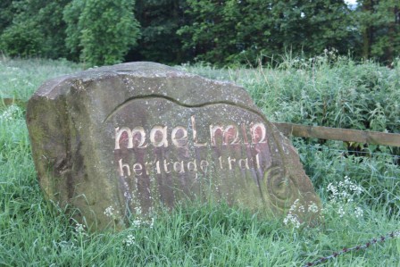
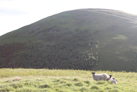
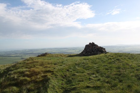
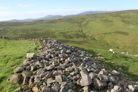
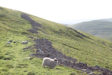
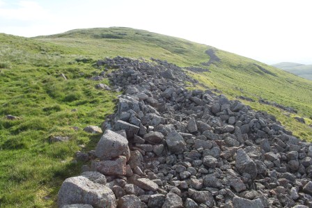
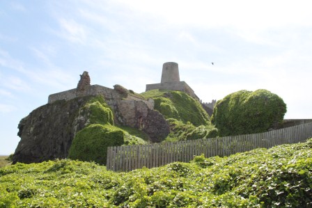
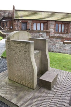
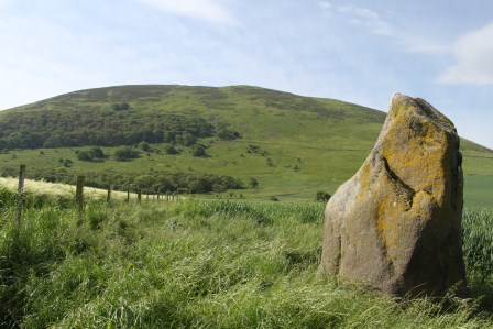
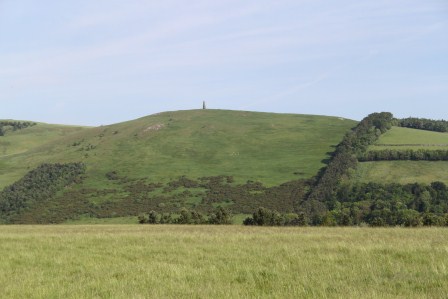
The Battle Stone and Yeavering Bell

Excavations at this site directed by Brian Hope-Taylor revealed evidence for a multi-phased, short-lived royal Anglo-Saxon settlement that straddled the period of Christian conversion from the late sixth to late seventh centuries AD.

Yet Ad Gefrin‘s story is not static, it is ever-changing. The site remains a focus of intensive interest, debate and reinterpretation, and perhaps soon new field work.

IMG_3217

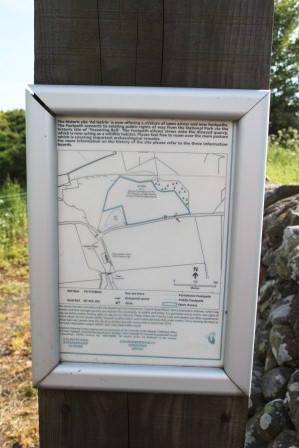
The management of the site of Ad Gefrin is thanks to the Ad Gefrin Trust’s partnership with Defra and others to ensure access and management to the site

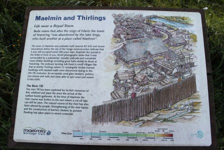
From Hope-Taylor’s and subsequent excavations and survey, we understand Yeavering as a settlement or ‘township’ with evidence of careful planning and alignments around earlier prehistoric features, a sequence of monumental hall buildings and ancillary structures, evidence of metalworking, a possible pagan temple, a ‘theatre’ structure and the Great Enclosure used as either a fort and/or a corral. The site was a focus for burial and ritual activity: early burials focused on prehistoric monuments and later a wooden church because a focus of multiple phases of burial.

IMG_3142

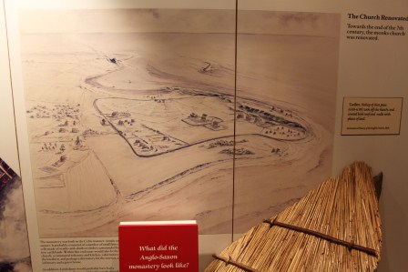
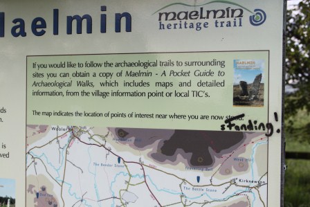
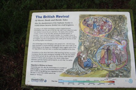
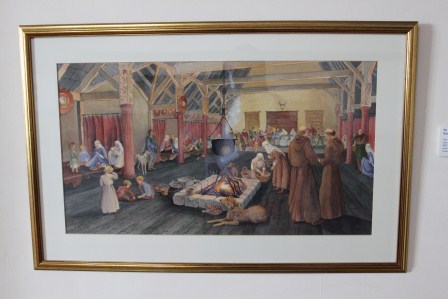
The introductory heritage signboard with artist’s reconstruction by Kelvin Wilson

The way the site was dug was innovative. Chasing high-quality aerial photographs, the excavations were not keyhole, but opened up large areas to reveal and understand the complex sequence of timber buildings surviving only as post-holes and trench-slots. Artefact poor but feature-rich, this was challenging archaeology for the 1950s.

IMG_3163

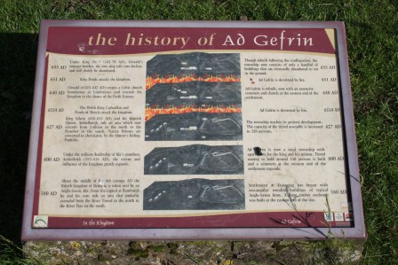
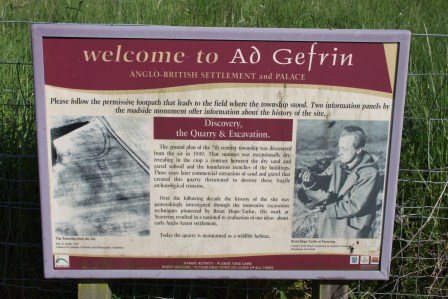
A brave attempt to communicate the complex sequence of archaeology with historical events known from the early history of the kingdom of Northumbria

IMG_3209

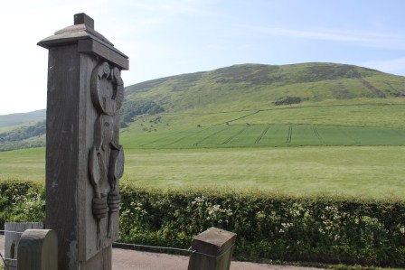
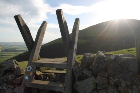
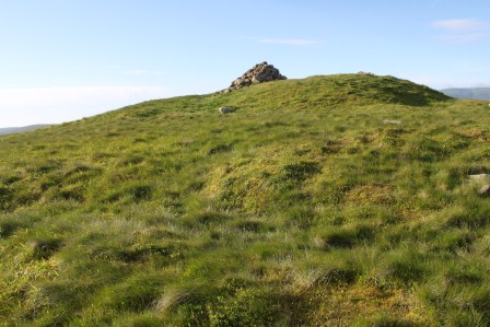
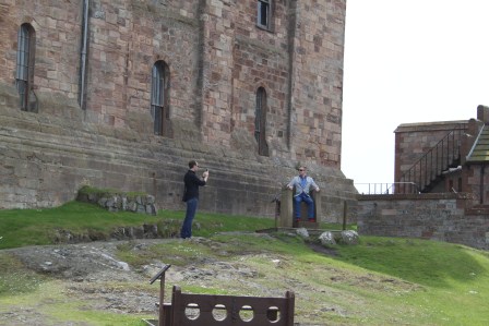
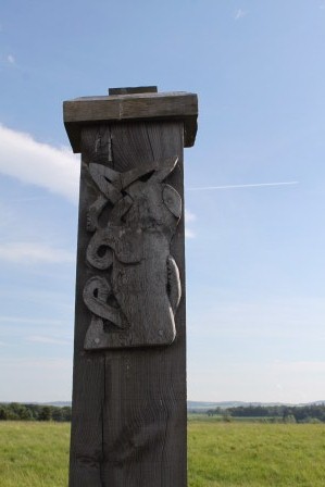
Gate-post carved with a bird-headdress wearing and four-spear-wielding warrior, with Yeavering Bell in background

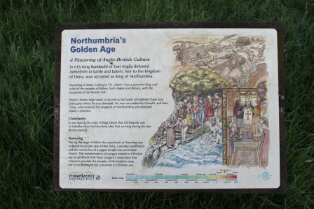
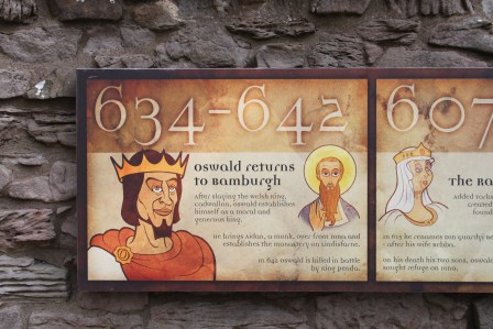
The site is important for its interpretations. Paired with Sutton Hoo, Yeavering has sat as pivotal in interpretations of early medieval kingship and Christian conversion, appearing again and again as a type-site for discussions of the history and archaeology of early Northumbria, the early Anglo-Saxon kingdoms more widely, as well as in broader studies of early medieval Britain and North-West Europe. This role comes not only from the quality of the archaeological excavations, but the historical tie-in the site offers. Hope-Taylor connected phases of the settlement’s relatively short evolution to the historical account of the Venerable Bede, linking phases of the site to the succession of pagan and early Christian rulers known from the historical record and phases of destruction to the attacks of Northumbria’s southern rival: Mercia. Moreover, this was the site where Bede informs us that the priest Paulinus, on instruction from Northumbria’s first Christian king, Edwin, baptised the people of Bernicia in the River Glen.

IMG_3237

Ad Gefrin – the Hill of Goats – is evoked here in the gate-post that simultaneously marks the site and throws the eye up to the hill-fort of Yeavering Bell behind

The power of the site has not been restricted to this historical narrative, however. The archaeology itself has spawned new narratives regarding the inheritance of the British past – the dominating hill-fort of Yeavering Bell, the reuse of a prehistoric burial mound, henge monument and postulated stone circle and the functions of elite settlements in the early Middle Ages. The halls themselves, the assembly structure and so much else have taken on narrative lives of their own within the academic and population literature.

Yet, this site is only partially understood and this is often forgotten in the popular accounts and many striking artist’s reconstructions afforded to the site.

IMG_3215

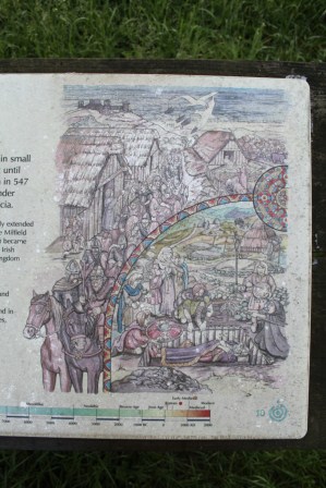
The other introductory signboard, showing the aerial photograph that inspired Hope-Taylor’s excavations, and the great man himself.

Only a sample of the site was investigated by Hope-Taylor and there are a series of festering frustrations among archaeologists regarding the chronological sequence he revealed and the nature of his interpretations. Excavations in the 1970s revealed more of the site and its later prehistoric origins as a  ceremonial complex. More recently, geophysics has been conducted on the site and more features identified. And yet there remains a need to ask fresh questions of the site and possibly conduct new fieldwork in and around this important location.

IMG_3185

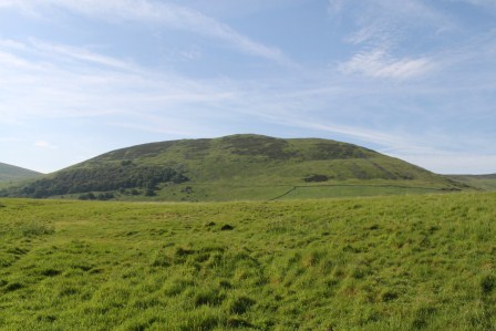
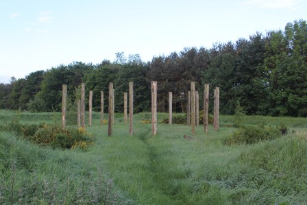
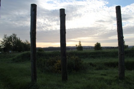
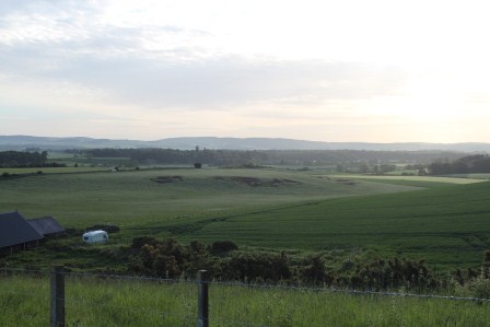
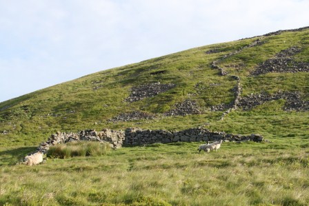
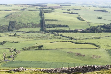
The empty field that was once Ad Gefrin, with Yeavering Bell

From a heritage perspective, the site is all about absence. There is literally nothing to see in reality. The historical narrative is for the imagination. Likewise, there is nothing to see about the ground surface and no heritage reconstructions have been attempted. It is just a field.

IMG_3221

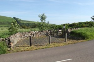
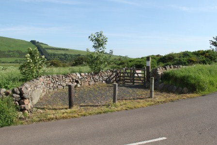
The western access to the site from the road


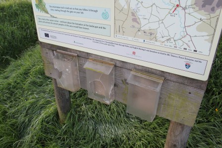
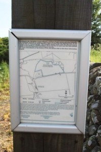
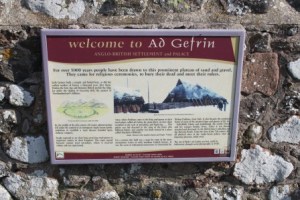
Only recently, through the efforts of the Ad Gefrin Trust, have attempts been made to present this important site to visitors. Developments have included the addition of a lay-by and monument, a pathway and new access gates for disabled and able visitors, a minimal number of well-constructed signboards, wonderful evocative carved gateposts inspired by the site’s history and Hope-Taylor’s own artwork. There is a management plan to retain the area of the excavations under grass rather than cultivation.

IMG_3207

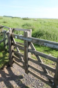
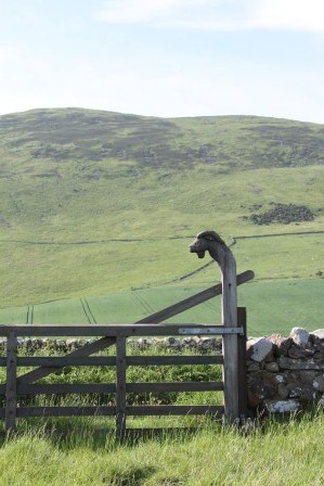
Access to the site via hinged kissing gates

The visitor is still left to face an empty field. Perhaps this is the correct way to leave the site. It is an experience that is largely and effectively ‘virtual’ experience in two senses. First, there is plenty of information online. The virtual is what the physical site is all about too. You are forced to engage with absence and how the topography implies this absence. Rather than through audio-wands and gift-shops and a panoply of sign boards, you are left to wander the field, imagining the phases of timber buildings that once populated this open space. You can also walk up Yeavering Bell and view the site en route, imagining the relationship between this striking hill, its hill-fort, and the Anglo-Saxon royal palace in its shadow.
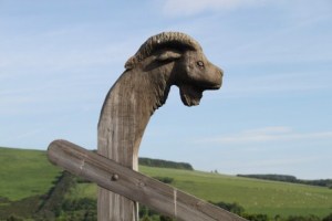
IMG_3154

Goat

Recently, I was invited to contribute to a research workshop organised by the Ad Gefrin Trust at Northumberland County Council’s offices. A brave thing to do to get regional and national ‘experts’ to comment on a draft proposal for new research at and around the site of Yeavering. Everyone has opinions about sites like this, and there was frank disagreements about the way to go forward. Indeed, this was the aim: to get some different views on what could/should be done, and what could/should not be done at this site.

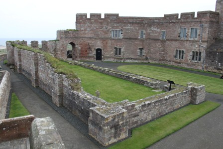
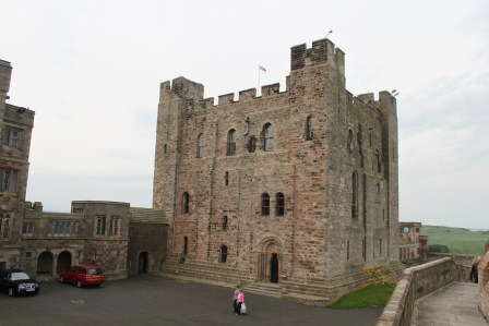
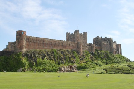
I felt particularly guilty that I was being asked for an ‘expert’ opinion when I had never visited the site. I was relieved to meet others who had only just visited, or had not visited the site at the meeting. Anyway, I rectified that by visiting myself the following morning en route to Bamburgh and Lindisfarne.

IMG_3157

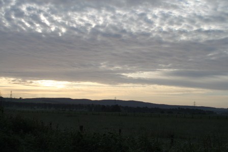
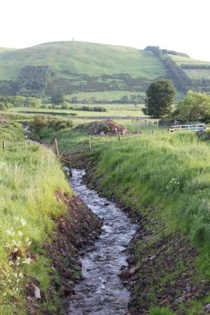
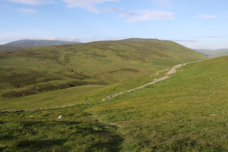
View northwards over the site of Ad Gefrin

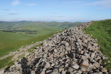
My impressions were many and striking. The site is ‘dramatic’ in no uncertain terms, not because the site’s immediate topography is particularly marked, in some ways it is quite subtle to the immediate impression. This is no Dunadd or Bamburgh. However, it is the combination of factors that the site ‘connects’ to that are important. The whaleback ridge upon which the Anglo-Saxon site was situated was close to the river and close to the northern edge of the Cheviot Hills and the massive hill of Yeavering Bell encircled by ancient earthworks. Perhaps more important still were the more subtle features in the immediate vicinity that also captured my imagination in relation to the known archaeology and also to areas that I don’t believe have received archaeological interventions. The isolated and enigmatic ‘Battle Stone’ nearby, the other spurs along the edge of the River Glen’s flood plain and the wider space between Yeavering Bell and the Ad Gefrin site all cry out for further attention, as do the smaller defended enclosures on nearby hills. I also noticed how the road, layby and managed ‘site’ gives a false impression to the extent and character of the potential Anglo-Saxon settlement. It is likely that Hope-Taylor opened and explored only a tiny fraction, perhaps an elite focus, of a far wider settlement, that in itself, sat within a local context in relation to a series of other settlements.

IMG_3151

More Anglo-Saxon carving

In short, as a fresh visitor to a site that I have long been familiar with from an archaeological perspective, the power of place in understanding, writing, and visualising Yeavering came home to be very strongly. Yet equally, I understood clearer than before why archaeologists remain intrigued and frustrated by what we think we know about this most iconic and distinctive of early medieval settlements.

IMG_3150

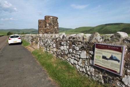
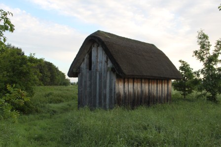
The lay-by, monument and heritage signboard, plus University of Chester fleet vehicle

IMG_3136

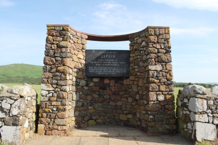
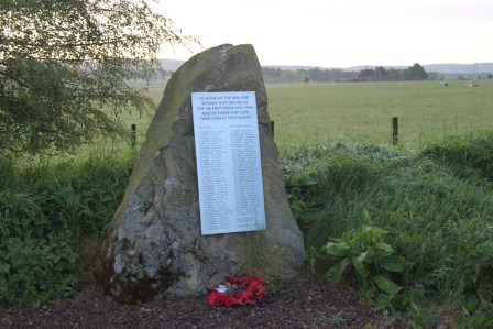
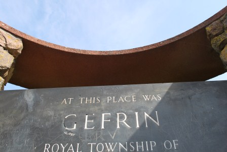
The monument at the Ad Gefrin site

As part of the Past in its Place project, I have a vision to write about Yeavering, not with regard to the early medieval settlement alone, but because Yeavering is a classic site for debating ‘the past in the past’, the inheritance of the prehistoric past in the Anglo-Saxon period, but also the subsequent literary, historical and archaeological reception of this iconic site where Christianity was brought to the kingdom of Bernicia that once straddled area that was to become the English-Scottish border