Lindisfarne

IMG_4090

Lindisfarne Priory from the Heugh

Re-posted from Archaeodeath.

Recently, for the first time in my adult life, I had the opportunity to visit the premier medieval site of Lindisfarne. This is a site of key historic and archaeological importance for understanding the Anglo-Saxon church, its origins, development and diversity. It was here that Aidan established the earliest Christian monastic foundation in the kingdom of Northumbria. His founder status was superseded to a large extent by the cult of St Cuthbert, but forgotten he was not. Lindisfarne is also famous for being subject to one of the earliest, and certainly the most famous of Norse raids, in AD 793. Following a decline (or abandonment) of the site during the tenth century, the Benedictine priory was a focus of monastic life and pilgrimage to the cenotaph of Cuthbert’s original grave and to St Cuthbert’s Isle – the site of his hermit’s cell – through the Middle Ages. The monastery survived until Henry VIII’s suppression of the monasteries.

IMG_3823

The English Heritage commissioned artist’s impression of the Anglo-Saxon monastic site

I couldn’t stay long on the island, but I can only enthuse about the striking landscape and seascape, appreciable even from a short visit. The first thing to note is the striking topography of the island itself, joined as it is by a tidal causeway to the mainland. Dunes constitute much of the north of the island, leaving a relatively small and protected area of habitable ground. The Anglo-Saxon monastery was located beside a natural harbour on the sheltered southern shore.

Continue reading

Maelmin

IMG_4105

The Maelmin Heritage Trail


Ok, I thought of the strained pun on the ‘The Postman Always Rings Twice’ and now I have absolutely no idea how this relates to this blog posting. This is the beauty of having no editor and no anonymous referees: I need not explain myself to anyone! If you can overcome this disappointment, please read on…

IMG_4111

Boards by the entrance outline the history of the RAF site

IMG_4110The landscape around Millfield, Northumberland is a rich archaeological landscape spanning from the Mesolithic to modern era. Having visited Yeavering/Ad Gefrin, Bamburgh and Lindisfarne the previous day, I went back to the Millfield basin to ascend Yeavering Bell. En route, I stopped off very early morning to walk around the Maelmin Heritage Trail on the edge of Millfield. Here I encountered something very different from the other sites.

IMG_4124

Millfield henge monument

The Anglo-Saxon palace site of Maelmin was the successor to Ad Gefrin. Never excavated, aerial photographs revealed a elaborate complex of timber halls, enclosures and burial sites comparable to Yeavering and Thirlings. Excavations of two Neolithic henges at Millfield also found secondary early Anglo-Saxon inhumation graves reusing these ancient monuments. Again it is unclear the full duration of the site without extensive excavations but close by lower-status Anglo-Saxon settlements at Cheviot Quarry (published in the Archaeological Journal) and other sites reveal the broader pattern of early medieval settlement around the Millfield basin.

IMG_4136

The woods

As with Ad Gefrin, the Maelmin Heritage Trail faces the stark challenge of communicating a rich archaeological landscape in which there is almost nothing to see above ground for the visitor. The heritage trail originally had three reconstructions (two extant) and a massive dose of heritage boards set within a plot of land managed as a mix grassland and woodland.

IMG_4161

Early morning views over the Millfield basin from the Maelmin Heritage Trail

The visitor to the site begins with a car parking area and three heritage boards giving details of the wartime history of the site as an RAF airfield for training pilots. There is a memorial stone upon which are the names of those – mostly of the RAF and RCAF – who lost their lives between 1942 and 1946 at the facility.

IMG_4172

The ‘Dark Age house’

An introductory heritage board gives details of the archaeological landscape. One then embarks on a time trail moving through a broadly anti-clockwise route through thick grass and then through the wood and back to the car park through the grass again. Board after board gives informative details of the local landscape, the chronological narrative: Mesolithic, early Neolithic, late Neolithic, Bronze Age, Iron Age, Roman, end of Roman Britain, the ‘revival of the Britons’, the early Anglo-Saxons, the conversion of the Northumbrian kingdom to Christianity.

IMG_4179

Sneaking a peak inside the Dark Age house

There are additional boards explaining details within the periods, about the three reconstructions: the Mesolithic hut (no longer extant), the Neolithic henge and the ‘Dark Age house’ and the excavations at Cheviot Quarry and the sites of Maelmin and Thirlings.

The henge is interesting, with ditches, banks and upright timber posts, it does indeed give a sense of how these monuments might have looked.

IMG_4207

Henge posts in early morning light

The ‘Dark Age’ house was locked, but sneaking a peak through the door, one got a sense of a relatively small and stark interior, but inevitably it sits without a context unlike the ‘settlement’ arrangements elsewhere like West Stow and Bede’s World.

A further set of heritage boards explores the preferable climate of the Millfield basin, the formation of the landscape, the hydrology of the basin, woodlands, animals and birdlife.

IMG_4215

Anal graffiti

Three things struck me about this heritage site

  1. The volume of boards, and the two reconstructions, do create a palpable sense of archaeology and landscape in a relatively small space. Given the lack of public accessible land in the immediate environs, this was a great foci for anyone interested in the heritage of the area, and works in this regard far better than Bamburgh, Lindisfarne or Ad Gefrin
  2. The information is accurate in general terms, but incredibly conventional and stylised, particularly notable (to me) in the proto-historic and early historic boards which advocate a simple migrationist framework for the emergence of the Anglo-Saxon kingdom. To be fair though, this is what happens everywhere in this region it seems: Lindisfarne even had the Dad’s Army style map with arrows showing the migration routes of the Anglo-Saxon tribes. For crying out loud!
  3. It is not unusual for the same artist to be responsible for the images, creating a coherence to the displays, creating a shared theme. Despite the perpetuation of stereotypes of dress and body proportions (all men had massive muscles, all women had massive breasts: at least in prehistory, then women and men both get far more boring and better clothed), at least it was a rare attempt to introduce a Carry On style humour into British heritage sites. At least that was my view. At most other sites you are really not expected to laugh at other heritage sites, and where humour is used, it is in infantile attempts to engage kids. For me, this worked well and created memorable images and information.
IMG_4216

Empty – no leaflets 🙁

So despite the absence of any ‘real’ archaeology, the Maelmin Heritage Trail tries its best. There were no leaflets to take away and one typo on the main introduction board has been angrily daubed with rectifying graffiti. Still, on the whole, this gets my tentative thumbs up.

As for the pun? Answers on a postcard to: Maelmin Heritage Trail Pun Competition, Millfield, Northumberland. Although perhaps, at a site where two henges were excavated, this is a site with two rings…

IMG_4150

I’m really not sure what the archaeological basis for any of this is, but still, a nice idea.

IMG_4164

I like this so much. Lovely chamber grave with wand-wielding priestess (I think) and the march of the Angles out of Bamburgh heading for glory…

IMG_4199

How Maelmin may have looked. Still, ‘royal town’ really does give the wrong impression to the visitor.

IMG_4186

Edwin getting hitched and Paulinus batpising people in the River Glen. ‘Flowering of Anglo-British Culture’: nice phrase but I think Northumbria was not more or less ‘Anglo-British’ than anywhere else in lowland Britain.


Bamburgh

IMG_3681

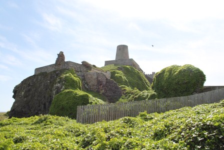
Bamburgh Castle from the beach

I recently visited Bamburgh where I received a warm welcome from Bamburgh Research Project director Graeme Young and his team. I was last at Bamburgh as a child. From photographs and from memory, I recall the castle as dramatic indeed. I half-expected to be underwhelmed by the reality. However, the site, its archaeology and its landscape failed to disappoint. A spectacular location and a fantastic archaeological site. What is ‘Bamburgh’ in archaeological terms? Well, I regard it as a famous multi-period fortress: the focus of the long-running but perhaps still under-valued archaeological research project: the Bamburgh Research Project (BRP).

IMG_3413

BRP excavations in Bamburgh Castle, chasing Hope-Taylor…. in the rooms behind, sealed like a mummy’s tomb, BRP uncovered Hope-Taylor’s work room!

IMG_3406

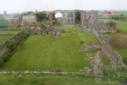
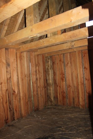
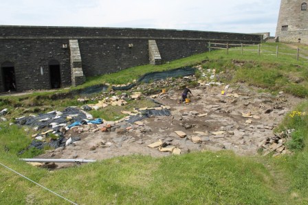
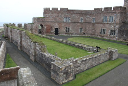
Excavations by BRP have revealed trench-slots possibly related to a guard-room and gate for the Anglo-Saxon fortress.

Their ongoing mission is to boldly go where others have gone before. Incorporating many training and community dimensions, their recent work has involved the re-evaluation early antiquarian discoveries and re-exploring the archives and trenches opened by Brian Hope-Taylor (of Yeavering fame) who dug at the castle but failed to complete or publish his work. Their other ongoing mission – that rubs shoulders (and trenches) with the first – is to boldly go where no-one has been before, since BRP has produced many exciting new discoveries both outside the castle and inside the castle grounds (in the trenches formerly opened by Hope-Taylor and beyond in new areas).

BRP’s excavations of the Bowl Hole early medieval cemetery have provided exciting new evidence of the complex social groups contributing to an Anglo-Saxon royal fortress’s population.

Meanwhile their work within the castle is providing evidence both in the area of castle’s church where they may have found an early medieval crypt, and in two zones in the northern half of the castle near what may have been the early medieval entrance and industrial areas serving the Anglo-Saxon fortress.

IMG_3347

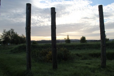
The likely original approach to the fortress from the west-north-west.

In very broad and simple terms, BRP are revealing new information about the socio-political and industrial dimensions of the fortress, as well as its mortuary and religious significance. Despite the inevitable restrictions on working at an open heritage attraction overlain by centuries of monumental late- and post-medieval castle architecture, BRP have soundly dismissed any cynic who might think that digging in a castle will only reveal slight traces of early medieval activity. If this wasn’t enough, reinterpreting other archaeologist’s old trenches is challenge enough but in the context of complex layers and a shallow bedrock, it is even more challenging. Unsurprisingly, for almost a decade, I have supported students from Exeter and Chester wishing to go on their fieldwork at Bamburgh but it was great to see the site finally in person.

I defer to their own website and blog for details regarding the archaeology and you can read about some of their recent discoveries in the castle’s museum, a book composed for visitors about the site’s archaeology, and also in academic publications in journals like Medieval Archaeology and Archaeologia Aeliana.

IMG_3551

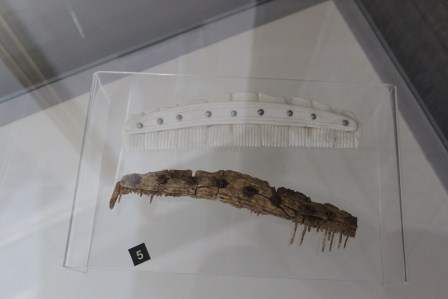
A classic and effective presentation strategy, an early medieval comb displayed next to a replica

IMG_3549

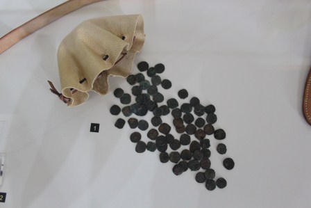
Display of a hoard of copper coins of Middle Anglo-Saxon (mid-ninth century) date, found in the excavations by BRP.

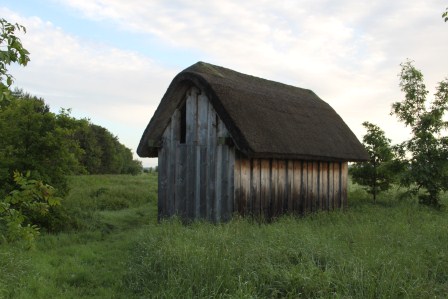
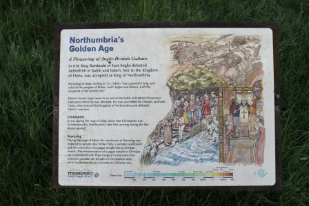
Early Medieval Bamburgh

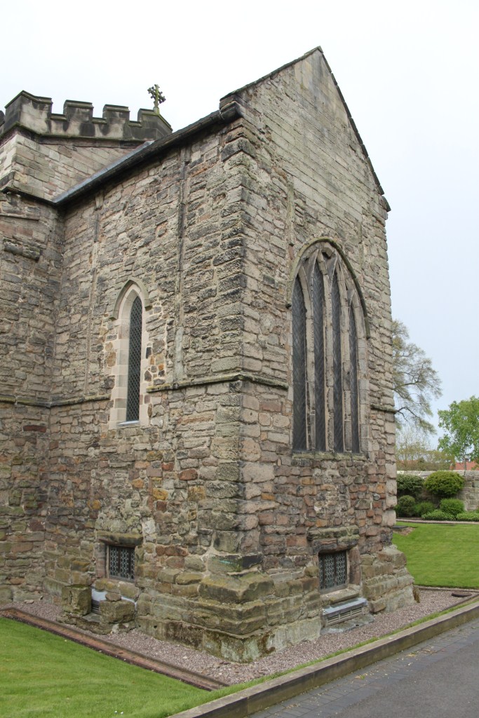
‘The city of Bebba’. As an early medievalist, the task is to see past all of the later medieval rubbish, and post-medieval fantasies regarding the Middle Ages, to try to discern what physical evidence survives from the Anglo-Saxon phase. For this was an Anglo-Saxon fortress. As such, it is best seen as one example of the many early medieval uses for hill-top fortifications. Hence it is best described as a ‘hill-fort’ in my view, prior to its recreation as a medieval castle.

IMG_3534

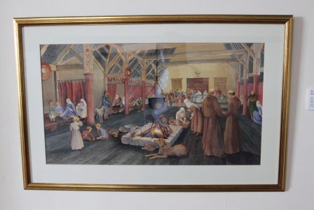
Jayne Brain’s reconstruction of a royal hall of Anglo-Saxon date.

Indeed, it is utterly anachronistic to see its early medieval phases as a ‘castle’, although I concede that the presence of later phases, and the place-name, make such back-projections seductive and confusing for visitors and experts alike. I still find it amazing that early medieval hill-forts are frequently caricatured as settlements of the ‘Britons’ and ‘Picts’ when there is plenty of evidence for their use in lowland Britain – in areas that are generally regarded as ‘Anglo-Saxon’, during the fifth to eleventh centuries AD. Bamburgh is one such example.

IMG_3397

Oswald almost certainly didn’t look like this, but that isn’t a problem in itself.

Re-posted from Archaeodeath

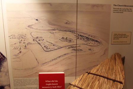
BRP believe they have found traces of a box-rampart in the northern area of the citadel. Analogy with Yeavering leads to imaginative but likely reconstructions of the monumental timber hall (or halls) that would have formed the focus of the royal site on the highest part of the hill-top, paired with one or more churches and chapels further to the east underlying the later church of St Peter.

IMG_3613

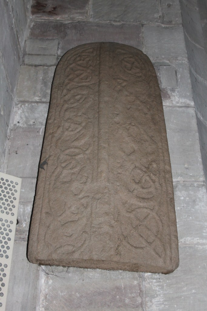
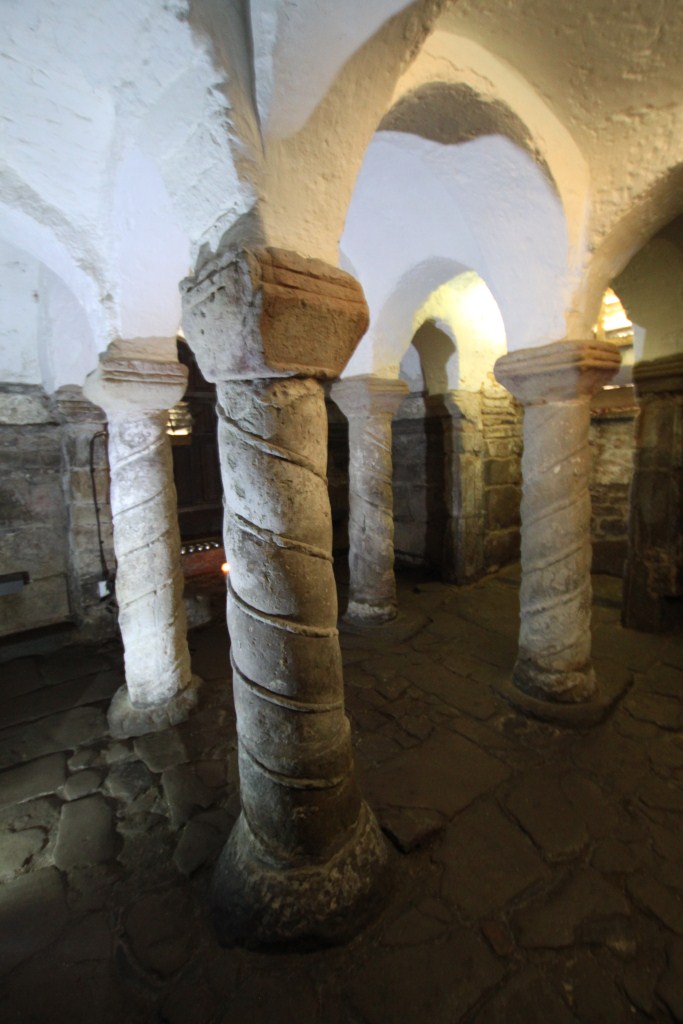
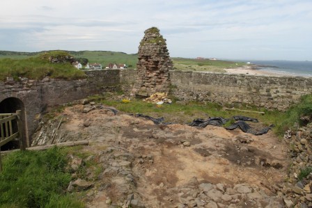
The ruined church, where BRP believe was a crypt containing the relics of St Oswald

IMG_3602

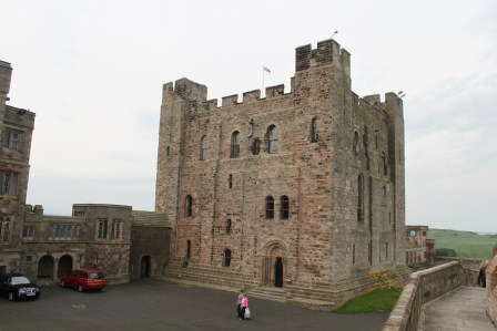
Did the Norman keep overlay a pre-existing palace site of the Earls of Northumbria?

A Place of Memory?

As an archaeologist of memory, the complex genealogy of the site, its enduring use and reuse as a place of power, make it of interest in a contrasting sense. From this perspective, my interest is not to strip away later activity, but to consider how the site’s ‘pedigree’ has been augmented and rewritten in multiple ways within the Early Middle Ages and then subsequently from the Anglo-Saxon period to the present day through a near-continuous sequence. Approaching Bamburgh’s long history of occupations means more than charting a time-line of events. It is instead about considering how the history of the site has fed into its social memories in contrasting and varied ways over time; how the site has been packaged and repackaged, subsumed and highlighted in contrasting ways. This is an interesting and legitimate focus of archaeological research in itself.

Hope-Taylor found evidence of Iron Age activity. It would be interesting to learn how much prehistory can be discerned and whether there was a demonstrable Iron Age/Roman predecessor to the early medieval fortress. How precisely was the early origin of the castle important in subsequent periods of use and reuse? These questions still seem to have sketchy answers at present, but the ongoing research by BRP is revealing more and more information about the long-term use of the site and its adaptations, but also its continuities over time. In many ways this is the inverse of the situation at Yeavering/Ad Gefin, where the argument for a ‘forgetting’ of the site after the seventh century still remains plausible.

IMG_3320

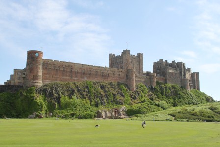
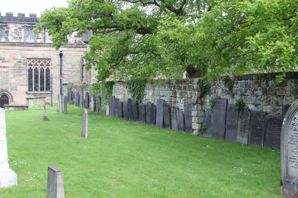
Bamburgh castle, view from the south-west

Landscape Archaeology

As a landscape archaeologist, one would take a further view, noting not only its maritime situation but its maritime context, the near presence of the Farne Islands, the monastery of Lindisfarne, and its situation on the maritime highway that defined the kingdom of Northumbria from the Firth of Forth to the Humber. A landward perspective is also legitimate, including the relationship to the dunes in which an early medieval cemetery has received extensive excavation by the Bamburgh Research Project, to the church of St Peter and the settlement of Bamburgh as well as the wider hinterland of land use. In many ways, Bamburgh is a node in a complex multi-scalar early medieval landscape of power and faith.

IMG_3367

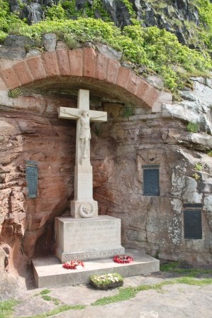
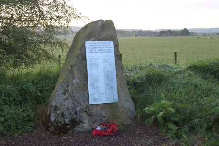
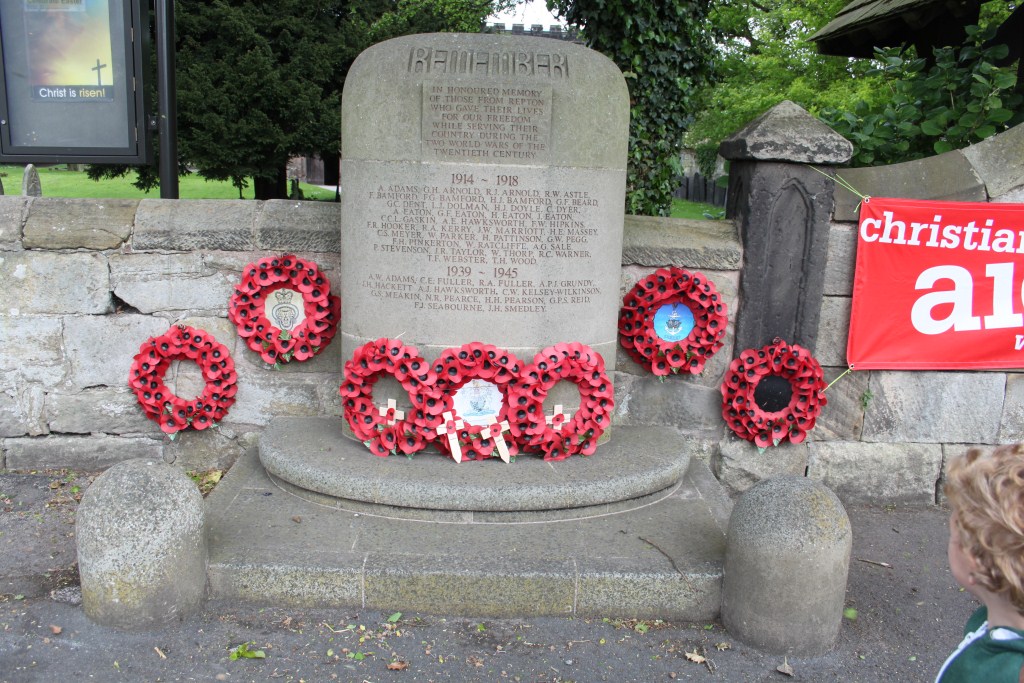
The war memorial, set into the rock at the base of Bamburgh Castle

IMG_3322

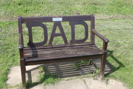
A memorial bench with a view of the castle

IMG_3617

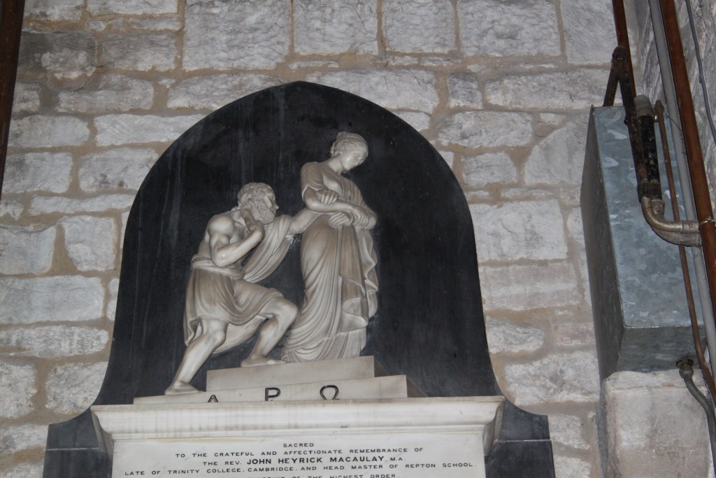
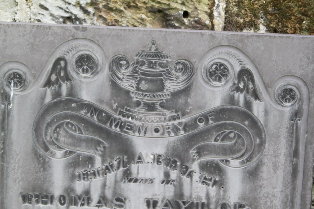
Memorial within the ruined church to the first Lord Armstrong

Contemporary Commemoration

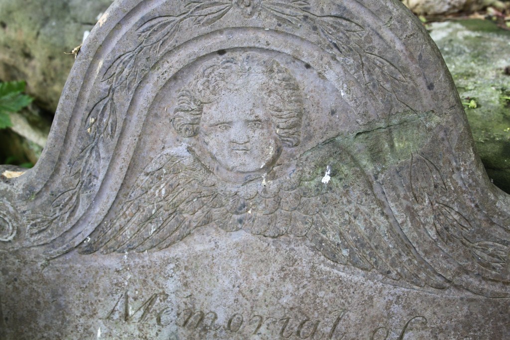
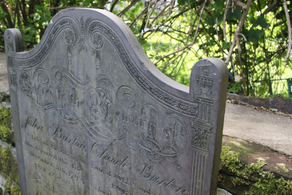
I was interested in how recent commemorative memorials to individuals and groups modern and medieval were integrated into the castle and its environs, including the industrialist and inventor, the first Lord Armstrong, who has a museum and plaques dedicated to his memory, while St Oswald is commemorated in the ruins of the chapel when his relics may once have resided. There is even a plaque commemorating the castle as a film-set, as for the 1972 film Macbeth. Equally fascinating was the utilisation of the castle’s immediate context as a memorial environment including Bamburgh’s First and Second World War memorial, and the commemoration of the cult of Victorian heroine Grace Darling, involving memorials in the church, churchyard and her RNLI museum.

IMG_3395

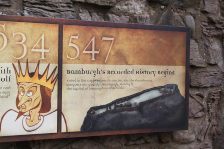
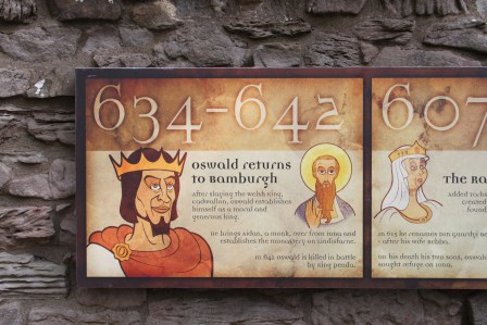
The start of the Bamburgh time-line…. I love the depiction of Aethelfrith

IMG_3590

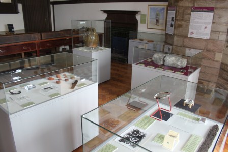
The archaeology museum

IMG_3475

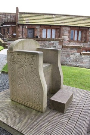
The Bamburgh chair, based on designs by Joanne Kirton

IMG_3471

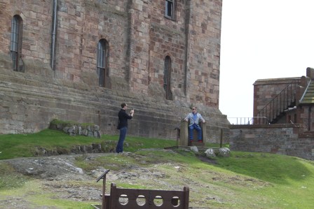
Tourists posing for pics in the Bamburgh chair

Heritage and Memory

From a heritage perspective, it is of interest in many regards as a privately owned site (i.e. not under the guardianship of English Heritage or the National Trust). What struck me was how archaeologists have been permitted to work in the heritage site conducting long-term excavations but also how much their work has been incorporated into the heritage signboards, reconstructions and even an archaeological museum within the castle. I was particularly proud of my student – Joanne Kirton’s – design utilised in the reconstruction of the ‘Bamburgh throne’, now a popular option for photographs by tourists. There are very few places where you can ‘sit like an Anglo-Saxon’…

IMG_3428

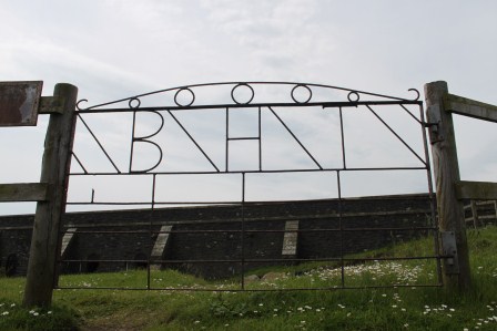
Gate forged with the initials ‘B H T’ (Brian Hope-Taylor)

Commemorating Archaeology

Interestingly, there is a striking piece of material culture commemorating the failed excavations of Brian Hope-Taylor – gates to his dig forged with his initials! I want some of these on my  future excavations….


Summary

So from my perspective, Bamburgh is important as an early medieval site, as a place of memory and power over the long term, as a node in a complex maritime landscape. Bamburgh is also an active and distinctive heritage site with everything from cheesy torture chambers to ongoing excavations to view.

Death and Memory at Repton

IMG_7931

The Repton Stone – not on display but pictured in the church

IMG_7982

St Wystan’s church, Repton, with modern focus for commemorating the dead – garden of remembrance – either side of the path to the SW of the church tower

Re-posted from Archaeodeath

All early medieval archaeologists will know about Repton, Derbyshire. The village’s signpost claims its status as the ‘historic capital’ of Mercia.

I have long been interested in what Repton can tell us about death and memory in the Anglo-Saxon period, but it comes into its own in relation to my work for the Past in its Place project in which I am especially interested in the role of stone monuments in the commemoration of the early medieval royal and saintly dead and the long-term biographies these relationships institute at particular locales. In this context, I felt compelled to revisit Repton to explore its famous Anglo-Saxon crypt and later memorials. My interest here was in exploring the long-term commemoration of the dead at a famous church, both before and after the Vikings made such a famous impact on the site.


IMG_8032

Anglo-Saxon cross-shaft in the church porch

Before the Danish Great Army

Repton had been a prosperous monastery for men and women, with a church, two mausolea, and monastic buildings, enjoying an ancient relationship with the kings of Merica’ (Biddle and Kjolbye-Biddle 2001, 84).

IMG_7927

Anglo-Saxon grave-cover replica – on display in the church

While the Viking presence at Repton has captured most popular interest (see below), it was the pre-Viking archaeology that drew me here. St Wystan’s church at Repton, Derbyshire sits on a prominent bluff on the south side of the valley of the River Trent. In the Early Middle Ages, the river was likely to have been much closer than today. This was a typical location for a prominent wealthy Middle Anglo-Saxon monastic centre, situated in relation to principal land and water routes.

The Biddles revealed considerable evidence of pre-Viking activity at Repton, suggesting the site was a royal and monastic focus. They propose that Repton is being referred to in a gift of land by Friduricus princeps to Haeda, abbot of Breedon. They equate the possibility of a seventh-century foundation with three phases timber buildings before the stone church was built.

IMG_7952

The Anglo-Saxon crypt (the lower levels of ‘megalithic’ stonework) as viewed from the SE

This was a double house for men and women ruled by an abbess but it was also a royal site of burial and saint’s cult. The Biddles revealed a semi-subterranean two cell structure that may have been a mausoleum before it was adopted by the Danes as a burial monument. Meanwhile, the crypt – investigated in detail by Harold and Joan Taylor – was originally an eighth-century baptistery before being converted, possibly to house King Aethelbald’s remains. It was converted again to serve as the focus of the cult of the murdered royal child saint, Wystan (Wigstan) with pillars and vaulting added and twin entrances, possibly to facilitate the movement of pilgrims through the crypt.

Found in excavations by the Biddles, the ‘Repton Stone’ depicts a crucifixion scene, hell-mouth scene, and mounted warrior-king brandishing a shield and sporting a fine moustache. This is possibly a fragment of a memorial cross to King Aethelbald. Archaeological evidence suggests that burial continued south and east of the chancel around Wystan’s tomb.

Much of my visit involved photographing the marvellous crypt using my digital SLR camera and a superb halogen torch. Here are some of the results.

IMG_7592

The steps descending into the crypt

IMG_7740

The Anglo-Saxon crypt

IMG_7755

Cylindrical pillar in the crypt

Viking Repton

The most famous archaeology relating to Repton relates to the Viking presence but this is surprisingly absent for a visitor and it is also yet to be fully published by its excavators. Still, it seems important to review what is known based on summary accounts published so far.

The reference in the Anglo-Saxon Chronicle tells us that the Danish Great Army wintered at Repton from AD 873 to 874. The excavations by Martin Biddle and Birthe Kjolbye-Biddle identified a massive ditch and bank and postulated that it joined the church on either side to the river, incorporated the church into a semi-circular defense that comprised the winter camp. This always brings to my mind the defense of the church by Michael Caine’s German soldiers in The Eagle has Landed.

Late ninth-century furnished weapon-graves ‘of Scandinavian type’ were uncovered from the churchyard around the crypt, one of which suffered a painful wound to the inner thigh that may have removed his genitalia. These might be Norse burials associated with the army’s presence and campaign and/or those of Norse descent settling in the vicinity subsequently.

Most intriguingly, evidence was found directly west of the church that the two-cell mortuary chapel of Middle Anglo-Saxon date (above) was transformed into a mass-burial of at least 264 disarticulated skeletons (c. 200 men and 50 women) surrounding a single intact burial in a stone coffin beneath a low stone cairn. The Biddles viewed this as a Viking war memorial, possibly focusing on the tomb of Ivar  the Boneless. This view remains particularly controversial and a number of archaeologists, notably Julian D. Richards and Dawn Hadley, have explored alternative scenarios.

IMG_7879

Late medieval knightly effigy with serious graffiti issues.

4km away to the SE, Julian D. Richards’ excavations at Ingleby have provided fresh detailed evidence of a long-known ninth-century barrow cemetery. This is interpreted as a relativley short-lived and unique Scandinavian-style locale for the pagan custom of cremation in operation contemporaneous with the furnished Norse-influenced inhumation graves in the Repton churchyard.

Burial subsequently focused on the cairn to the west of the church, some of high-status character. Meanwhile a hogback stone was found west of the church and might indicate an enduring Norse influence in commemorative practice into the early tenth century.

IMG_7907

Fabulous 16th-century memorial

While the details of this evidence remain hotly debated and discussed, it is evident that the Viking era brought a radical shift, but also a continued centrality for Repton as a cult centre. What strikes me is that, for the casual, and even for the informed, visitor, the Viking presence is negated, near-invisible, by the weight of memorial culture from before and after their brief interlude.

Later Memorial Culture

Despite the Danish army’s short and dramatic imposition on the cult centre, continuity seems to have prevailed. The church retained its focus as a place of Christian burial and worship from the early tenth century to the present day. The church and churchyard reveal traces of this long history from its many remains including a medieval male effigy tomb and a fair selection of early modern and late-modern floor and mural monuments. The churchyard has an amazing collection of nineteenth-century slate gravestones, many repositioned along the churchyard boundaries. It also possesses a recent garden of remembrance for the interment of cremated human remains. This is a further example of interest to me where the careful selection of location and arrangement makes close connection to the sacred space and the church building in particular. Below are a selection of photographs to afford an impression of the church and churchyard at Repton.

IMG_7864

Eighteenth-century mural monument

IMG_7903

Detail of odd neo-classical mural monument in Repton church


IMG_7573

Rearranged grave-stones along the eastern boundary of Repton’s churchyard

IMG_7565IMG_8022IMG_8012


IMG_7550

The war memorial, at the churchyard gate