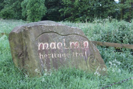
The Maelmin Heritage Trail
Ok, I thought of the strained pun on the ‘The Postman Always Rings Twice’ and now I have absolutely no idea how this relates to this blog posting. This is the beauty of having no editor and no anonymous referees: I need not explain myself to anyone! If you can overcome this disappointment, please read on…
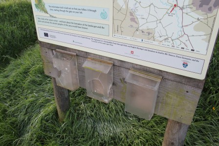
Boards by the entrance outline the history of the RAF site
 The landscape around Millfield, Northumberland is a rich archaeological landscape spanning from the Mesolithic to modern era. Having visited Yeavering/Ad Gefrin, Bamburgh and Lindisfarne the previous day, I went back to the Millfield basin to ascend Yeavering Bell. En route, I stopped off very early morning to walk around the Maelmin Heritage Trail on the edge of Millfield. Here I encountered something very different from the other sites.
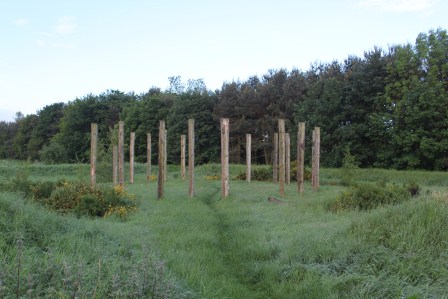
Millfield henge monument
The Anglo-Saxon palace site of Maelmin was the successor to Ad Gefrin. Never excavated, aerial photographs revealed a elaborate complex of timber halls, enclosures and burial sites comparable to Yeavering and Thirlings. Excavations of two Neolithic henges at Millfield also found secondary early Anglo-Saxon inhumation graves reusing these ancient monuments. Again it is unclear the full duration of the site without extensive excavations but close by lower-status Anglo-Saxon settlements at Cheviot Quarry (published in the Archaeological Journal) and other sites reveal the broader pattern of early medieval settlement around the Millfield basin.
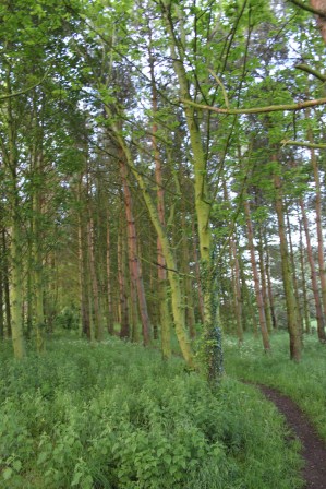
The woods
As with Ad Gefrin, the Maelmin Heritage Trail faces the stark challenge of communicating a rich archaeological landscape in which there is almost nothing to see above ground for the visitor. The heritage trail originally had three reconstructions (two extant) and a massive dose of heritage boards set within a plot of land managed as a mix grassland and woodland.
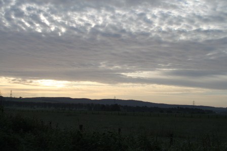
Early morning views over the Millfield basin from the Maelmin Heritage Trail
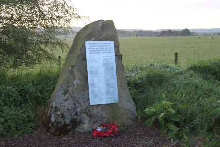
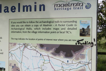
The visitor to the site begins with a car parking area and three heritage boards giving details of the wartime history of the site as an RAF airfield for training pilots. There is a memorial stone upon which are the names of those – mostly of the RAF and RCAF – who lost their lives between 1942 and 1946 at the facility.
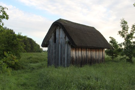
The ‘Dark Age house’
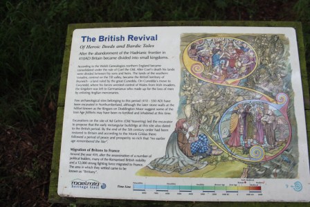
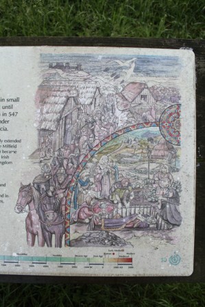
An introductory heritage board gives details of the archaeological landscape. One then embarks on a time trail moving through a broadly anti-clockwise route through thick grass and then through the wood and back to the car park through the grass again. Board after board gives informative details of the local landscape, the chronological narrative: Mesolithic, early Neolithic, late Neolithic, Bronze Age, Iron Age, Roman, end of Roman Britain, the ‘revival of the Britons’, the early Anglo-Saxons, the conversion of the Northumbrian kingdom to Christianity.
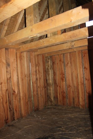
Sneaking a peak inside the Dark Age house
There are additional boards explaining details within the periods, about the three reconstructions: the Mesolithic hut (no longer extant), the Neolithic henge and the ‘Dark Age house’ and the excavations at Cheviot Quarry and the sites of Maelmin and Thirlings.
The henge is interesting, with ditches, banks and upright timber posts, it does indeed give a sense of how these monuments might have looked.
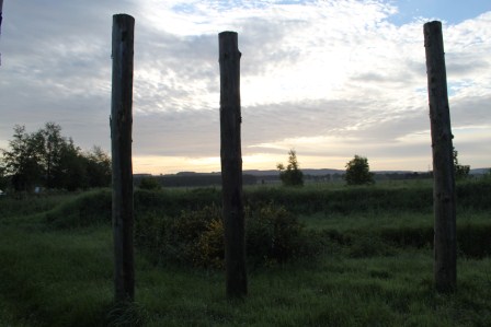
Henge posts in early morning light
The ‘Dark Age’ house was locked, but sneaking a peak through the door, one got a sense of a relatively small and stark interior, but inevitably it sits without a context unlike the ‘settlement’ arrangements elsewhere like West Stow and Bede’s World.
A further set of heritage boards explores the preferable climate of the Millfield basin, the formation of the landscape, the hydrology of the basin, woodlands, animals and birdlife.
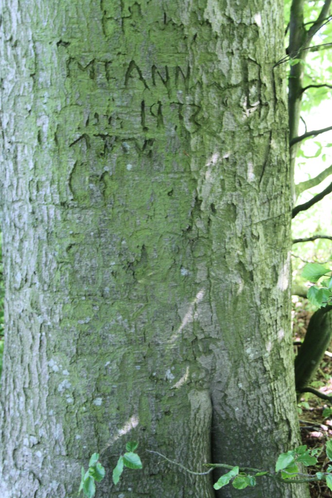
Anal graffiti
Three things struck me about this heritage site
- The volume of boards, and the two reconstructions, do create a palpable sense of archaeology and landscape in a relatively small space. Given the lack of public accessible land in the immediate environs, this was a great foci for anyone interested in the heritage of the area, and works in this regard far better than Bamburgh, Lindisfarne or Ad Gefrin
- The information is accurate in general terms, but incredibly conventional and stylised, particularly notable (to me) in the proto-historic and early historic boards which advocate a simple migrationist framework for the emergence of the Anglo-Saxon kingdom. To be fair though, this is what happens everywhere in this region it seems: Lindisfarne even had the Dad’s Army style map with arrows showing the migration routes of the Anglo-Saxon tribes. For crying out loud!
- It is not unusual for the same artist to be responsible for the images, creating a coherence to the displays, creating a shared theme. Despite the perpetuation of stereotypes of dress and body proportions (all men had massive muscles, all women had massive breasts: at least in prehistory, then women and men both get far more boring and better clothed), at least it was a rare attempt to introduce a Carry On style humour into British heritage sites. At least that was my view. At most other sites you are really not expected to laugh at other heritage sites, and where humour is used, it is in infantile attempts to engage kids. For me, this worked well and created memorable images and information.
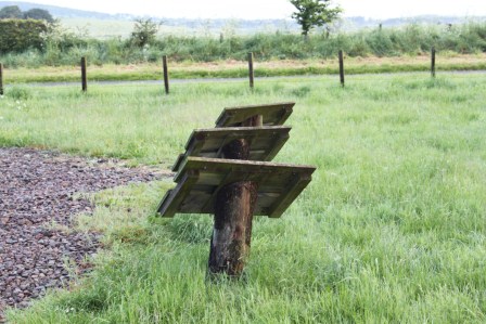
Empty – no leaflets 🙁
So despite the absence of any ‘real’ archaeology, the Maelmin Heritage Trail tries its best. There were no leaflets to take away and one typo on the main introduction board has been angrily daubed with rectifying graffiti. Still, on the whole, this gets my tentative thumbs up.
As for the pun? Answers on a postcard to: Maelmin Heritage Trail Pun Competition, Millfield, Northumberland. Although perhaps, at a site where two henges were excavated, this is a site with two rings…
I’m really not sure what the archaeological basis for any of this is, but still, a nice idea.
I like this so much. Lovely chamber grave with wand-wielding priestess (I think) and the march of the Angles out of Bamburgh heading for glory…
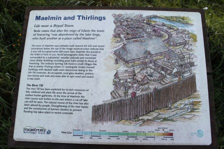
How Maelmin may have looked. Still, ‘royal town’ really does give the wrong impression to the visitor.
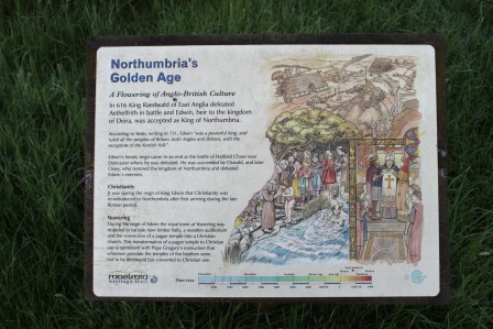
Edwin getting hitched and Paulinus batpising people in the River Glen. ‘Flowering of Anglo-British Culture’: nice phrase but I think Northumbria was not more or less ‘Anglo-British’ than anywhere else in lowland Britain.