Death and Memory at Repton

IMG_7931

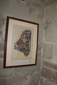
The Repton Stone – not on display but pictured in the church

IMG_7982

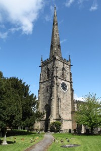
St Wystan’s church, Repton, with modern focus for commemorating the dead – garden of remembrance – either side of the path to the SW of the church tower

Re-posted from Archaeodeath

All early medieval archaeologists will know about Repton, Derbyshire. The village’s signpost claims its status as the ‘historic capital’ of Mercia.

I have long been interested in what Repton can tell us about death and memory in the Anglo-Saxon period, but it comes into its own in relation to my work for the Past in its Place project in which I am especially interested in the role of stone monuments in the commemoration of the early medieval royal and saintly dead and the long-term biographies these relationships institute at particular locales. In this context, I felt compelled to revisit Repton to explore its famous Anglo-Saxon crypt and later memorials. My interest here was in exploring the long-term commemoration of the dead at a famous church, both before and after the Vikings made such a famous impact on the site.


IMG_8032

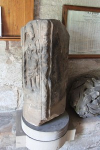
Anglo-Saxon cross-shaft in the church porch

Before the Danish Great Army

Repton had been a prosperous monastery for men and women, with a church, two mausolea, and monastic buildings, enjoying an ancient relationship with the kings of Merica’ (Biddle and Kjolbye-Biddle 2001, 84).

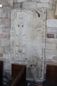
IMG_7927

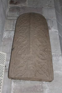
Anglo-Saxon grave-cover replica – on display in the church

While the Viking presence at Repton has captured most popular interest (see below), it was the pre-Viking archaeology that drew me here. St Wystan’s church at Repton, Derbyshire sits on a prominent bluff on the south side of the valley of the River Trent. In the Early Middle Ages, the river was likely to have been much closer than today. This was a typical location for a prominent wealthy Middle Anglo-Saxon monastic centre, situated in relation to principal land and water routes.

The Biddles revealed considerable evidence of pre-Viking activity at Repton, suggesting the site was a royal and monastic focus. They propose that Repton is being referred to in a gift of land by Friduricus princeps to Haeda, abbot of Breedon. They equate the possibility of a seventh-century foundation with three phases timber buildings before the stone church was built.

IMG_7952

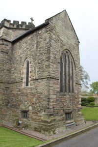
The Anglo-Saxon crypt (the lower levels of ‘megalithic’ stonework) as viewed from the SE

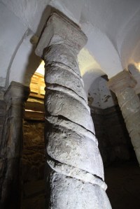
This was a double house for men and women ruled by an abbess but it was also a royal site of burial and saint’s cult. The Biddles revealed a semi-subterranean two cell structure that may have been a mausoleum before it was adopted by the Danes as a burial monument. Meanwhile, the crypt – investigated in detail by Harold and Joan Taylor – was originally an eighth-century baptistery before being converted, possibly to house King Aethelbald’s remains. It was converted again to serve as the focus of the cult of the murdered royal child saint, Wystan (Wigstan) with pillars and vaulting added and twin entrances, possibly to facilitate the movement of pilgrims through the crypt.

Found in excavations by the Biddles, the ‘Repton Stone’ depicts a crucifixion scene, hell-mouth scene, and mounted warrior-king brandishing a shield and sporting a fine moustache. This is possibly a fragment of a memorial cross to King Aethelbald. Archaeological evidence suggests that burial continued south and east of the chancel around Wystan’s tomb.

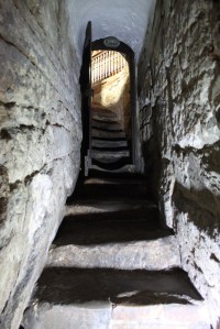
Much of my visit involved photographing the marvellous crypt using my digital SLR camera and a superb halogen torch. Here are some of the results.

IMG_7592

The steps descending into the crypt

IMG_7740

The Anglo-Saxon crypt

IMG_7755

Cylindrical pillar in the crypt

Viking Repton

The most famous archaeology relating to Repton relates to the Viking presence but this is surprisingly absent for a visitor and it is also yet to be fully published by its excavators. Still, it seems important to review what is known based on summary accounts published so far.

The reference in the Anglo-Saxon Chronicle tells us that the Danish Great Army wintered at Repton from AD 873 to 874. The excavations by Martin Biddle and Birthe Kjolbye-Biddle identified a massive ditch and bank and postulated that it joined the church on either side to the river, incorporated the church into a semi-circular defense that comprised the winter camp. This always brings to my mind the defense of the church by Michael Caine’s German soldiers in The Eagle has Landed.

Late ninth-century furnished weapon-graves ‘of Scandinavian type’ were uncovered from the churchyard around the crypt, one of which suffered a painful wound to the inner thigh that may have removed his genitalia. These might be Norse burials associated with the army’s presence and campaign and/or those of Norse descent settling in the vicinity subsequently.

Most intriguingly, evidence was found directly west of the church that the two-cell mortuary chapel of Middle Anglo-Saxon date (above) was transformed into a mass-burial of at least 264 disarticulated skeletons (c. 200 men and 50 women) surrounding a single intact burial in a stone coffin beneath a low stone cairn. The Biddles viewed this as a Viking war memorial, possibly focusing on the tomb of Ivar  the Boneless. This view remains particularly controversial and a number of archaeologists, notably Julian D. Richards and Dawn Hadley, have explored alternative scenarios.

IMG_7879

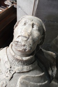
Late medieval knightly effigy with serious graffiti issues.

4km away to the SE, Julian D. Richards’ excavations at Ingleby have provided fresh detailed evidence of a long-known ninth-century barrow cemetery. This is interpreted as a relativley short-lived and unique Scandinavian-style locale for the pagan custom of cremation in operation contemporaneous with the furnished Norse-influenced inhumation graves in the Repton churchyard.

Burial subsequently focused on the cairn to the west of the church, some of high-status character. Meanwhile a hogback stone was found west of the church and might indicate an enduring Norse influence in commemorative practice into the early tenth century.

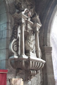
IMG_7907

Fabulous 16th-century memorial

While the details of this evidence remain hotly debated and discussed, it is evident that the Viking era brought a radical shift, but also a continued centrality for Repton as a cult centre. What strikes me is that, for the casual, and even for the informed, visitor, the Viking presence is negated, near-invisible, by the weight of memorial culture from before and after their brief interlude.

Later Memorial Culture

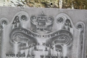
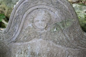
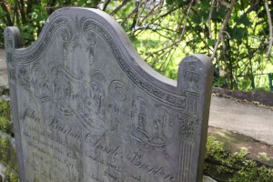
Despite the Danish army’s short and dramatic imposition on the cult centre, continuity seems to have prevailed. The church retained its focus as a place of Christian burial and worship from the early tenth century to the present day. The church and churchyard reveal traces of this long history from its many remains including a medieval male effigy tomb and a fair selection of early modern and late-modern floor and mural monuments. The churchyard has an amazing collection of nineteenth-century slate gravestones, many repositioned along the churchyard boundaries. It also possesses a recent garden of remembrance for the interment of cremated human remains. This is a further example of interest to me where the careful selection of location and arrangement makes close connection to the sacred space and the church building in particular. Below are a selection of photographs to afford an impression of the church and churchyard at Repton.

IMG_7864

Eighteenth-century mural monument

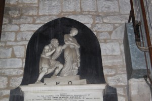
IMG_7903

Detail of odd neo-classical mural monument in Repton church


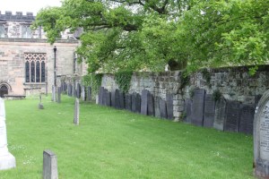
IMG_7573

Rearranged grave-stones along the eastern boundary of Repton’s churchyard

IMG_7565IMG_8022IMG_8012


IMG_7550

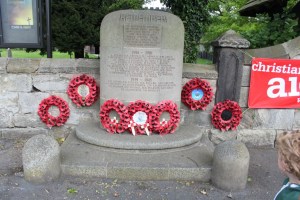
The war memorial, at the churchyard gate

Vlogging Eliseg

A re-post from Archaeodeath.

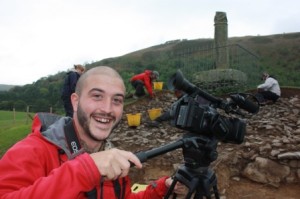
I am currently working on a research article for Project Eliseg together with former-student and archaeologist Joseph Tong. Joe served as media supervisor in the 2011 field season and subsequently came back to record more video-blogs (vlogs) in 2012. Our article, written together with Suzanne Evans and other colleagues on Project Eliseg, aims to explore critically our use of vlogs within the 2011 and 2012 field seasons. Why did we do them? Were they effective? Were they fun? We are soon to submit our article to a peer-review archaeological journal and hopefully you will find about it very soon when it comes into print (he says optimistically).

JT2

2011 and 2012 Project Eliseg media guru: Joseph Tong

It makes sense that this is a good time to update the Project Eliseg website and add further information about the third and final field season in 2012. So the Project Eliseg website has now had a facelift for 2014, with new information added in the following areas:

  • Project Eliseg 2012 – an interim summary of the 2012 field season has been added here, this includes a link to a pdf of the 2012 interim report.
  • Further Reading – an updated ‘further reading’ section including three key new books by Nancy Edwards, Thomas Charles-Edwards and Sarah Semple here.
  • Acknowledgements – recognition and thanks has been duly given to those who helped with the 2012 field season here.
  • Details of the 2012 vlogs have been added with links to each one here.

We hope you enjoy these new additions as well as the ongoing posts about the Pillar of Eliseg and its environs.

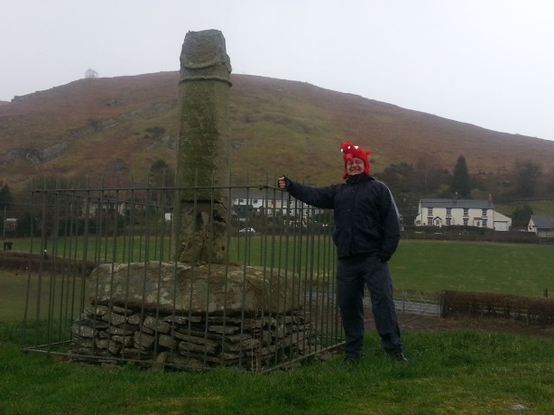
In other news, here is a picture of me with the Pillar of Eliseg in a dragon-hat. Priceless moments caught on camera for posterity….

Me feeling a bit Welsh

Me feeling a bit Welsh

The Alban Pilgrimage

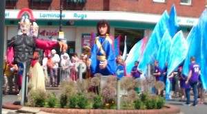
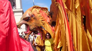
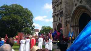
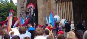
On Saturday 21 June, some of us were in St Albans for the Alban Pilgrimage. In its contemporary manifestation, this involves a festive procession through the city centre accompanied by troops of children dressed as Romans and roses. As the pilgrims process, the drama of Alban’s martyrdom is enacted by a host of giant puppets. Characters in the pageant include the renegade priest Amphibalus, his self-sacrificing convert Alban, a merciless judge, a pair of Roman soldiers, and some historically dodgy lions. In other years, the appearance of a miraculous spring to quench the Saint’s thirst at the place of execution has been re-enacted with the help of the Fire Department; this year, though, the FBU were on strike.

The pilgrimage seems to grow in scale and popularity from year to year. But how old is the tradition? When were the puppets introduced? When did it become an event for tourists and the St Alban’s populace, as well as self-designated pilgrims? What explicit and implicit negotiations between cathedral and city lie behind the current event, which serves as a celebration of both? And who thought up the bit with the eyeballs?

alban and romans

At the start of the procession, Alban is arrested by two Roman soldiers.

alban lions

Lions were scarce in third-century Verulamium, but they are a beloved feature of the modern pilgrimage.

alban gates

At the Cathedral entrance, Alban prepares to meet a fate worse than Grimthorpe

alban eyeballs

As the Saint falls, the eyeballs of the executioner plunge into view….

Poem of the Week (Cornish edition): Ursula Le Guin’s “Castle an Dinas and Chysauster Village”

Ursula Le Guin’s novels, most notably the Earthsea Trilogy, have millions of admirers. Less well-known is her slim volume of verses, Walking in Cornwall (1976). There are just three fairly short poems in the pamphlet, including one on Chûn hill fort and another on “Castle an Dinas and Chysauster Village”. Here’s an excerpt from the latter.

. . .

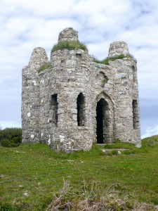
There on top of things is Roger’s Tower.

Who on earth was Roger? Bishop, prince?
Landgrave of Ludgvan? Emperor of St. Erth?
Why did he build his Tower? No one knows.
It looms up here for miles, a great keep,
a mighty ruin on the vaulting hill;
you get there, and it’s all of twelve feet high.
Never was higher. Four fat little turrets
complete its whole ambition.
Two men might fit inside it,
if they had not been eating Cornish cream.
Around behind it, ruinous,
and breaking into yellow gorse-flame everywhere,
the rings, Chun’s sister, Castle An Dinas.
So here’s the Bronze Age, and in front of it
the Middle Ages. Here’s the granite walls
(boulders for base, small stones set vertical)
And here’s the granite walls (cut square, set true).
And who were they? and who was Roger? who?
the wind says to the heather.
Elegant, the arch above the door.
And no one knows what Roger’s Tower’s for.

Place is three fourths of Time.


Roger's Tower

It doesn’t seem to me to defeat the point or the poignancy of the poem to note that Roger’s Tower, pictured above, is not in fact a vestige of the “Middle Ages,” but a late-eighteenth-century folly.


Poem of the Week: Ann Radcliffe, “St Albans Abbey: A Metrical Tale”

Ann Radcliffe  (1764-1823) is best known for her Gothic novels, including The Mysteries of Udolpho and The Italian. Her poetry is less familiar, and little attention seems ever to have been paid to the “Metrical Tale” published after her death, St Albans Abbey (1826). The poem deals mainly with the War of the Roses and the Battle of St Albans; but the impressive first Canto is devoted to the Abbey itself, its history and its present state. Among other things, it sheds an intriguing light on the nineteenth-century Abbey before it achieved cathedral status, and before the restorations of Grimthorpe. Here are some extended excerpts.

CANTO I.

THE ABBEY.

I.
Know ye that pale and ancient choir,
Whose Norman tower lifts its pinnacled spire?
Where the long Abbey-aisle extends
And battled roof o’er roof ascends;
Cornered with buttresses, shapely and small,
That sheltered the Saint in canopied stall;
And, lightened with hanging turrets fair,
That so proudly their dental coronals wear,
They blend with a holy, a warlike air;
While they guard the Martyr’s tomb beneath,
And patient warriors, laid in death?

Continue reading

Poem of the Week(ish): Spenser’s Ruines of Time

This one might best be left to the specialists and the masochists. Edmund Spenser’s The Ruines of Time (1591) is no light read (even by Spenser’s standards), but at points it achieves an almost sublime weirdness. Here we find the poet walking in pensive mood along the Thames when he encounters the wailing ghost of old Verulamium (“Verlame”). She recounts her long and painful history — from Roman foundation to Boudicca’s onslaught and the depredations of the Saxons, to the present day when nothing remains to be seen but “weeds and wasteful grass”. Not a whisper about St Alban or his shrine here (unless in that ill-fated “Image, all of massie Gold”), but much about the Earl of Leicester, and an interesting nod to William Camden. Enjoy.

It chaunced me one day beside the Shore
Of silver streaming Thamesis to be,
Nigh where the goodly Verlame stood of yore,
Of which there now remains no Memory,
Nor any little Monument to see;
By which the Traveller, that fares that way,
This once was she, may warned be to say.

There, on the other side, I did behold
A Woman sitting sorrowfully wailing,
Rending her yellow Locks, like wiry Gold,
About her Shoulders carelesly down trailing,
And Streams of Tears from her fair Eyes forth railing:
In her right Hand a broken Rod she held,
Which towards Haven she seem’d on high to weld.

Continue reading

The future heritage of the past: the Canterbury Town Plan

As part of the Past-Place project, I visited Canterbury last week, with an interest in post-war planning.

Like many cities that had been bombed during the Second World War (e.g. Exeter and Coventry), an all-encompassing post-war plan was put forward for Canterbury. Like many such schemes, Holden and Enderby’s (1945) Canterbury Town Planning Report proposed a more efficient road network – including a broad new main shopping street and inner ring road, and a fitting range of public buildings and transport hubs. In short, it contained an over-riding sense of reaching out to the ‘city of the future’; a modernist dream of metropolitan efficiency and mobility. While German bombers had inadvertently done a lot of ground work for this dream of the future, a lot of old buildings still needed to be cleared; many narrow streets needed to be widened and public spaces required systematic re-organisation, with the clean lines, efficiency and lightness of re-enforced concrete.

While these schemes are sometimes held up as a Philistine attempt to destroy the material heritage of the past, a reflection of the thoughts of post-war planners such as Charles Holden suggests a slightly different view. In 1957, Holden said that “I don’t seek for a style, either ancient or modern … I want an architecture which is through and through a good building; a building planned for specific purpose, constructed in the method and use of materials, old or new, most appropriate to the purpose the building has to serve”. His Plan for Canterbury did not go down very well with the locals, but many of Holden’s buildings around the country came to be strongly supported by preservation lobbyists and practitioners alike. For instance, many of his London Underground stations are now protected under heritage law, as is Charles Holden’s most famous building, the University of London’s Senate House. As his writings make clear, Holden did not seek to ‘destroy the past’. Rather, his attitude towards ‘heritage’ was more focussed on use and meaning than on tangible constructions. This is a heritage of function rather than one of built form. The considerable public debate and conflict over the post-war plan for Canterbury, therefore, was not simply about the ‘preservation’ and ‘destruction’ of heritage, but was rather focussed on what heritage was; how the past is presenced in the built landscape of the city; a heritage of function, and the function (or purpose) of heritage; and of the ‘future heritage’ that people in post-war Canterbury desired to pass on.

Within the public realm, the debate over the Canterbury plan raged on during the Summer of 1945 through a series of public meetings and within the letters pages and editorials of local newspapers (especially the Kentish Gazette). The local elections of November 1945 saw a clean sweep of victories for candidates of the ‘Canterbury Citizens Defence Association’ (CCDA), who had led the opposition to the sweeping plans of Charles Holden (et al).; the Canterbury Plan seemed to be dead – or was it? Despite some of the rhetoric of their proclamations, the CCDA were actually quite supportive of some of the ‘sweeping aside’ of old buildings and routeways. It was the amount of land under orders of compulsory purchase and, most of all, the apparent practices of central planners riding rough-shod over local rights of Freehold that seemed to raise the hackles of the CCDA. The CCDA put forward their own plan – there is still a ring road and a lot of development around the centre of Canterbury, but the re-development largely follows lines of pre-existing freehold patterns. The Plan that was finally settled upon was the Wilson Plan of 1949, which moved the ring road inside the old city walls and included a large roundabout in the very centre, just off the High Street (around Jewry Lane/White Horse Lane). The Wilson Plan was never fully implemented, leaving Canterbury as it is found today: a hybrid of partially implemented ‘comprehensive plans’, the changing visions of what Canterbury should look like, and the unplanned-for eventualities of finance, investment and happenstance.

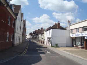
The vestiges of this heritage of future heritage can be seen today in the buildings and streetscapes of the city. Along Northgate, for instance, the ‘ghost’ of a planned-for wide boulevard can still be seen next to St John’s Hospital, where a Veterinary practice and a William Hill Bookmakers were built during the 1950s(?) to sit along the side of a widened street that was never built (see photos below). Had this street been built, then the St John’s Hospital would have been demolished – indeed, the older buildings actually overlap very slightly with the footprint of 1950s re-build.

It is within these hybrid streetscapes that the heritage of heritage planning can be seen – the prospective heritage of the past.

Heritage claims and heritage rejection: from Irish-British relations to Ukrainian-Russian relations and back again

[This is a re-blog from David Harvey’s ‘Geographies of Heritage’ site]

I have previously posted a few items on issues of national heritage, and of how heritage becomes a potent weapon in proverbial battles within the Atlantic archipelago – with relations between Ireland and the UK, or the experience of a sense of Scottish nationhood within the polity of the United Kingdom. Indeed, mirroring the Queen’s heritage-heavy visit to Ireland in 2011, the Irish President this week has been visiting London with both ‘sides’ keen to construct and support a singular heritage narrative that emphasises a cordial partnership between a diversity of flavours, amid a broader sense of common inheritance. With more dissonant overtones, this summer will also see the commemoration of the Battle of Bannockburn as a centre-point of claims to a Scottish heritage that is distinct from and perhaps antagonistic to a sense of Britishness. But this is a ‘heritage battle’ in which no shots will be fired, and no-one will get hurt.

In Eastern Europe, meanwhile, recent weeks have witnessed an altogether more serious and troubling confrontation over issues of heritage; between Russia and Ukraine. These recent experiences can be related to heritage issues on two levels. Firstly, these events have displayed the very real contemporary power of purposefully conjured and deployed heritage images: from the calculated use of notions of the Peoples’ will and democratic mandates for political circumstance, to the conscious use of terms regarding fascists, and revolutionaries. Heritage provides a deep rhetorical resource that has tremendous affective power. Secondly, however, the Post-Soviet heritage experience has long provided fertile ground for such metaphorical and increasingly real conflicts.

One of the key elements of Post-Soviet experience over the last 25 years has been the rise of seemingly cut-and-dried senses of nationhood. Indeed, a sense of national identity has long been one of the key axes through which change in the 1980s and 1990s was prompted and occurred – arguably, it was a crucial element in the break-up of the old system and the expansion of social freedoms. But this also left a residue in the form of heritage being seen as easily categorise-able into supposedly stable and homogenous national units. In trying to account for and manage the numerous elements of Second World War and Soviet-era sites and artefacts that litter the region, many heritage resources in the Baltic States and Eastern Europe have been categorised – implicitly or explicitly – as heritage that is not ours: German cemeteries, Cold War era bunkers, Soviet buildings and institutions. Whether military installations or collective farm buildings, this has become a category that is specifically not of the nation state in which they are located, be it Estonia, Moldova or in the Crimea.

Such a narrative places the nation at the heart of all heritages and as the key axis of identity that all citizens should recognise as their primary loyalty. On the face of it, the question of what we should do with these items of Soviet heritage – a heritage that is not ours – seems fair: another group of people left it here and we don’t want it. But there are pitfalls. Should Scotland deny its Norse heritage on the basis that it represents a group of raiders that we would rather forget? Should Britain deny its Neolithic heritage on the basis that the builders of Stonehenge would not have known the words to the national anthem? The temporal proximity, specific power relations and rawness of feeling of the events in Eastern Europe gives a different quality to the issue in comparison with the Neolithic in Britain, but there is still a lesson to be learnt, in terms of how heritage is categorised and claimed – or specifically not claimed.

The process of delineating a category of heritage that ‘is not ours’ seems to invoke heritage as something to be rejected. One could argue, however, that the act of rejecting the heritage as specifically ‘not ours’ is actually a powerful means through which to claim it as being most definitely ours: ours to interpret and present in a certain manner – through a process of rejection. And of course, the act of rejecting heritage tacitly invites another group to claim ownership. Indeed, the act of rejection – whether of physical artefacts and buildings, or languages, practices and customs – arguably paves the ground that legitimises a set of practical ‘rescue’ procedures by whoever is making this claim of ownership. They perhaps may even send in a gang of hooded militia-men to undertake this rescue operation.

It has taken the best part of a century for the Irish and UK Governments to agree on a common ‘heritage message’, and many thousands of people have died in the process. As the Irish President Michael D Higgins put it, during a speech in Westminster on the 8th April 2014: “[A]s both our islands enter periods of important centenaries we …. must reflect on the ethical importance of respecting different but deeply interwoven narratives. Such reflection will offer us an opportunity to craft a bright future on the …. common ground we share and where we differ … to have respectful empathy for each other”. President Higgins was referring to the on-going and up-coming Centenaries of the First World War and the Dublin Easter Uprising, both of which have often been used to cement the building of boundaries in the intervening 100 years. Rather than laying the foundations for yet more walls and boundaries, let us hope that heritage might be used in a more creative and peaceful means for the sake of people in Eastern Europe.

Offa’s Dyke – The Past in its Place?

This is a reblog from Prof. Howard Williams’s Archaeodeath site.

Offa’s Dyke is sixth century, not eighth century?

I rarely post responses to breaking archaeological news, and at first glance this news does not relate to the archaeology of death and memory. However, this morning’s news comes from Clwyd Powys Archaeological Trust and relates to new discoveries regarding a national monument: new radiocarbon dates from Offa’s Dyke. The dates seemingly come from a reliable context: re-deposited turf from underneath the bank. You can read the first press release here and the BBC story here. It is relevant to the Past in its Place project because Offa’s Dyke delineates the eastern end of the Vale of Llangollen study area for Strand 3 of the project.

I aim to show why this has implications not only for understanding the political and military development of Mercia and its Welsh rivals, but also the literary and memory culture of the Welsh border in the Early Middle Ages. Death and memory comes in because these results, if correct, have knock-on implications for understanding the Pillar of Eliseg and its landscape context.

These results come from emergency excavations following the shameful destruction of part of the dyke near Chirk last summer.

Of course, the usual provisos apply: this is only one section of the monument, the radiocarbon dates have yet to be published, and there are inevitable problems in dating any earthwork based on the material it covered over. Still, these results are extremely important: the first to be obtained from the monument despite decades of digging.

The key results published in the press release are that the part of Offa’s Dyke near Chirk might date to the late sixth century, not the late eighth century.

The Rise of Mercia and the Construction of Earthworks

CPAT’s press release challenges convention and that is always fun. This is true not only for our understanding linear earthwork building as a military and political practice in the Early Middle Ages but also our understanding of the development of the Anglo-Saxon kingdom of Mercia and its relationship with both British and Anglo-Saxon rivals. It also runs counter to a trend: the shorter and more modestly built Wat’s Dyke is now thought to date later than Offa’s Dyke to the early ninth century. If correct, the radiocarbon dates might suggest that the entire earthwork is a late sixth-century construction: a time when Mercia was only coming into the light of history as an aggressive, expansionist military force and political entity in the West Midlands (and so was Mercia the group building the sixth-century dyke? Or, perhaps more likely (and hinted at in the press release), the results open up the possibility that while ‘Offa’s Dyke’ was indeed late eighth century, it had a more complex history of evolution over the two centuries prior to Offa’s reign.

Early Medieval Literary Culture and Memory

Furthermore, these results also have the ramifications for our understanding of the literary and memory culture of the Early Middle Ages , because until now the only real dating evidence for the earthwork has been the ninth-century Life of Alfred the Great by the Welsh monk Asser, ascribing the earthwork to King Offa  who reigned from Chester to London between AD 757-796:

There was in Mercia in fairly recent times a certain vigorous king called Offa, who terrified all the neighbouring kings and provinces around him, and who had a great dyke built between Wales and Mercia from sea to sea (translation by Keynes and Lapidge 1983: 71).

So was Asser wrong? Was he simplifying a complex situation? Or are we simply expecting too much from Asser who was lifting from Gildas anyway? Was Offa really nothing to do with the dyke, or was he simply  the last king of Mercia to extend and effectively use a pre-existing earthwork, making it thus effectively ‘his’? Was Offa simply the best and meanest Mercia king in memory, and perhaps the one with the right ancestral name from an Anglo-Saxon perspective, worthy of association with this earthwork in the context of the later ninth century? Indeed, is Asser recalling a tradition of earthwork-building from the Migration Period Continental Offa – a mythological attribution to a famed earthwork – rather than evidence of the historical deeds of the eighth-century Offa in any case?

The Vale of Llangollen as a Landscape of Contestation

Regardless of whether Asser was wrong or has simply been misunderstood by generations of historians and archaeologists, and regardless of whether the radiocarbon dates apply to the construction of the whole dyke or just the segment near Chirk, there is no question that these results promise to have implications for understanding the Vale of Llangollen in the Early Middle Ages.

For me, this is important because of my on-going collaborative work, as part of Project Eliseg, investigating the early ninth-century monument known as the Pillar of Eliseg, supposedly set up to honour the king of Powys who was a contemporary of Offa: Eliseg.  I have recently discussed the Pillar of Eliseg and its landscape context as part of my other ongoing project: the Past in its Place. If these results are correct, they remind us that this territory was a landscape of contestation far earlier than was previously realised.

It will be interesting to learn how archaeologists and historians respond to this news…

The Pillar of Eliseg’s Topography of Memory

Reposted from Prof. Howard Williams’s Archaeodeath blog, this post explores the Vale of Llangollen in the Early Middle Ages.IMG_8137

The Pillar of Eliseg

I here summarise the paper I presented at this year’s EMWARG conference. I focus on the landscape context of the Pillar of Eliseg, a subject of numerous previous talks and blog entries on the Archaeodeath site.

Introduction

Stone monuments of the Early Middle Ages are profitably considered as an important commemorative medium. They were more than stores of social and religious memories for early medieval individuals and communities through their carving and placement. They also constituted memories through the stone’s provenance, translation, installation and subsequent ongoing and shifting contexts of use and reuse. In these intertwined fashions, stone monuments were key components of early medieval memory work. We might regard them less as repositories of memories, but as technologies of remembrance that enchained people through practices to particular visions of past, present and future. This approach foregrounds early medieval stone monuments as components in what Paul Connerton helpfully refers to as inscribing practices – acts of inscription and collective ritual – and incorporating practices – including embodied and habitual actions of engagement.

Integral to this approach to early medieval stone monuments are three themes: materiality, biography and landscape.

  1. Materiality: Recent work has revised and overhauled our perspectives on the commemorative materialities of stone monuments. Readings of the form, imagery, ornament and text inscribed on stone have increasingly been situated in relation to interpretations of other material dimensions including stone provenance, mass, texture, colour and patina. The deliberate allusions and interplay between commemorative media – skeuomorphism – is also a key focus of enquiry.
  2. Biographies: Over the last two decades in particular, work has increasingly engaged with the biographies of monuments. This work regards stone monuments less as commemorative ‘moments’, but as unfolding projects looking back to their sites of extraction and production and forward to their use, reuse and relocation).
  3. Landscape: The third element is the principal focus of this paper. Over the last decade in particular, there has been a more careful consideration of the spatial settings and relationships between stones within sites and locales, and their wider landscape situation. Hampered by difficulties of locating contexts for many stones, for those in situ or with possible and probably contexts, attention has been drawn to the reuse of prehistoric and Roman stones and the reuse of prehistoric and Roman sites as settings for monuments. Furthermore, relationships with routes, boundaries, settlements, religious sites (chapels, shrines, holy wells) and burial sites as well as the relationship with topography, vegetation and view-sheds have received increasing consideration.

These themes are the focus of a forthcoming book project that I am co-editing.
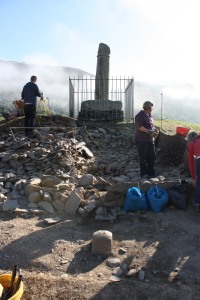
IMG_0134
The 2012 excavations at the Pillar of Eliseg

The Pillar of Eliseg

As a case study in approaching early medieval sculpture as memory work in which each of these three themes are pertinent, I wish to explore recent work on the Pillar of Eliseg near Valle Crucis Abbey, Llangollen, Denbighshire, also known as Llandysilio Yn Iâl 1 (SJ 2027 4452) (Edwards 2013: 322-336). Situated to the western side of the Nant Eglwyseg, this striking and unique-for-Wales monument is dated through the text upon it, to between AD 808 and around 854/55. Raised by the ruler of Powys, Cyngen ap Cadell, its lengthy Latin inscription honours his great-grandfather Elise ap Gwylog and his military victories against the English (presumably the Mercians during the last years of the reign of King Aethelbald and the early years of the reign of King Offa) and the subsequent recovery of Powys, possibly around AD 757 (Charles-Edwards 2013: 417). It might be the case, but not proven because of the partial survival of the text when transcribed in the 17th century by Edward Lhuwyd, that Cyngen ap Cadell himself made a similar, parallel recovery at the beginning of his kingship following subsequent Mercian incursions early in his reign by Cenwulf (Charles-Edwards 2013: 418-19). If so, the Pillar might be regarded a victory monument that juxtaposes, compares and celebrates together the restorative military endeavours of multiple generations of the rulers of Powys.

The Pillar’s text, form and materiality worked together. In her 2009 Antiquaries Journal article, and subsequently in her 2013 Corpus of Early Medieval Inscribed Stones and Stone Sculpture in Wales, Professor Nancy Edwards presents a reinterpretation of the text as political propaganda. She also considers how the material form of the script – Latin half-uncial – makes sense in the context of a land charter. Its performative nature is explicit in the text: it was to be read out loud. Furthermore, the cylindrical form of the shaft may have evoked Roman triumphal columns and its location on a far-older mound were key to the text’s commemorative message linking imagined pasts to the present, honouring the legendary forebears, immediate ancestry and current household of the rulers of Powys. Presenting a contrasting history of the origins of Powys to the Historia Brittonum descending from a positively viewed Vortigern, married to the daughter of Maximus, the cross reveals the competitive, conflicting and temporal manipulations possible in ninth-century genealogies and origin myths (Charles-Edwards 2013: 449-50).

Together, these disparate multi-media commemorative monument projected Cyngen and Confarch’s aspirations to lordship and military might forward into the future together with their hopes of eternal salvation. Edwards suggests that the monument may have served as an assembly place and possibly served, or was intended to serve, as a site of royal inauguration. Furthermore, through her detailed attention to the monument’s life-history, Edwards not only reveals the origins of the cross, but also shows its persistent presence in the landscape over eleven hundred years. I have previously regarded this as the creation of a cyclical transtemporality through text and context, concerned as much with projecting an aspired future as recollecting a distant past (Williams 2011).

IMG_0280
Excavating a cist-grave during the 2012 field season of Project Eliseg

Project Eliseg

The materiality and biography of the Pillar of Eliseg have been revealed further still through the ongoing research of Project Eliseg (Edwards et al. 2010; Edwards et al. 2012). This collaborative fieldwork project between the universities of Bangor and Chester and supported by Llangollen Museum and Cadw has received generous support from a number of funding sources, including the Society of Antiquaries of London, the Prehistoric Society, the Cambrian Archaeological Association, the Aberystwyth and Bangor Universities’ Institute of Medieval and Early Modern Studies University of Wales, Bangor University, University of Chester and Cadw. Co-directed by Dai Morgan Evans, Gary Robinson, Nancy Edwards and myself, we have attempted to enhance and extend our understanding of the commemorative programme of the Pillar of Eliseg. Three seasons of work on and around the mound took place in the summers of 2010, 2011 and 2012 (http://projecteliseg.org/).

I have discussed the project in many previous blogs such as here. Our fieldwork was restricted by working on a scheduled site, excavating only a small sample in the area deemed most disturbed. It is evident that the monument as a whole has been heavily disturbed through barrow-digging, vegetation, animals and human visitors, and retains the important restriction of having on top of it a very heavy re-arrangement of fragments of a ninth-century cross. Still, our project has seen moderate successes, although post-excavation work is ongoing and results and interpretations presented below remain interim.

Following on from a geophysical survey conducted by Alex Turner and Sarah Semple, the 2010 season examined without result a concentration of geophysical anomalies in the field to the north of the mound. We also stripped areas of the mound to reveal its surface appearance beneath the turf. In 2011, we began excavating into the mound on its western side, revealing multiple stages to its construction and revealing burial cists. In 2012, we returned to complete our work, excavating three burial cists – one proving to be undisturbed and packed with cremated human remains of at least 8 individuals. We also completed our field recording, as well as conducting a detailed topographical survey of the mound and its environs.

IMG_0542
Elements of the cairn’s structure visible on the surface, 2012

Materiality and Biography

In terms of biography and materiality, we await final confirmation from radiocarbon dating, we have found conclusive artefactual, monumental and stratigraphic evidence that suggests that the mound was originally a kerbed cairn of Early Bronze Age date. It was subject to a sequence of secondary burials and structural augmentation over an as-yet unspecified duration. Unfortunately, we found no conclusive evidence of early medieval reuse of the mound, although the largest cist, empty when excavated, could have originally contained a burial of any date from the Bronze Age to the Early Middle Ages.

Still, the composition and character of the mound helps us understand how the mound was perceived in the Early Middle Ages and selected as a site for raising a striking royal stone cross upon it. What became clear during excavation was that the superficial location of the secondary cists we discovered. We know that, by the ninth century, there was a long tradition of burial associated with ancient monuments in the Welsh landscape. Moreover, monuments were becoming mythologised, evidenced by broadly contemporary sources such as the Stanzas of the Graves (Petts 2007; Edwards 2009). Yet the superficial position of the cists prompts to imagine it was extremely likely that anyone encountering and superficially digging into the mound in the Early Middle Ages would have uncovered comparable secondary cists, if not these very ones (given that two out of three were disturbed). Indeed, digging need not have been necessary: cists may have eroded out and been exposed upon surface inspection, then as now, especially on the steep southern side. Therefore, while there are no surviving folkore and legends associated with the mound, this evidence  hints that the mound would have been understood to be a funerary monument: in ‘theory speak’, the Bronze Age cists had an agency, encouraging the mound’s reuse in future generations, if not the specific character of its reuse.

The balance of evidence suggests that this was a long-abandoned prehistoric monument reactivated through use as a cross, but by individuals conscious that the mound was an ancient burial monument. Still, there is an account of excavations in the 1780s, prior to the re-erection of the Pillar, describing the discovery in the centre of the mound of a stone box containing a skeleton box with a silver disc. Edwards (2009; 2013) makes clear her view that a Bronze Age burial mound is an unlikely context for an eighth-century high-status burial. Certainly our excavations did not, and could not, secure a view on this matter either way: we had no permission to remove the heavy stone sculpture to investigate what lay beneath the centre of the mound. Still, given:

  1. the possibility that mounds continued to attract burials away from church settings across early medieval Britain long after Christian conversion (bearing in mind how difficult it is to date the end-date of many early Christian cemeteries excavated in North Wales: see Longley 2009).
  2. that we cannot be sure that the mound was not part of a Christian church focusing on the site that was to later attract a Cistercian foundation (bearing in mind that early  Christian church sites might have multiple burial foci, some focusing on anceitn mounds, as at Repton, North Yorkshire, Hall and Whyman 1996).
  3. given that while most early medieval burials in Wales are findless, if accurately reported, a ‘silver disc’ could refer to all manner of artefacts – coins, disc brooches – that can occasionally, if rarely, be found in early medieval graves of the later seventh and early eighth centuries.

In the light of these points, we still shouldn’t rule out the possibility that the cross was part of a longer series of early medieval activities on the site, including its eighth-century reuse as a burial monument to honour Elise or other members of the ruling dynasty of Powys. Either way, we have demonstrated that the choice of site mobilised links to the ancient past, a mythologizing of place that mirrors the text and form of the monument (Petts 2007, 166; Edwards 2009, 149-51; 2013).

Our excavations also revealed traces of post-medieval activity on the mound, antiquarian disturbance and further indications regarding how the fragments were re-erected over the mound in the late eighteenth century, so the longer biography of the monument has been informed by our fieldwork.

IMG_0492
Excavations in 2012

The Topography of Memory

Nancy Edwards has explored varied dimensions to the landscape contexts of early medieval stone sculpture (Edwards 2001a and b; 2007). Yet both Edwards’ research and the fieldwork by Project Eliseg have been both focused upon the mound rather than the wider landscape (Edwards 2009; 2013). Hence, much remains to be explored regarding the wider early medieval landscape in which this striking commemorative cross was situated. How was the location integral to the commemorative project of the monument in the ninth century? Here, I would advocate that we need to think about the location from a multi-scalar perspective, thinking first about the immediate environs, then the wider Vale of Llangollen.

My working hypothesis is that, as I have argued previously, crosses like this need to be regarded as pivots within early medieval topographies of remembrance, located spatially and conceptually at the intersection between secular elites and sacred commemorative traditions focusing on churches (Williams 2006, 192). I have outlined some tentative suggestions regarding how the monument may have operated as a commemorative landmark informed by previous research and a sense of the topography surrounding the site today (Williams 2011). This year brings the opportunity to test these ideas further, as part of the interdisciplinary Past in its Place project, funded by the Leverhulme Trust and the European Research Council, I am working with Drs Patricia Murrieta-Flores (University of Chester) together with other project researchers to explore further the topographies of memory revealed in archaeological, historical and literary sources from the eastern part of the Vale of Llangollen. In the context of this ongoing research, I want to outline some tentative observations regarding the landscape context of the Pillar of Eliseg.

IMG_0505
Fisheye Eliseg

Place and Performance

Topography, metal-detector finds and aerial photographs combine to support and extend Edwards’ 2009 suggestion that the Pillar of Eliseg was one node in a assembly or central place. The site may have operated as a theatre for large gatherings and there are hints that high-status settlement and/or other ceremonial spaces were located in its proximity

IMG_1619
The monument in its landscape setting, view from Velvet Hill to the SW, looking NE

Movement and Memory

I presented a series of strands of evidence to suggest the key relationship between movement through the landscape and the location of the Pillar as a mnemonic landmark. I argued that the Pillar was located in a topographical bottle-neck and a zone of movement in and out of the Vale. I also put forward the suggestion that the movement of the stone to the site was also a ‘translation’ that was memorable. Together, movement and memory were intertwined in making the monument’s text, form and materiality effective as a commemorative medium.

IMG_1654
A view of the thirteenth-century foundation of Valle Crucis Abbey, SE of the Pillar of Eliseg. Was this the site of an earlier church?

Sacred and Military Landscapes

I reviewed the latest evidence regarding what we know about the sacred and political geography of the Vale of Llangollen, a subject for which far more work is required. I suggested that the Pillar was located at a defensible location as well as an accessible one and related to both secular and religious networks of places and routes. The cult site of St Collen (Silvester and Evans 2009), the well of St Collen and a possible church site beneath the later abbey were discussed. Whilst hillforts are dated in the region to the Late Bronze Age and Early Iron Age (e.g. Grant 2010), I explored the possibility that many were reused in the Early Middle Ages for a range of functions, providing a further settlement context for the Pillar. I also argued that the relationship with the near-contemporary early ninth-century Wat’s Dyke needs further attention and interpretation (Malim and Hayes 2008), and possibly also to short-dykes of unknown date (Silvester and Hankinson 2002), alongside established discussions of the Pillar in relation to Offa’s Dyke (Hill 2000).

IMG_2618
Eliseg prison break – linking monument and landscape through archaeology

Conclusion

Project Eliseg has been very much about breaking into the monument – using archaeology to investigate the mound’s biography and materiality. I have previously referred to this as the Pillar of Eliseg’s prison break. In this paper, I presented the flip-side, because the archaeological work as part of the Past in its Place project is very much about breaking out, resituating the Pillar within a series of landscapes. This is a multi-scalar approach to understanding how the monument may have operated and functioned in the early medieval landscape and subsequently through the Middle Ages to the present day with regards to topographies of memory.

References

Charles-Edwards, T. 2013. Wales and the Britons 300-1064, Oxford: Oxford University Press.

Edwards, N. 2001a. Monuments in a landscape: The early medieval sculpture of St David’s, in H. Hamerow & A. MacGregor (eds) Image and Power in the Archaeology of Early Medieval Britain, Oxford: Oxbow, pp. 53-77.

Edwards, N. 2001b. Early medieval inscribed stones and stone sculpture in Wales: context and function, Medieval Archaeology 45: 15-39.

Edwards, N. 2007. A Corpus of Early Medieval Inscribed Stones and Stone Sculpture in Wales. Volume II, South-West Wales, Cardiff: University of Wales Press.

Edwards, N. 2009. Rethinking the Pillar of Eliseg, The Antiquaries Journal 89: 143-77.

Edwards, N. 2013. A Corpus of Early Medieval Inscribed Stones and Stone Sculpture in Wales. Volume III, North Wales, Cardiff: University of Wales Press

Edwards, N., Robinson, G., Williams, H. and Evans, D.M. 2010. The Pillar of Eliseg, Llantysilio, incomplete inscribed cross and cairn, SJ 2027 4452. NPRN 101160; 101161, Archaeology in Wales 50: 57-59.

Edwards, N., Robinson, G. and Williams, H. 2012. Project Eliseg: Preliminary Report Prepared for Cadw, December 2012. Unpublished Report.

Grant, I. 2010. Moel y Gaer hillfort, Llantysilio, Denbighshire, Archaeological Excavation. CPAT Report No. 1059.

Griffiths, D. 2006. Maen Achwyfan and the context of Viking settlement in north-east Wales, Archaeologia Cambrensis 155: 143-62.

Hill, D. 2000. Offa’s Dyke: pattern and purpose, Antiquaries Journal 80, 195-206.

Longley, D. 2009. Early medieval burial in Wales, in . Identifying the mother churches of North-East Wales, in N. Edwards (ed.) The Archaeology of the Early Medieval Celtic Churches, Society for Medieval Archaeology Monograph 29. Leeds: Maney, pp. 21-40.

Malim, T. and Hayes, L. 2008. The date and nature of Wat’s Dyke: a reassessment in the light of recent investigations at Gobowen, Shropshire, in S. Crawford and H. Hamerow (eds) Anglo-Saxon Studies in Archaeology and History 15, Oxford: Oxford University School of Archaeology, pp. 147-79.

Petts, D. 2007. De Situ Brecheniauc and Englunion y Beddau: Writing about burial in early medieval Wales, in S. Semple & H. Williams (eds) Early Medieval Mortuary Practices, Anglo-Saxon Studies in Archaeology and History 14, Oxford: Oxford University School of Archaeology, pp. 163-172.

Silvester, R. J. and Hankinson, R. 2002. The Short Dykes of Mid and North-East Wales. March 2002. Welshpool: Clwyd-Powys Archaeological Trust.

Silvester, R. & Evans, J.W. 2009. Identifying the mother churches of North-East Wales, in N. Edwards (ed.) The Archaeology of the Early Medieval Celtic Churches, Society for Medieval Archaeology Monograph 29. Leeds: Maney, pp. 21-40.

Williams, H. 2006. Death and Memory in Early Medieval Britain, Cambridge: Cambridge University Press.

Williams, H. 2011. Remembering elites: early medieval stone crosses as commemorative technologies, L. Boye et al. (eds) Arkæologi i Slesvig/Archäologie in Schleswig. Sonderband ‘Det 61. Internationale Sachsensymposion 2010’ Haderslev, Denmark, 13-32, Neumünster: Wachholtz