About howardwilliams

I am an archaeologist with research interests in death, burial and commemoration.

Mortuary Selfies: Photos from Among the Tombs

12

Ruth photographing memorials in the cloister of Canterbury Cathedral

Reblogged from Howard’s Archaeodeath.

There is much outrage and indignation about the proliferation of ‘selfies’ extending into mortuary and dark touristic realms in the media of late. Boundaries of ‘taste’ have been infringed apparently. With this in mind, and nearing the completion of Strand 1 of the Past in its Place project, with a forthcoming exhibition about our work planned at Exeter Cathedral, it seems appropriate to post some photographs of the project team exploring the memorials and tombs of English and Welsh cathedrals.

As part of the project, we have been taking an exhaustive set of digital photographs of the memorials on windows, fittings, walls and floors in a series of English and Welsh cathedrals. This has presented all manner of methodological and practical challenges and I am not always pleased with the results. The advantages have been tremendous too, since we are focusing not only on the grandest monuments, but on the humble ledgers too. Hence, we are exploring the chronological and spatial variability of commemorative practices in and around cathedrals.

Incidentally and sometimes accidentally, Ruth and I have captured pictures of project members going about photographing and investigating memorials and tombs, talking with each other around memorials and tombs, and meeting librarians, archivists and archaeologists.

I didn’t go about this recording of other people in a systematic way, and likewise pics with me in are rare and accidental. In and around cathedrals where I was alone on my visit, there are few pics of myself. I wonder if these photographs will arouse anger and indignation. If not, this blog entry might simply be a bit self-indulgent. Still, they are not really ‘selfies’ in the usual sense, but in the collective project sense, they are photographs of ‘us’.

Be that as it may, like funeral selfies, it is not mere narcissism of myself and/or of the project. These photographs serve to document, to mark our presence in time and place, at different times of day, times of year, and in different English and Welsh places with long and complex ‘histories of memory’. We were there, we saw the tombs, we saw the memorials, we visited that place.  As such, in a humble sense, they are a snapshot of the many thousands of pilgrims and visitors who, over the centuries, for different motives and different circumstances, have explored and inscribed, prayed and remembered, sung and sobbed among the tombs…. In many ways, this is exactly the kind of memory work our project is seeking to investigate.

Featured are Philip, Naomi, Paty, Ruth and various other scholars with whom with met at Norwich, Canterbury, St Albans and elsewhere.

10

Howard at St Albans

11

Naomi, Paty and Philip at Exeter

13

The team at Norwich

15

Philip and Ruth at Norwich

16

Naomi and Philip at Norwich

17

Ruth, bravely exploring Ripon Cathedral on crutches! What a star!

19

Naomi at Norwich

20

Philip at Edith Cavell’s grave, outside Norwich Cathedral

22

Howard at St Albans

24

Meeting Julian Litten at Norwich

25

Ruth at Canterbury

Commemorating Cures

IMG_20140723_155143

Although not about one of the sites that form a focus of the Past in its Place project, this recent blog entry explores the material practices taking place at sites of pilgrimmage, particulary from the 19th century. It is reblogged here from Howard Williams’s Archaeodeath site.

Recently I visited St Winifred’s Well, a tourist attraction and Christian cult focus at Holywell, Flintshire. For further details see their website here.

With twins in tow, I didn’t get a chance to walk around the museum, but I did get the opportunity to explore well chapel itself: the ‘Lourdes of Wales’. A focus of legend associated with the supposed 7th-century female saint. Wini lost her head to save her virginity from a rapist, and it miraculous was reattached. Headstrong Wini lived out her life a nun and her cult grew throughout the Middle Ages. The structure you can see is a phenomenal early 16th-century well-chapel with later additions during the 18th and 19th centuries.

IMG_20140723_152006

St Wini’s chapel from the north (above the well)

As with all foci of veneration by pilgrims, there are various ephemeral material cultures that inhabit and augment this space, from candles to cards. There are also different forms of memorial.

IMG_20140723_153334

Colin Stell’s section of the chapel and well

IMG_20140723_153843

St Winifred’s Well: 16th century.

IMG_20140723_154021

The facade of the well

IMG_20140723_154639

The vaulting within the chapel – fabulous construction

IMG_20140723_154113

Inside the well, water bubbling up

IMG_20140723_154032

The museum – formerly Victorian custodian’s house

Commemorating the Dead

The historic churchyard associated with and uphill from the chapel has now been cleared completely, but it is a strikingly steep space that reminded me of Coalbrookdale’s Quaker burial ground. Along its western edge there remain a collection of in situ and relocated memorials of 18th- and 19th-century date.

IMG_20140723_151920

The cleared burial ground above the chapel

IMG_20140723_151933

IMG_20140723_152015

IMG_20140723_152245

More gravestones

More recent memorials allowed in the chapel grounds take the form of our good old friend the memorial bench. These include a notable number to ladies named ‘Winifred’. Lining the route to, around and within, and from the well, these benches allow the dead to be remembered at, and presenced at, the holy well.

IMG_20140723_152634

A further memorial or votive practice is placing potted plants and flowers around the statue of St Winifred in front of the well.

Commemorating Cures

The most prevalent historic form of memorial is the graffiti that adorns all surfaces, including notably the sites of the structure that face into the waters. The motives of inscribers are unclear: counter-souvenirs of the act of pilgrimage itself (i.e. marking the place been to rather than/or additional to bringing a memento back with the pilgrim), dedications of prayers to Saint Winifred for hoped-for cures, or commemorative statements celebrating cures received by pilgrims. There are forms of graffiti familiar from cathedrals where pilgrims have thronged around the crypts and shrines containing the remains of the saintly dead.

IMG_20140723_154333IMG_20140723_154632IMG_20140723_154624IMG_20140723_154511IMG_20140723_154404

In the visitor exhibition there are wooden boards recording financial offerings to the chapel, as well as another form of discard; crutches left behind by cured pilgrims. Crutches were something I hadn’t encountered before as an assemblage of similar artefacts at a sacred site. They reminded me of the sinister display of artefacts in horrific piles at Auchwitz-Birkenau; the possessions – suitcases, shoes, cut hair etc – of those killed by the Nazi regime and serving as material testimony to this atrocity. Yet at St Winifred’s while the former owners are undoubtedly now dead, these artefacts commemorate cures and the lifting of suffering by saintly intercession.

IMG_20140723_153641IMG_20140723_153457

Death-Defying Cistercians?

IMG_2625

Buildwas Abbey, Shropshire

Re-posted from Howard’s Archaeodeath blog. In the Past in its Place project we are exploring how memories are located in cathedrals, ancient habitations and the wider landscape. Here, I muse over how the dispersal of tombs and memorials, and the heritage management of the ruins of Cistercian monasteries, is more than a casual ‘forgetting’ of the dead, but an overt dimension of heritage interpretation with its focusing on the religious and economic life of medieval monks that downplays the dynamic relationships between patrons and abbeys in which memory was key.

I recently visited Buildwas Abbey, Shropshire, a site managed by English Heritage and staffed that day by one of its most friendly of employees.  Beside the River Severn, this is a perfect ruin of a 12th-century Cistercian house, suppressed in 1536 and adapted into a secular mansion.

It is truly a ‘perfect ruin’, together with woodland walks down to the river. It was a great stop-off en route back from Oxfordshire to North Wales. For me this was a real nostalgia visit, since I last went there as a kid myself. Here are some general pictures of this superb ruin with the neatly trimmed grass that typifies EH sites.

Continue reading

Cremation Switchback and the Churchyard

IMG_8628

Pennant Melangell church

This is re-posted from Howard Williams’s Archaeodeath blog.

Recently I posted about a visit to Pennant Melangell and the shrine of St Melangell. Well, it must be said that this is a fascinating site for its church and internal memorials, but even more so for its churchyard.

IMG_8500

18th-century graves: Pennant Melangell

Many urban,suburban and large rural churchyards (whether in use or abandoned) have very complex patterns of memorialisation with multiple foci to them. In such environments, the bodies of the dead compete with each other, jostling down the generations within the restrictions of limited space. From the 19th century in particular, some churchyards bear signs of a new trend of expansion rather than reuse.

Continue reading

Grace Darling

Grace Horsley Darling by Thomas Musgrave Joy. Reproduced from http://en.wikipedia.org/wiki/Grace_Darling

Grace Horsley Darling (1815-42) is one of the Victorian era’s premier heroines and her story is well told by the website dedicated to her memory. Grace was born in a cottage next to St Aidan’s Church, Bamburgh, Northumberland.

She grew up a lighthouse keeper’s daughter upon Brownsman Island, one of the Farne Islands. Adept at sea and familiar with seabirds and island life, she then moved aged 10 into the newly built Longstone Lighthouse in 1825.

On 7th September 1838, she observed the wreck and survivors of the Forfarshire and subsequently rowed with her father in a storm to their rescue. Grace was a young woman who lived a relatively isolated life who through her heroism became a worldwide early Victorian celebrity.

The Victorian obsession with this female celebrity (including fascination from clergy as well as laypeople) was replete with Christian spiritual allusions connecting her residence and acts and the deeds and habitations of the early saints Aidan and Cutbhert who inhabited the Farne Islands. Grace also embodied the adventurous romance of the sublime isolation and dangers of this maritime environment.

Yet the affinity for Grace manifest itself in the deeply, material and corporeal one desire to possess her body. People wrote fan mail to Grace, wished to kiss the paper and post it back, send locks of her hair, asking her to appear at public events as a ‘token’ and almost as an living saintly icon. People travelled to see her and there was a desire to have her act of bravery depicted by artists. Also, portraits of this lady were taken and widely distributed. Grace embodied the virtues of English Christian virginal womanhood. Whether it was the pressure of her fame alone, Grace died only four years later, aged only 26, on 20th October 1842. Perhaps she was hounded to an early grave by her public exposure; near her end she was fearful of imagined eyes watching her. Still, she was ultimately diagnosed with tuberculosis and died from that condition.

Continue reading

Lindisfarne Stones

Re-posted from Archaeodeath

This is my fourth and final comment about a short visit to Lindisfarne. The principal reason for my visit was to view the early medieval stone sculpture in the visitor centre and priory. Strip away the archaeological excavations elsewhere on Holy Island, strip away the historical record, the vast majority of the material evidence that this had been an important monastic foundation of the seventh to ninth centuries AD comes from the collection of Anglo-Saxon sculpted stones discovered in and around the priory. It is a fabulous and varied collection as one might expect. I have already mentioned the Petting Stone. In the priory itself is a cross-base with serpentine crosses on its front.

Continue reading

Commemoration at Lindisfarne Priory

Re-posted from Archaeodeath

As a place of worship and pilgrimage, with St Mary’s church and churchyard right next to the priory ruins, and given the long-standing associated with the absent saintly dead in the form of Aidan and Cuthbert, it is hardly surprising that death and memory are interwoven with the site of Lindisfarne Priory’s ruins. I have mused over the landscape and seascape context and the heritage interpretation of the famous Viking raid, but what of death and commemoration in the English Heritage site of Lindisfarne Priory and its environs? Even a brief consideration of this topic reveals the complexity of what is memorialised and what is not; where memorialisation has historically been allowed, and where it is not.

The ruins are a marvel in themselves, already one of my favourite sets of Romanesque and Gothic monastic ruins before I even got there. I loved the patina of the windblown sandstone and the fabulous columns of the nave, so reminiscent of Durham Cathedral. Here are some standard  photos for your viewing pleasure.

Continue reading

Lindisfarne

IMG_4090

Lindisfarne Priory from the Heugh

Re-posted from Archaeodeath.

Recently, for the first time in my adult life, I had the opportunity to visit the premier medieval site of Lindisfarne. This is a site of key historic and archaeological importance for understanding the Anglo-Saxon church, its origins, development and diversity. It was here that Aidan established the earliest Christian monastic foundation in the kingdom of Northumbria. His founder status was superseded to a large extent by the cult of St Cuthbert, but forgotten he was not. Lindisfarne is also famous for being subject to one of the earliest, and certainly the most famous of Norse raids, in AD 793. Following a decline (or abandonment) of the site during the tenth century, the Benedictine priory was a focus of monastic life and pilgrimage to the cenotaph of Cuthbert’s original grave and to St Cuthbert’s Isle – the site of his hermit’s cell – through the Middle Ages. The monastery survived until Henry VIII’s suppression of the monasteries.

IMG_3823

The English Heritage commissioned artist’s impression of the Anglo-Saxon monastic site

I couldn’t stay long on the island, but I can only enthuse about the striking landscape and seascape, appreciable even from a short visit. The first thing to note is the striking topography of the island itself, joined as it is by a tidal causeway to the mainland. Dunes constitute much of the north of the island, leaving a relatively small and protected area of habitable ground. The Anglo-Saxon monastery was located beside a natural harbour on the sheltered southern shore.

Continue reading

Maelmin

IMG_4105

The Maelmin Heritage Trail


Ok, I thought of the strained pun on the ‘The Postman Always Rings Twice’ and now I have absolutely no idea how this relates to this blog posting. This is the beauty of having no editor and no anonymous referees: I need not explain myself to anyone! If you can overcome this disappointment, please read on…

IMG_4111

Boards by the entrance outline the history of the RAF site

IMG_4110The landscape around Millfield, Northumberland is a rich archaeological landscape spanning from the Mesolithic to modern era. Having visited Yeavering/Ad Gefrin, Bamburgh and Lindisfarne the previous day, I went back to the Millfield basin to ascend Yeavering Bell. En route, I stopped off very early morning to walk around the Maelmin Heritage Trail on the edge of Millfield. Here I encountered something very different from the other sites.

IMG_4124

Millfield henge monument

The Anglo-Saxon palace site of Maelmin was the successor to Ad Gefrin. Never excavated, aerial photographs revealed a elaborate complex of timber halls, enclosures and burial sites comparable to Yeavering and Thirlings. Excavations of two Neolithic henges at Millfield also found secondary early Anglo-Saxon inhumation graves reusing these ancient monuments. Again it is unclear the full duration of the site without extensive excavations but close by lower-status Anglo-Saxon settlements at Cheviot Quarry (published in the Archaeological Journal) and other sites reveal the broader pattern of early medieval settlement around the Millfield basin.

IMG_4136

The woods

As with Ad Gefrin, the Maelmin Heritage Trail faces the stark challenge of communicating a rich archaeological landscape in which there is almost nothing to see above ground for the visitor. The heritage trail originally had three reconstructions (two extant) and a massive dose of heritage boards set within a plot of land managed as a mix grassland and woodland.

IMG_4161

Early morning views over the Millfield basin from the Maelmin Heritage Trail

The visitor to the site begins with a car parking area and three heritage boards giving details of the wartime history of the site as an RAF airfield for training pilots. There is a memorial stone upon which are the names of those – mostly of the RAF and RCAF – who lost their lives between 1942 and 1946 at the facility.

IMG_4172

The ‘Dark Age house’

An introductory heritage board gives details of the archaeological landscape. One then embarks on a time trail moving through a broadly anti-clockwise route through thick grass and then through the wood and back to the car park through the grass again. Board after board gives informative details of the local landscape, the chronological narrative: Mesolithic, early Neolithic, late Neolithic, Bronze Age, Iron Age, Roman, end of Roman Britain, the ‘revival of the Britons’, the early Anglo-Saxons, the conversion of the Northumbrian kingdom to Christianity.

IMG_4179

Sneaking a peak inside the Dark Age house

There are additional boards explaining details within the periods, about the three reconstructions: the Mesolithic hut (no longer extant), the Neolithic henge and the ‘Dark Age house’ and the excavations at Cheviot Quarry and the sites of Maelmin and Thirlings.

The henge is interesting, with ditches, banks and upright timber posts, it does indeed give a sense of how these monuments might have looked.

IMG_4207

Henge posts in early morning light

The ‘Dark Age’ house was locked, but sneaking a peak through the door, one got a sense of a relatively small and stark interior, but inevitably it sits without a context unlike the ‘settlement’ arrangements elsewhere like West Stow and Bede’s World.

A further set of heritage boards explores the preferable climate of the Millfield basin, the formation of the landscape, the hydrology of the basin, woodlands, animals and birdlife.

IMG_4215

Anal graffiti

Three things struck me about this heritage site

  1. The volume of boards, and the two reconstructions, do create a palpable sense of archaeology and landscape in a relatively small space. Given the lack of public accessible land in the immediate environs, this was a great foci for anyone interested in the heritage of the area, and works in this regard far better than Bamburgh, Lindisfarne or Ad Gefrin
  2. The information is accurate in general terms, but incredibly conventional and stylised, particularly notable (to me) in the proto-historic and early historic boards which advocate a simple migrationist framework for the emergence of the Anglo-Saxon kingdom. To be fair though, this is what happens everywhere in this region it seems: Lindisfarne even had the Dad’s Army style map with arrows showing the migration routes of the Anglo-Saxon tribes. For crying out loud!
  3. It is not unusual for the same artist to be responsible for the images, creating a coherence to the displays, creating a shared theme. Despite the perpetuation of stereotypes of dress and body proportions (all men had massive muscles, all women had massive breasts: at least in prehistory, then women and men both get far more boring and better clothed), at least it was a rare attempt to introduce a Carry On style humour into British heritage sites. At least that was my view. At most other sites you are really not expected to laugh at other heritage sites, and where humour is used, it is in infantile attempts to engage kids. For me, this worked well and created memorable images and information.
IMG_4216

Empty – no leaflets 🙁

So despite the absence of any ‘real’ archaeology, the Maelmin Heritage Trail tries its best. There were no leaflets to take away and one typo on the main introduction board has been angrily daubed with rectifying graffiti. Still, on the whole, this gets my tentative thumbs up.

As for the pun? Answers on a postcard to: Maelmin Heritage Trail Pun Competition, Millfield, Northumberland. Although perhaps, at a site where two henges were excavated, this is a site with two rings…

IMG_4150

I’m really not sure what the archaeological basis for any of this is, but still, a nice idea.

IMG_4164

I like this so much. Lovely chamber grave with wand-wielding priestess (I think) and the march of the Angles out of Bamburgh heading for glory…

IMG_4199

How Maelmin may have looked. Still, ‘royal town’ really does give the wrong impression to the visitor.

IMG_4186

Edwin getting hitched and Paulinus batpising people in the River Glen. ‘Flowering of Anglo-British Culture’: nice phrase but I think Northumbria was not more or less ‘Anglo-British’ than anywhere else in lowland Britain.


Yeavering Bell

IMG_4287

Yeavering Bell from the south

Re-posted from Archaeodeath

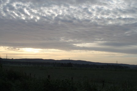
At the research workshop on new research at Ad Gefrin/Yeavering, many of the experts present proclaimed, from different perspectives, that you cannot understand Ad Gefrin without understanding the hill-fort of Yeavering Bell. Ad Gefrin, it was said, is ‘in the shadow’ of Yeavering Bell. This was no empty metaphor: during a large portion of the year, the Ad Gefrin site is in the shadow of the hill over which the low winter sun cannot project. Frosts stay longest at the Ad Gefrin site than in surrounding fields I was told.

And indeed, to observe Ad Gefrin and understand its situation I was told that one cannot do better than to ascend Yeavering Bell. Many of those there told me they had made out possible crop-marks from the perspective offered by the hill upon which the fort is situated.

IMG_4229

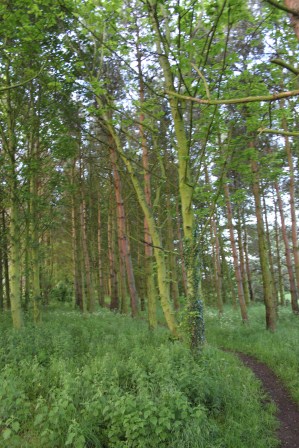
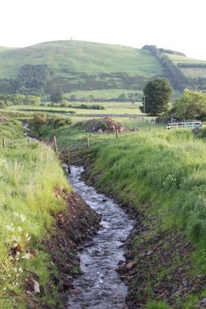
Stream on the ascent

IMG_4235

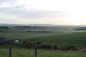
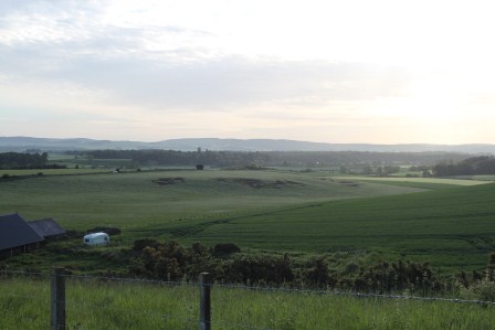
View over the Ad Gefrin site during the ascent of Yeavering Bell

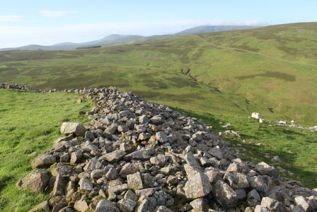
Yeavering Bell is the only ‘true’ hill-fort in the Cheviots although it must be said that almost every hill along the northern edge of the Cheviots has a smaller fortification of presumed (if not proven) late prehistoric date upon it. Aerial photograph has shown how this is simply a surviving dimension of a wider settlement pattern; in lower areas similar fortified sites have been obliterated by medieval and post-medieval agriculture. Despite this advance in knowledge, Yeavering Bell still stands out in terms of the prominence of the hill itself and the size of the defences and the number of house-platforms identified within it.
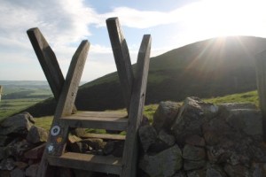
IMG_4262

Leading the way

There remains considerable debate regarding Yeavering Bell’s date of construction and occupation and whether the small hill-top fortification within the hill-fort, around the highest point is a contemporary Anglian fortification linked to the palace site of Ad Gefrin. Surveys and excavations have only partly identified the extent to which this site may offer ‘continuity’ from the first millennium BC through to the mid/later first millennium AD. Was Ad Gefrin a direct successor to a persistent central (and possibly sacred) place? Or was it a reactivation of a locale whose original (or many previous) uses were long forgotten but whose monumental and topographical supremacy could never to be ignored?
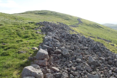
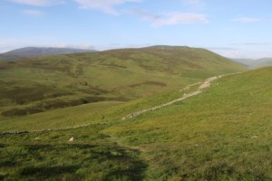
IMG_4264

Up Yeavering Bell

I won’t use this blog as the place to wade into these debates yet, and you can read the views of the different authors in Paul Frodsham and Colm O’Brien’s fascinating survey Yeavering: People, Power and Place. Richard Bradley’s superb 1987 paper in the Journal of the British Archaeological Association, that has done so much to inspire me and others in thinking about ‘the past in the past’, should also never been ‘forgotten’. Before that, Hope-Taylor’s publication on Yeavering has many (if sometimes very frustratingly vague) things to say about the hill-fort. For a list of available publications, see the Gefrin Trust website. Roger Miket has recently published on this topic in Archaeologia Aeliana but I have yet to secure a copy of this publication.

IMG_4304

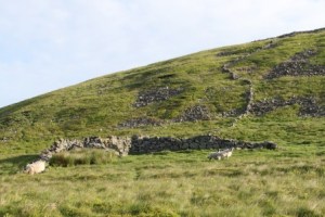
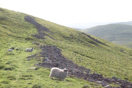
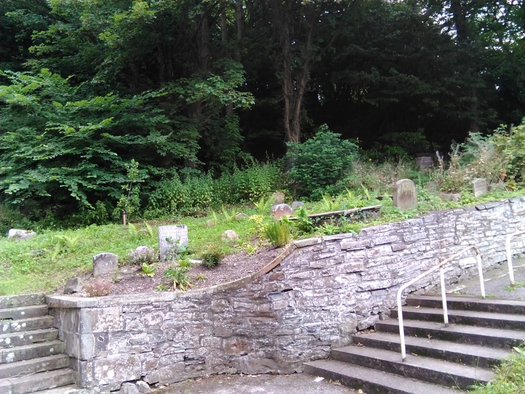
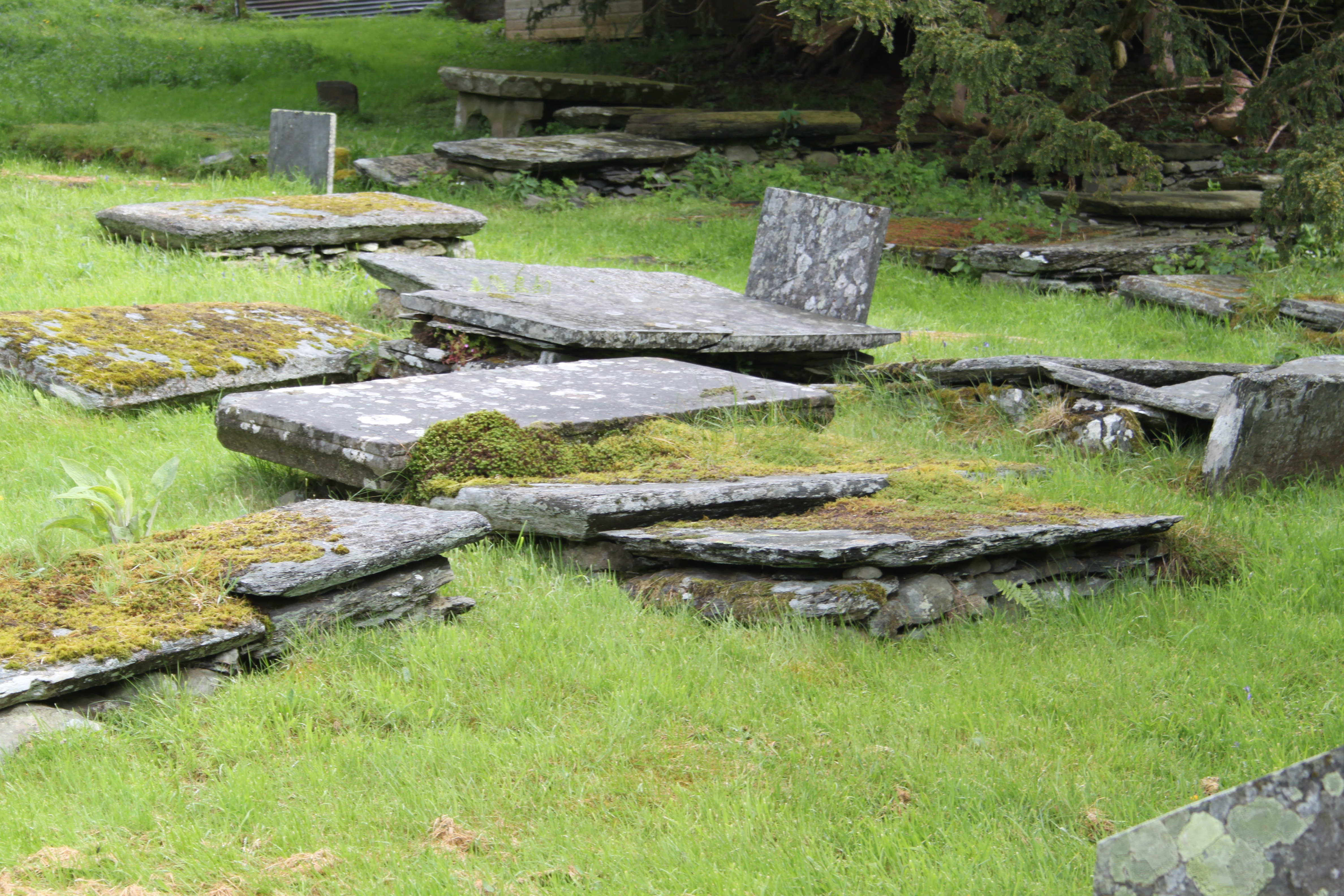
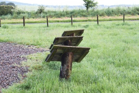
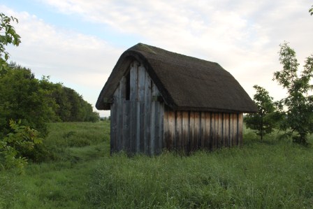
Farm building and field walls: post-medieval

What I will say is that I often rant against archaeologists who define sites by period, when those sites persisted and were open to reinterpretation and reuse long after their initial construction. Equally though, I am cynical of claims at ‘continuity’ without precise clarification regarding what is meant by this.

IMG_4323

View south from Yeavering Bell over the ramparts

I intend to synthesise an appraisal of the hill-fort and its relationship with Ad Gefrin with regard to its remembering and its forgetting, responding to the work of Bradley, Frodsham, Oswald and others, as part of the Past in its Place project.

IMG_4330

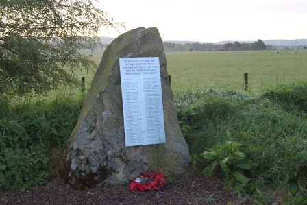
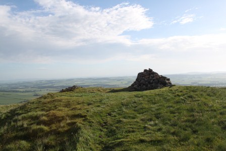
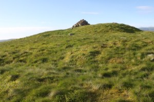
The summit cairn of Yeavering Bell

In doing so, my aspiration is to try and disagree with everyone, not because I think that everyone who has worked on this fascinating site and its context is ‘wrong’, but because I feel their frames of reference and theoretical perspectives (where expressed) are different from mine and my colleagues with our interest in the history of memory from archaeological and literary perspectives.

IMG_4346

Me at the summit of Yeavering Bell

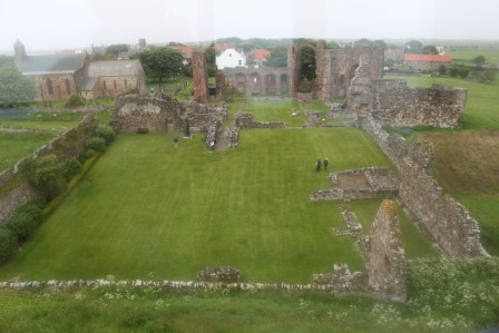
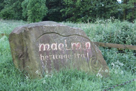
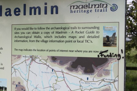
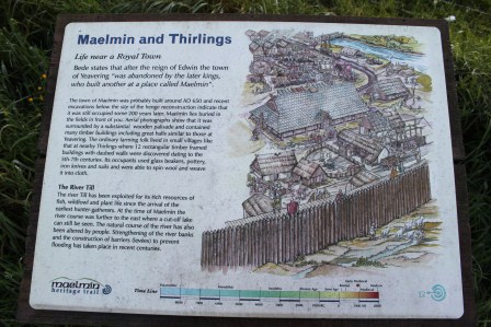
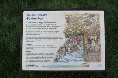
So on the day after I visited Ad Gefrin and Bamburgh, followed by a visit to Lindisfarne in heavy rain, I went back to park at the Ad Gefrin lay-by and walked up Yeavering Bell on a windy but beautifully warm and sunny summer’s morning. I was up early, having been awoken by Berwick-upon-Tweed drunks at 4 am (my Travelodge was adjacent to a 24-hour McDonald’s restaurant that clearly attracts the intoxicated and inarticulate of Berwick on the Sunday morning after a Saturday night). I stopped en route at Maelmin (topic of another blog inevitably) before I moved on to ascend Yeavering Bell.

IMG_4357

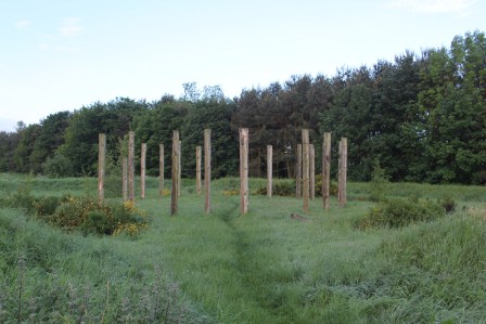
The summit of Yeavering Bell with the line of the fortlet’s defences running around the summit.

From the perspective of the Past in its Place project, visiting the site was a real eye-opener as expected and promised. I saw much that I anticipated but far more than I didn’t. Visiting Ad Gefrin was simply not enough.

IMG_4358

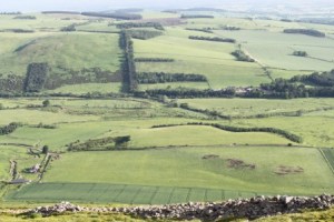
View over the Ad Gefrin site from Yeavering Bell

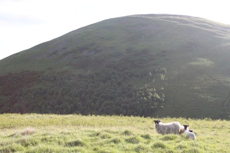
What an experience! Alone on a Sunday morning, and with only semi-inquisitive sheep, a whimbrel (symbol of Northumberland National Park) and a skylark for company, I got to ascend, explore and descend a fabulous hill-fort.

The site affords stupendous views southwards over the Cheviots and north over the valleys of the rivers Glen, Till and Tweed. I saw no goats, I am sad to say but I saw the fortifications, the fortlet at the highest point, and some of the house platforms.

I can also attest that the Ad Gefrin site is intimately bound up visually and physically with the hill-fort, but I am not convinced it was bound up with the hill-fort in any practical or successive sense. It seems to me that the hill and the earthworks would have significance in the early medieval period even if the active use of the hill-fort was restricted to a short duration within the Late Bronze Age or Early Iron Age. There may be traces of Roman activity on the hill-top, but its scale and looming presence would surely be enough to afford the site significance for the emerging kingdom of Northumbria in the late sixth and early seventh century.

With these thoughts in mind, I aim to return in August with the group of Past-in-its-Placers to outline and refine my musings.

IMG_4418

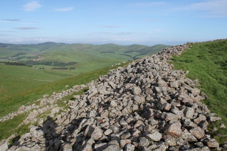
The hill-fort defences

IMG_4414IMG_4429IMG_4421